 Hiking
 Login
Login More
More EN
EN Premium
Toerisme Vlaams-Brabant
Diest, Belgium
Kinderen Baas in Webbekoms Broek
3.3 km
At the Webbekoms Broek visitor center, a (totem of) a beaver welcomes you and invites you on the hike. During this adven... read more

© Stadia Maps © OpenStreetMap contributors, © NodeMapp
Put on your hiking shoes and discover the most beautiful hiking routes in Diest! You will also see all places where hiking nodes are currently available.
Below you will find the latest hiking trails in Diest offered by official tourism organisations or by verified users of our platform.
Pathfinders are hikers who share their hiking adventures in Diest with you.
Looking for an adventure? Try our 'Surprise Me' feature! Enter your preferences below, and we will suggest a number of hikes using the hiking nodes in Diest. The routes are calculated in real-time using the hiking node network.
3.3 km
At the Webbekoms Broek visitor center, a (totem of) a beaver welcomes you and invites you on the hike. During this adven... read more

2.9 km
On this short walk, discover nature near the center of Deurne on the edge of the Valley of the Three Brooks. Follow the ... read more

8.2 km 4.6/5
The Valley of Three Streams owes its name to the three streams that flow side by side there: the Little , Middle and Big... read more

10.8 km 4.4/5
At the transition between the Kempen and the Hageland you will discover the hiking area Asdonk. The sandy soils provide ... read more

5.1 km 3.5/5
Begin your exploration of the city at the Grand Place where many facades date from the 17th and 18th centuries and where... read more

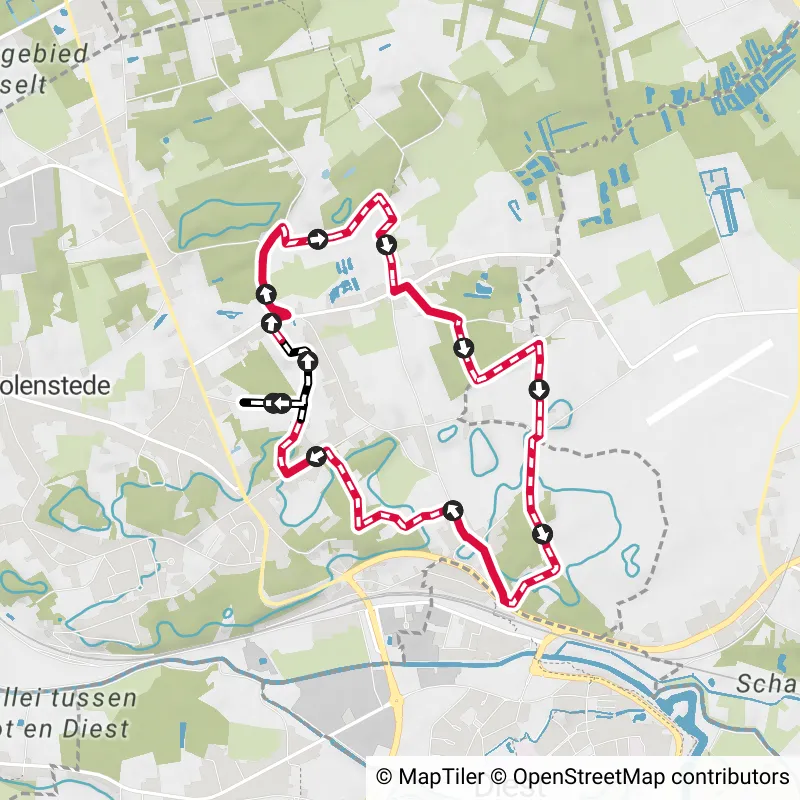
4.7 km 3.7/5
Discover the beautiful nature reserve Webbekoms Broek. You walk through the crossing area for the Demer and Velpe rivers... read more

3.3 km
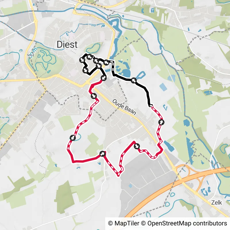
Walk along the historic defensive ramparts of the city of Diest and discover the Demertrefplaats where you can enjoy the... read more

9.8 km 4.1/5
You step through hollow roads and enjoy beautiful vistas. You overlook the valley of the Veldbeek, the wooded Hageland h... read more

10.9 km 3/5
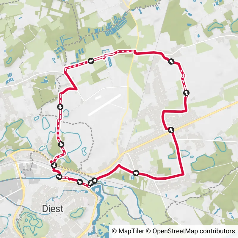
This walk takes you via the city walls and the station of Diest towards the airfield of Schaffen where, with a bit of lu... read more

9.4 km
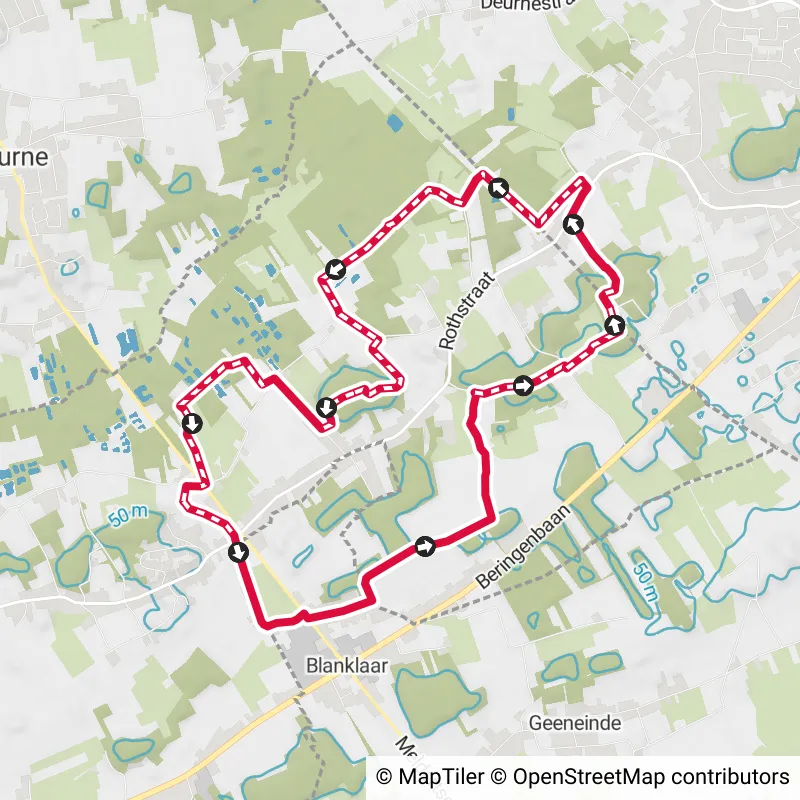
The quiet village of Deurne has a gently rolling landscape that provides beautiful vistas. During this walk you overlook... read more

9.1 km 4.5/5
Discover the beautiful nature reserve Webbekoms Broek. You walk through the crossing area for the Demer and Velpe rivers... read more

1.8 km
You cannot erase the influence of the Premonstratensians from DIEST. Since 1163, the Norbertine abbey of Tongerlo has le... read more

25.3 km 3.5/5
Tie on your hiking boots for a brisk day of walking. Or opt for a two-day visit in the Merode area and combine the walk ... read more

11 km 5/5
You notice here that the flat Kempen passes into the hilly Hageland. And that makes for an area with its own character. ... read more


7.8 km
Parking: Turnhoutsebaan Diest, Berkenhof Sports Complex. Signage: Junction nodes / Hiking app or GPS. Beautiful walk thr... read more

8.4 km
Parking: Cemetery Diest, Halve Maanplaats. Signage: Junctions and a part via NodeMapp app/GPS. Beautiful walk in and aro... read more

12.2 km
This lovely walk can start at the Diest station. From there, it continues to Molenstede. In Molenstede, one can see on t... read more


16 km
The walk is very rural with quite a bit of forest. It covers about 9 km of unpaved roads. The paved roads are low-traffi... read more


10.8 km
WARNING! Due to works by the VMM, the route between junction 97 and 98 will be interrupted from 5/08/2024 to 30/04/2025.... read more

10.7 km
7.5 km unpaved. Paved part is low traffic. Beautiful rural route. "6 walks with unique heritage and nature elements in t... read more

8.8 km
Parking: Church Square in Paal (Blue Zone) Signage: NodeMapp app or GPS The hike is a variant of the red triangle (13.7 ... read more


8.8 km
Parking: Community Center In Zelk (Halen), Zelkstraat 16 Signage: Orange dot and green rectangle / GPS or NodeMapp app. ... read more


13.5 km
A splendid and varied hike that begins at the Abbey of Averbode, a place that is freely accessible and absolutely worth ... read more


15.6 km
A splendid walk through the Houterenberg-Pinnekenswijer nature reserve. The Houterenberg, one of many sand hills, was pl... read more


22.5 km
Between the rivers of the Grote Laak in the north and the Zwart Water in the south lies a beautiful hiking area. Adjacen... read more

The Route Planner Pro has changed a bit on our new website. The ability to plan routes that deviate from the hiking network is now integrated into our node planner (continue reading below image):

If you open our route planner, you can press the magnet symbol in the upper right corner. If you then choose Offgrid (auto) (automatic route planning) or Offgrid (manual) (connecting places manually), you can select places on the map and plan a route that deviates (partially or completely) from the hiking network.
You can switch between Node and Offgrid mode to create a route that runs partly along nodes and partly away from the node network.
The Route Planner Pro has changed a bit on our new website. The ability to plan routes that deviate from the bicycle network is now integrated into our node planner (read more below image):

If you surf to our route planner, you can press the magnet symbol in the upper right corner. If you then choose Offgrid (auto) (automatic route planning) or Offgrid (manual) (connecting places manually), you can select places on the map and plan a route that deviates (partially or completely) from the biking network.
You can switch between Node and Offgrid mode to create a route that runs partly along nodes and partly away from the node network.

Are you sure you want to log out?
With this QR-code or text code you can login to our app. Open the login screen of the NodeMapp Hike app or NodeMapp Bike app and press the button with the QR-code. In the same screen, you can also enter the text code (case sensitive!) if you prefer.
Time remaining to log in with this code:
01:00

 Upgrade to Premium Plus