 Hiking
 Login
Login More
More EN
EN Premium

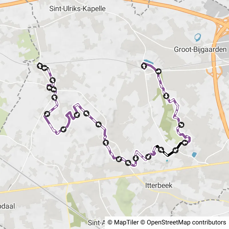
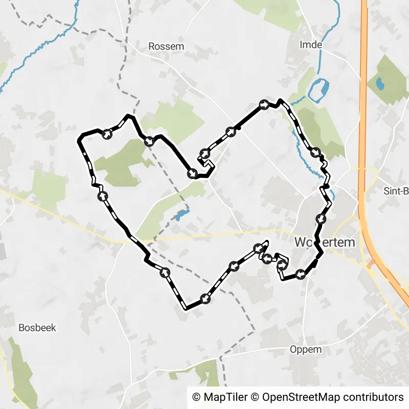
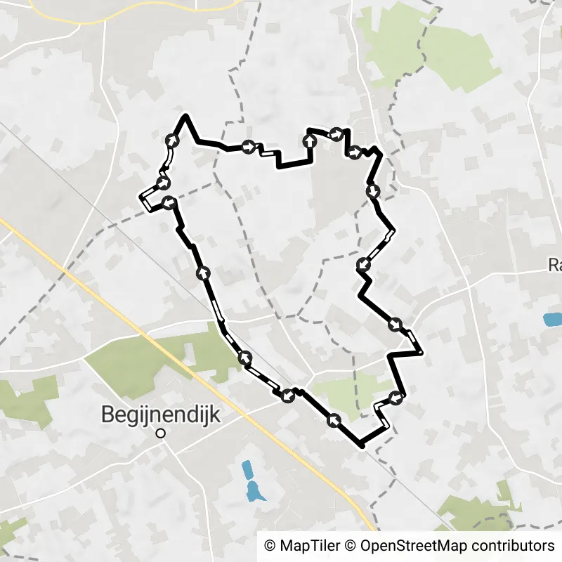
Between Rail and Fochel
11.4 km 4.5/5
This walk was part of the 2024 edition of the Hiking Node Point Searches and starts along the Dendermonde-Brussels railw... read more

© Stadia Maps © OpenStreetMap contributors, © NodeMapp
Put on your hiking shoes and discover the most beautiful hiking routes in Flemish Brabant! You will also see all places where hiking nodes are currently available.
Below you will find the latest hiking trails in Flemish Brabant offered by official tourism organisations or by verified users of our platform.
Pathfinders are hikers who share their hiking adventures in Flemish Brabant with you.
Looking for an adventure? Try our 'Surprise Me' feature! Enter your preferences below, and we will suggest a number of hikes using the hiking nodes in Flemish Brabant. The routes are calculated in real-time using the hiking node network.
11.4 km 4.5/5
This walk was part of the 2024 edition of the Hiking Node Point Searches and starts along the Dendermonde-Brussels railw... read more

4.8 km
This route is the short variant of the archiculture walk, starting at the Dilbeek swimming pool. The walk combines inter... read more

3.7 km
This route is the short variant of the archicultural walk, starting at cultural center Westrand. During your walk you wi... read more

3.3 km
You start at the Museum Café, located next to the Sugar Museum on the Grote Markt, for this accessible walk in the cente... read more

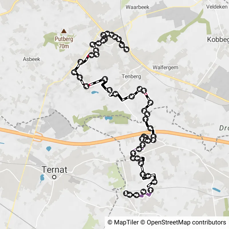
12.2 km
The route connects the stations of Dilbeek and Sint-Martens-Bodegem. This walk takes you along quiet, green paths throug... read more
13.2 km
The route connects the stations of Sint-Martens-Bodegem and Asse. This walk takes you along rolling, green paths of Dilb... read more
4.5 km
In 2024, it will be 100 years since painter Jean Brusselmans came to live permanently in Dilbeek. Take a short walk thro... read more

5.8 km
Follow the rippling waters of the Gete and discover the charm of the city in its purest form. This route takes you along... read more

7.7 km
Sint-Margriete-Houtem will forever be associated with the horror of the Great War. On August 19, 1914, a bitter battle w... read more
7 km
In the 18th century, the noble de Merode family resided in Goetsenhoven. This walk, which refers to this family's stay i... read more

4.1 km
The Tien district of Grimde literally lies between sweet and sour with the Tien Sugar Refinery on one side and the Citri... read more

8.1 km
The starting place of the Saint Lambert Walk is, of course, the Saint Lambert Church in Groot-Overlaar. The St. Lambertu... read more

7.5 km
This walk connects the two churches of Vissenaken. From St. Peter's Church, the walk goes to St. Martin's Church. The wa... read more

2.8 km
Through this city walk you will get to know our beautiful city. Through the mapped out route you will explore the most b... read more


12.3 km
Departure: Heirbaan 137 - Galmaarden A varied walk across the fields and in the Raspaillebos. The Raspaillebos forms a w... read more

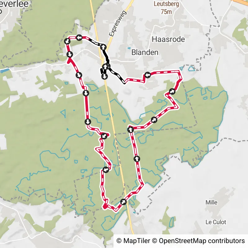
16.8 km
Parking: Parking Welcome Gate “De Torenvalk”, Naamsesteenweg 72, Blanden. Signposting: Junction points. First 1.2 km on ... read more

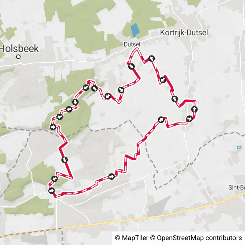
13.3 km
Parking at café Den Arend (pt 124) or Chartreuzebos Meidries (pt 113) or Linden (pt 5). For those who love ups and downs... read more

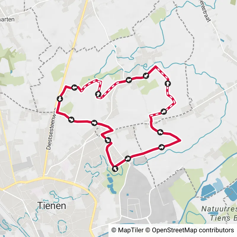
8.1 km
Parking: Brunenshof, Tienen. Signposting: Junction points. Typical walk in this part of Flemish Brabant with many open f... read more

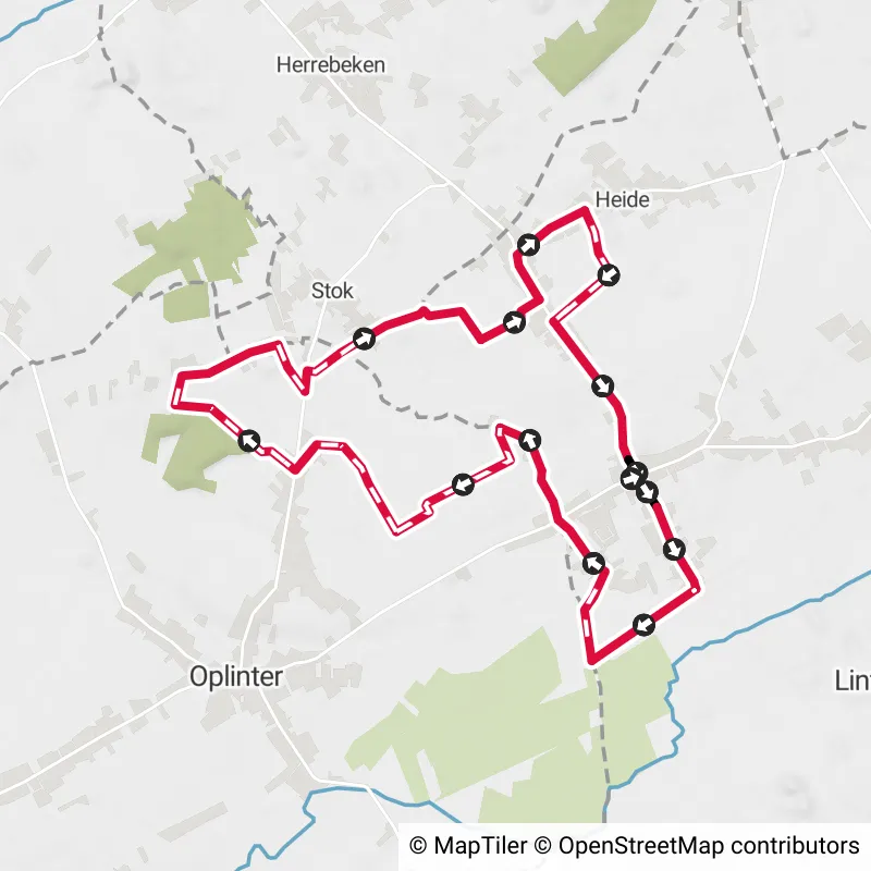
11.4 km
Parking: Grote Steenweg Neerlinter. Signage: Junction points. This peaceful walk goes through the fields and orchards of... read more

12.2 km
Departure: Cemetery Wolvertem - Klepperstraat Peaceful walk on neighborhood roads and footpaths, largely along fields. I... read more

7.8 km
Parking: Turnhoutsebaan Diest, Berkenhof Sports Complex. Signage: Junction nodes / Hiking app or GPS. Beautiful walk thr... read more

12.4 km
Departure: Stationsplein Hombeek A walk along slow paths and along the water. In rainy periods, good waterproof shoes ar... read more

8.4 km
Parking: Cemetery Diest, Halve Maanplaats. Signage: Junctions and a part via NodeMapp app/GPS. Beautiful walk in and aro... read more

10.6 km
Park for free at the parking lot in Veldstraat or come by train. Don't expect a walk through vast nature reserves or lar... read more

13.2 km
Departure: Sint Amandus Church, Jozef Vermaesen Square, Londerzeel We generally walk on paved roads that are passable ev... read more

9.1 km
Departure: free parking at Hollestraat 192, 1500 Halle (Halle cemetery). Due to lack of amenities, no sanitary stop alon... read more

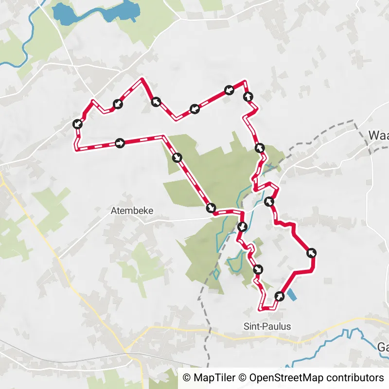
16.9 km
To plot this walk, we mainly used the junction network. Between KP 45 and 415, we temporarily left the KP network to enj... read more


19.4 km 4/5
Parking: Keienpoelweg in Hakendover. Signage: NodeMapp app or GPS. Ideal walk for a wet period, lots of walking on concr... read more

The Route Planner Pro has changed a bit on our new website. The ability to plan routes that deviate from the hiking network is now integrated into our node planner (continue reading below image):

If you open our route planner, you can press the magnet symbol in the upper right corner. If you then choose Offgrid (auto) (automatic route planning) or Offgrid (manual) (connecting places manually), you can select places on the map and plan a route that deviates (partially or completely) from the hiking network.
You can switch between Node and Offgrid mode to create a route that runs partly along nodes and partly away from the node network.
The Route Planner Pro has changed a bit on our new website. The ability to plan routes that deviate from the bicycle network is now integrated into our node planner (read more below image):

If you surf to our route planner, you can press the magnet symbol in the upper right corner. If you then choose Offgrid (auto) (automatic route planning) or Offgrid (manual) (connecting places manually), you can select places on the map and plan a route that deviates (partially or completely) from the biking network.
You can switch between Node and Offgrid mode to create a route that runs partly along nodes and partly away from the node network.

Are you sure you want to log out?
With this QR-code or text code you can login to our app. Open the login screen of the NodeMapp Hike app or NodeMapp Bike app and press the button with the QR-code. In the same screen, you can also enter the text code (case sensitive!) if you prefer.
Time remaining to log in with this code:
01:00

 Upgrade to Premium Plus