Loading...

Through Brabantine woods.

automatic translation

16.8 km • Oud-Heverlee

1860 0 0/5

16.8 km 0.0 km 0.0 km
10 km
© OpenStreetMap contributors, Tracestrack

route offered by

Jan Theunis

Icon starting point Addresse starting point (approximate)

Naamsesteenweg 72, 3052 Oud-Heverlee, BE
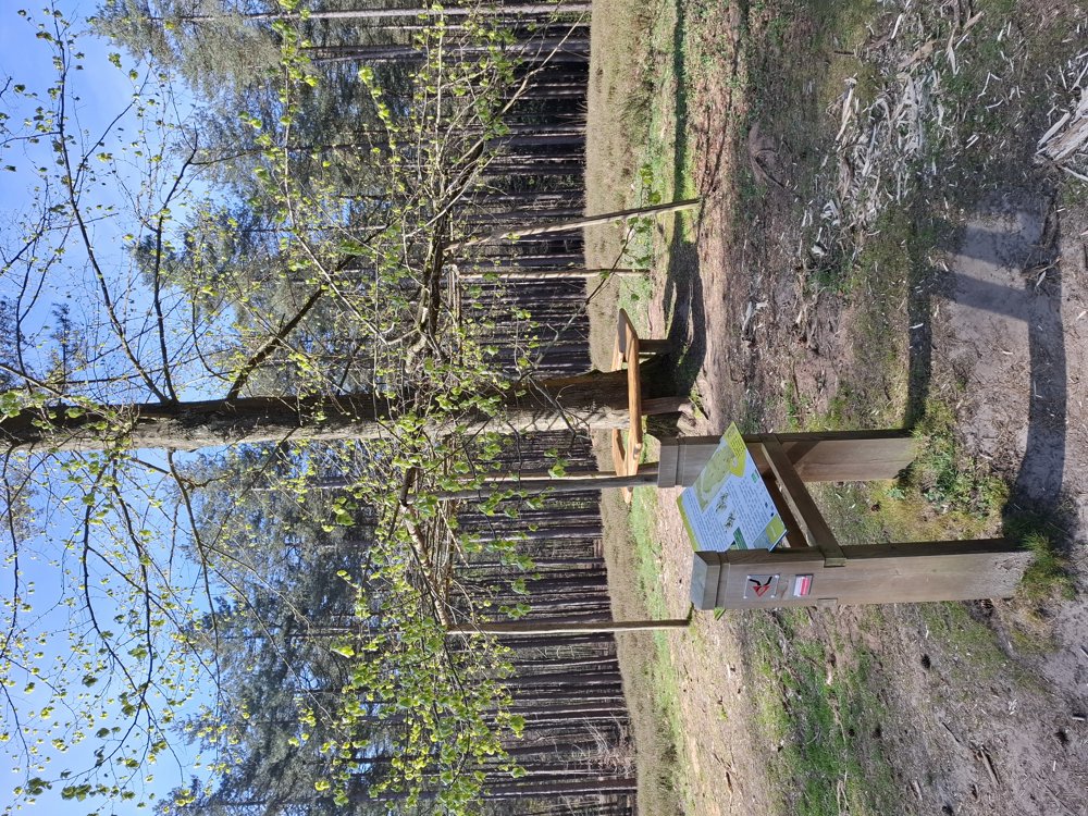
Icon type signage of route signage

The route is fully signposted with nodes.

177.4 m 217.1 m 118.6 m 49.5 m These values indicate respectively the number of meters to rise, the highest and the lowest point in meters.
Atmosphere image 1 of route Through Brabantine woods. Atmosphere image 2 of route Through Brabantine woods. Atmosphere image 3 of route Through Brabantine woods.
© Jan Theunis

Icon description route Description

Parking: Parking Welcome Gate “De Torenvalk”, Naamsesteenweg 72, Blanden.

Signposting: Junction points.

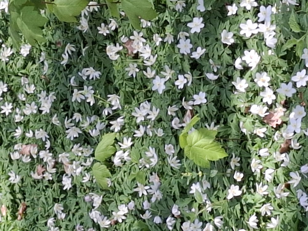
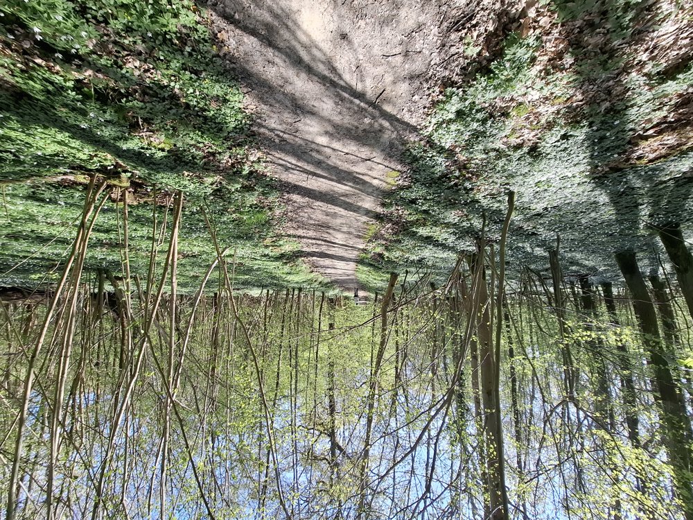
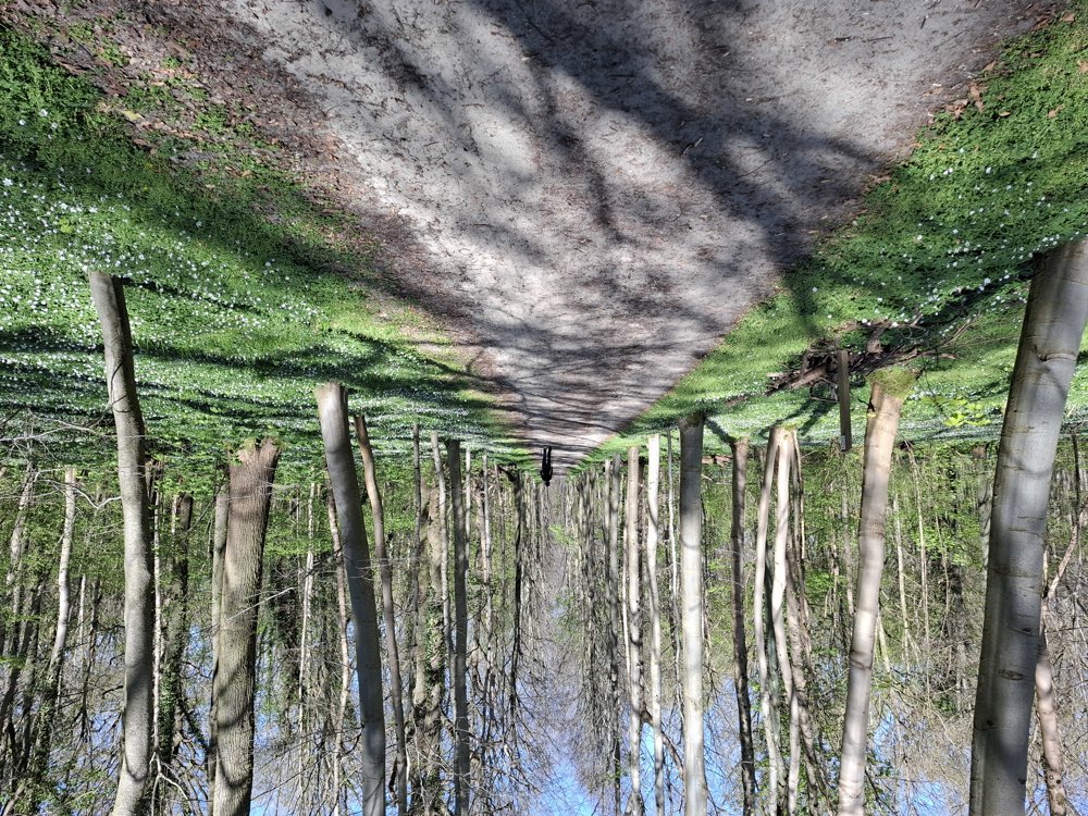
First 1.2 km on the road and through the village of Blanden and further to Oud-Heverlee. From then on, you mainly walk through the Heverlee Forest, the Meerdaal Forest, and the Mollendaal Forest. From junction point 111 to 113, you walk through a sea of wood anemones, which are now in full bloom (11/4/2025). Wonderful to see.

It is not a flat walk; it goes up and down constantly with 169 meters of elevation. Lovely walk in very beautiful forests with magnificent avenues.

Bench(es): among others at 2.4/5.5/8.1/9.3/11.5 and 12.6 km.

automatic translation

Icon nodes to follow nodes to follow

Icon start route
0 km
Icon deviation route
0.5 km
Icon deviation route
0.6 km
Image node TP
1.7 km
Image node 135
2.2 km
Image node 117
2.4 km
Image node 118
2.9 km
Image node 120
4 km
Image node 121
4.1 km
Image node 112
5.5 km
Image node 111
5.8 km
Image node 758
8.1 km
Image node 757
9.5 km
Image node 113
11 km
Image node 114
11.1 km
Image node 115
12.6 km
Image node 138
13.9 km
Image node 136
15.5 km
Icon stop route
16.8 km
This route does not have any reviews yet. Be the first!
Rate route!

Which POI do you want to show on the map?

Experimental hiking network
Unsigned icon

The route you have chosen runs (partly) along an experimental virtual hiking node network (the blue-coloured nodes and sections on the map).

You must be logged in to plan routes here.

Experimental hiking network
Unsigned icon

The route you have chosen runs (partly) along an experimental virtual hiking node network (the blue-coloured nodes and sections on the map).

These routes are not controlled in the field. Before you start hiking here, take a minute to read what an experimental hiking node network is and what rules you should follow when hiking here.

By clicking 'Accept all cookies,' you agree to the use of cookies for an enhanced user experience, website traffic analysis, and personalized advertisements. Cookie policy