Loading...

Walking in the Attic

automatic translation

10.9 km • Heusden-Zolder

00 0 0/5

10.9 km 0.0 km 0.0 km
10 km
© OpenStreetMap contributors, Tracestrack

route offered by

Eddy & Rita

Icon starting point Addresse starting point (approximate)

L. Hoelenstraat 68, 3550 Heusden-Zolder, BE

Icon type signage of route signage

The route is fully signposted with nodes.

102.8 m 88.3 m 61.5 m 26.5 m These values indicate respectively the number of meters to rise, the highest and the lowest point in meters.
Atmosphere image 1 of route Walking in the Attic Atmosphere image 2 of route Walking in the Attic Atmosphere image 3 of route Walking in the Attic
© Eddy & Rita

Icon description route Description

We did this walk on 12/03/2025 (14104 steps).

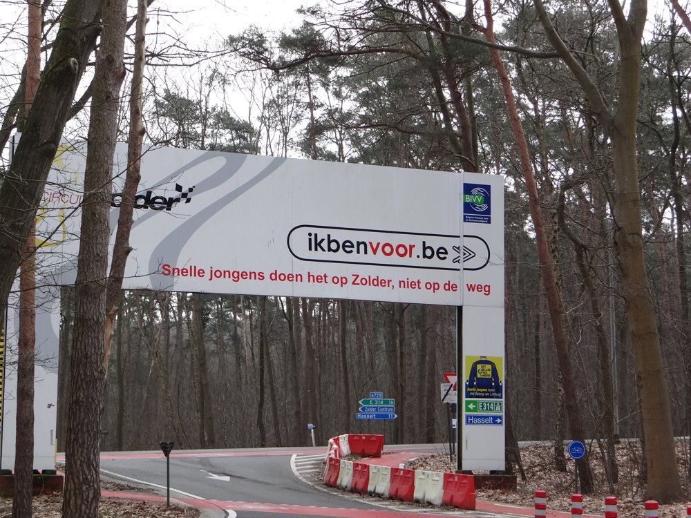
You can park in the spacious parking lot of Circuit Zolder. Circuit Zolder brings the European top in car, motor, bike, and X-sport to a wide audience.

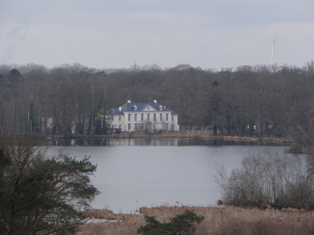
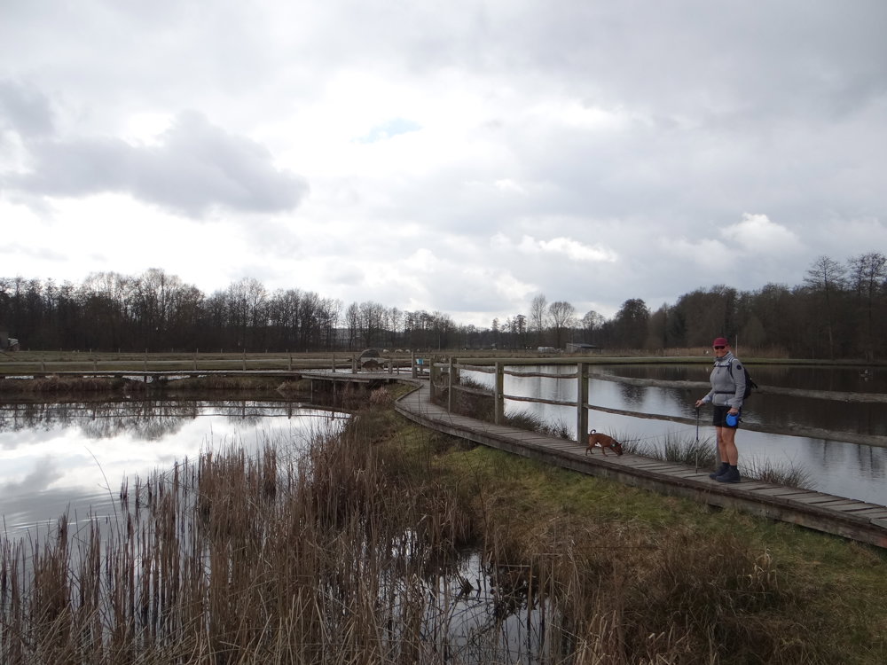
This is a walk with a lot of variety. You pass through the Bolderberg nature reserve where you get a beautiful view of the Terlaemen castle, the Terlaemen ponds, and the Laambeek valley. As if this treat wasn't enough, in Bolderberg, you also get a lovely piece of boardwalks over the Moerasvijver and the Bovy Fish Pond.

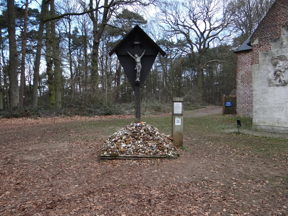
Also, stop by the hermitage of Bolderberg. There is a pilgrim's cross with a heap of stones at the base. Take a small stone from home or along the way to add to it. This symbolically expresses the desire to contribute to a more humane society.

More photos: https://photos.app.goo.gl/DGZmEZzHqQ6RKXAq9

Enjoy your walk,
Eddy, Rita, and Prinske

automatic translation

Icon nodes to follow nodes to follow

Image node 35
0 km
Image node 34
0.7 km
Image node 33
1.3 km
Image node 99
1.6 km
Image node 30
2.3 km
Image node 32
2.6 km
Image node 31
2.9 km
Image node 40
3.9 km
Image node 41
4 km
Image node 42
4 km
Image node 43
4.2 km
Image node 44
4.9 km
Image node 45
5.2 km
Image node 101
7.1 km
Image node 102
8.4 km
Image node 103
8.9 km
Image node 39
10.5 km
Image node 35
10.9 km
This route does not have any reviews yet. Be the first!
Rate route!

Which POI do you want to show on the map?

Experimental hiking network
Unsigned icon

The route you have chosen runs (partly) along an experimental virtual hiking node network (the blue-coloured nodes and sections on the map).

You must be logged in to plan routes here.

Experimental hiking network
Unsigned icon

The route you have chosen runs (partly) along an experimental virtual hiking node network (the blue-coloured nodes and sections on the map).

These routes are not controlled in the field. Before you start hiking here, take a minute to read what an experimental hiking node network is and what rules you should follow when hiking here.

By clicking 'Accept all cookies,' you agree to the use of cookies for an enhanced user experience, website traffic analysis, and personalized advertisements. Cookie policy