Loading...

To "Helsheaven"

automatic translation

20.7 km • Sint-Truiden

1441 0 0/5

20.7 km 0.0 km 0.0 km
10 km
© OpenStreetMap contributors, Tracestrack

route offered by

Jan Theunis

Icon starting point Addresse starting point (approximate)

Begijnhof 12, 3800 Sint-Truiden, BE

Icon type signage of route signage

The route is not signposted. Use a GPS device or our app to follow the route through the virtual nodes.

100.9 m 108.8 m 90.6 m 42.9 m These values indicate respectively the number of meters to rise, the highest and the lowest point in meters.
Atmosphere image 1 of route To "Helsheaven" Atmosphere image 2 of route To "Helsheaven" Atmosphere image 3 of route To "Helsheaven"
© Jan Theunis

Icon description route Description

Parking: Speelhoflaan, Sint-Truiden

Signage: Walking app/GPS.

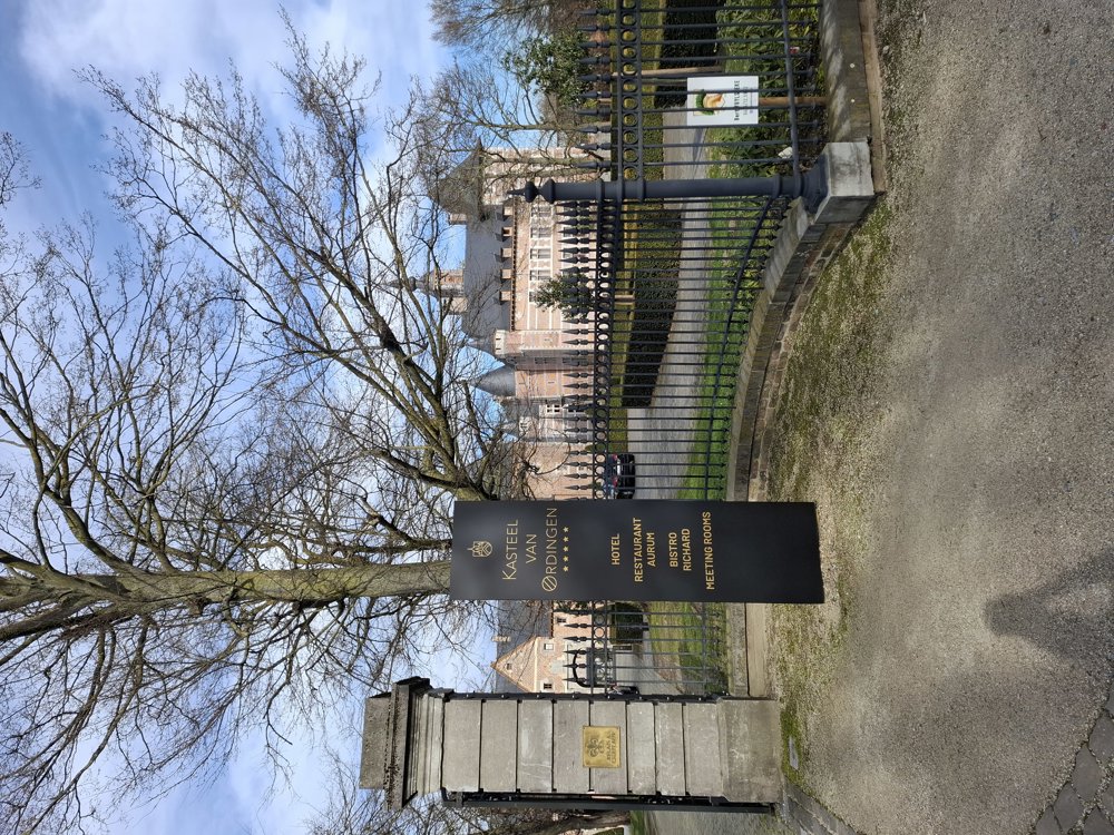
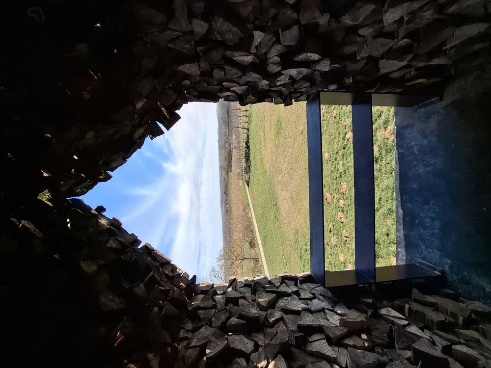
Up to junction 23, we have mapped out the route ourselves. The section through the industrial area up to the N80 is a bit dull, but after that, it mostly follows quiet roads and takes you past the beautiful castle of Ordingen. From here, you follow virtual junction points. In Hoepertingen, you pass Château de Looz. After 12 km, you can rest at the floating chapel (Helsheaven). From the chapel, it mostly goes through the orchards towards St.-Truiden. If the trees are in bloom, it must be beautiful here.

Rest benches: among others at 2.4/3.8/5.7/8.9/10.5/12/14.9/16/16.6 and 20.1 km.

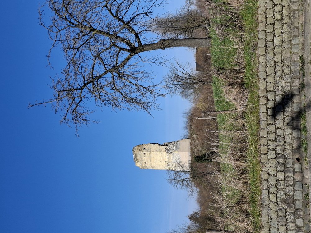
Sights: Castle of Ordingen/ Château de Looz/ Helsheaven/ Tower Fortress (Brustem).

automatic translation

Icon nodes to follow nodes to follow

Icon start route
0 km
Icon deviation route
0.1 km
Icon deviation route
0.3 km
Icon deviation route
0.9 km
Icon deviation route
2 km
Icon deviation route
3.1 km
Icon deviation route
3.7 km
Icon deviation route
4.4 km
Icon deviation route
4.9 km
Image node 23
8.9 km
Image node TP
10.1 km
Icon deviation route
11.9 km
Icon deviation route
12 km
Image node 22
12.1 km
Image node TP
17.3 km
Icon deviation route
20.3 km
Icon deviation route
20.4 km
Icon stop route
20.7 km
This route does not have any reviews yet. Be the first!
Rate route!

Which POI do you want to show on the map?

Experimental hiking network
Unsigned icon

The route you have chosen runs (partly) along an experimental virtual hiking node network (the blue-coloured nodes and sections on the map).

You must be logged in to plan routes here.

Experimental hiking network
Unsigned icon

The route you have chosen runs (partly) along an experimental virtual hiking node network (the blue-coloured nodes and sections on the map).

These routes are not controlled in the field. Before you start hiking here, take a minute to read what an experimental hiking node network is and what rules you should follow when hiking here.

By clicking 'Accept all cookies,' you agree to the use of cookies for an enhanced user experience, website traffic analysis, and personalized advertisements. Cookie policy