Loading...

Deuster Chapel and Snow Valley

automatic translation

8.7 km • Peer

550 0 0/5

8.7 km 0.0 km 0.0 km
10 km
© OpenStreetMap contributors, Tracestrack

route offered by

Jan Theunis

Icon starting point Addresse starting point (approximate)

Deusterstraat 74G, 3990 Peer, BE

Icon type signage of route signage

The route is not signposted. Use a GPS device or our app to follow the route through the virtual nodes.

36.6 m 30.1 m 74.9 m 62 m These values indicate respectively the number of meters to rise, the highest and the lowest point in meters.
Atmosphere image 1 of route Deuster Chapel and Snow Valley
© Jan Theunis

Icon description route Description

Parking: Sports complex 'De Deuster', Deusterstraat Peer

Signage: Walking app / GPS.

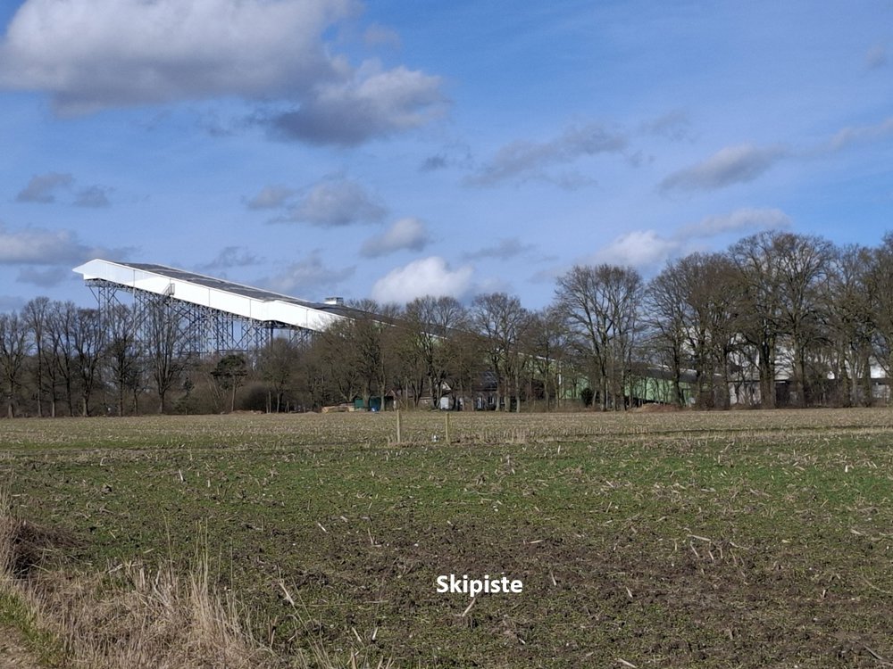
This walk is approximately 50/50 over paved roads and field paths. The ski slope of Peer is regularly visible on the skyline, quite an impressive building. The start is 300m along the busier Deusterstraat, but from then on the walking route is low on traffic. Even in the center of Peer, the hustle and bustle are very manageable.

Rest bench(es): among others at 1.1/4 and 5.3 km.

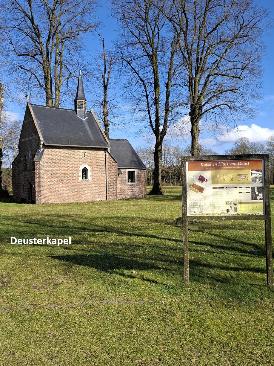
Sightseeing: Deuster Chapel / Ski slope.

Catering: In the center of Peer.

automatic translation

Icon nodes to follow nodes to follow

Icon start route
0 km
Icon deviation route
0.8 km
Image node 6
1.2 km
Image node 7
1.2 km
Image node 5
1.4 km
Image node 1
4.7 km
Image node 309
5.7 km
Icon deviation route
6.2 km
Icon deviation route
6.6 km
Icon deviation route
6.9 km
Icon deviation route
7 km
Icon deviation route
7.4 km
Icon deviation route
7.6 km
Icon deviation route
8 km
Icon stop route
8.7 km
This route does not have any reviews yet. Be the first!
Rate route!

Which POI do you want to show on the map?

Experimental hiking network
Unsigned icon

The route you have chosen runs (partly) along an experimental virtual hiking node network (the blue-coloured nodes and sections on the map).

You must be logged in to plan routes here.

Experimental hiking network
Unsigned icon

The route you have chosen runs (partly) along an experimental virtual hiking node network (the blue-coloured nodes and sections on the map).

These routes are not controlled in the field. Before you start hiking here, take a minute to read what an experimental hiking node network is and what rules you should follow when hiking here.

By clicking 'Accept all cookies,' you agree to the use of cookies for an enhanced user experience, website traffic analysis, and personalized advertisements. Cookie policy