Loading...

Hiking in Korspel

automatic translation

9.2 km • Beringen

3390 0 0/5

9.2 km 0.0 km 0.0 km
10 km
© OpenStreetMap contributors, Tracestrack

route offered by

Jan Theunis

Icon starting point Addresse starting point (approximate)

Kroonstraat 40, 3581 Beringen, BE
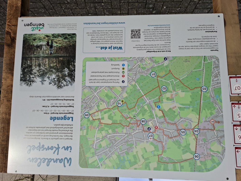
Icon type signage of route signage

The route is fully signposted with nodes.

45.8 m 72.5 m 65.3 m 33.4 m These values indicate respectively the number of meters to rise, the highest and the lowest point in meters.
Atmosphere image 1 of route Hiking in Korspel Atmosphere image 2 of route Hiking in Korspel
© Jan Theunis

Icon description route Description

Parking: Crown Street Korspel (parking lot at the church)

Signposting: Junctions.
The route is well signposted but somewhat amateurishly done. Hopefully, this will be brought to the same level as all other junction signs.

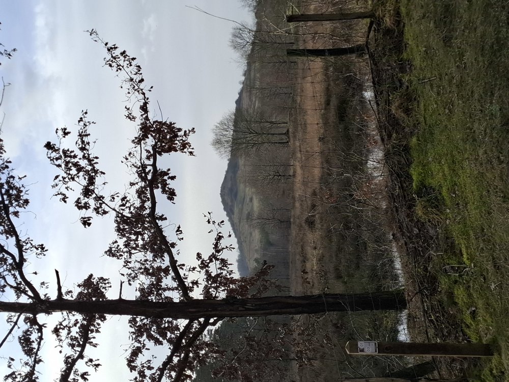
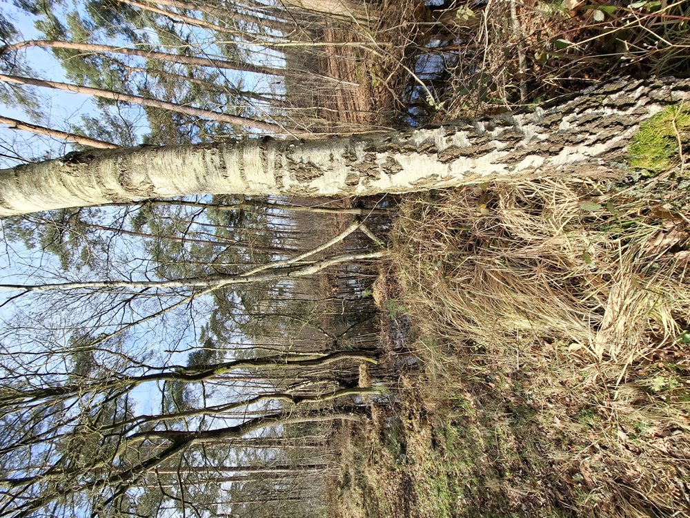
The walk goes mainly through forests that are very muddy in some places. After a heavy rainstorm, it's better to avoid the section between km 3.8 and km 5.8 or adjust the route.

But mud or not, it remains a beautiful walk.

Rest bench(es): among others after 1.4/2.2/2.9 and 4.5 km.

automatic translation

Icon nodes to follow nodes to follow

Image node 7
0 km
Image node 8
0.4 km
Image node 9
2.1 km
Image node 10
2.8 km
Image node 2
4.2 km
Image node 1
4.4 km
Image node 3
5.8 km
Image node 4
6.8 km
Image node 6
7.4 km
Image node 7
9.2 km
This route does not have any reviews yet. Be the first!
Rate route!

Which POI do you want to show on the map?

Experimental hiking network
Unsigned icon

The route you have chosen runs (partly) along an experimental virtual hiking node network (the blue-coloured nodes and sections on the map).

You must be logged in to plan routes here.

Experimental hiking network
Unsigned icon

The route you have chosen runs (partly) along an experimental virtual hiking node network (the blue-coloured nodes and sections on the map).

These routes are not controlled in the field. Before you start hiking here, take a minute to read what an experimental hiking node network is and what rules you should follow when hiking here.

By clicking 'Accept all cookies,' you agree to the use of cookies for an enhanced user experience, website traffic analysis, and personalized advertisements. Cookie policy