Loading...

Along the "Mining" Past.

automatic translation

8 km • Houthalen-Helchteren

600 0 0/5

8 km 0.0 km 0.0 km
10 km
© OpenStreetMap contributors, Tracestrack

route offered by

Jan Theunis

Icon starting point Addresse starting point (approximate)

Lakerweg 11, 3530 Houthalen-Helchteren, BE

Icon type signage of route signage

The route is partially signposted with nodes. Use a GPS device or our app to follow the route.

44.3 m 47.3 m 70.6 m 50.2 m These values indicate respectively the number of meters to rise, the highest and the lowest point in meters.
Atmosphere image 1 of route Along the "Mining" Past. Atmosphere image 2 of route Along the "Mining" Past. Atmosphere image 3 of route Along the "Mining" Past.
© Jan Theunis

Icon description route Description

Parking: Sportpark Lakerveld, Lakerweg Houthalen-Helchteren.

Signage: Walking app or GPS.

On the entire walk, 1 km of unpaved paths, so easily accessible everywhere. You have to cross the busy N715 twice, but this can be done via traffic lights and is therefore not a problem. Except for the Grote Baan, it is a quiet walk with some nice views, such as the attractions mentioned below.

Benches: among others after 0.8 and 1.4 km, so only at the beginning and nothing for the rest, unless you go inside the McDonald's. :-)

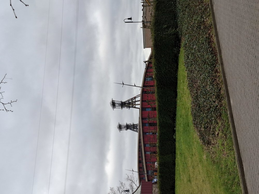
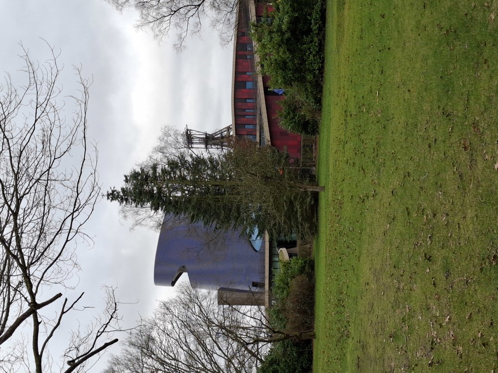
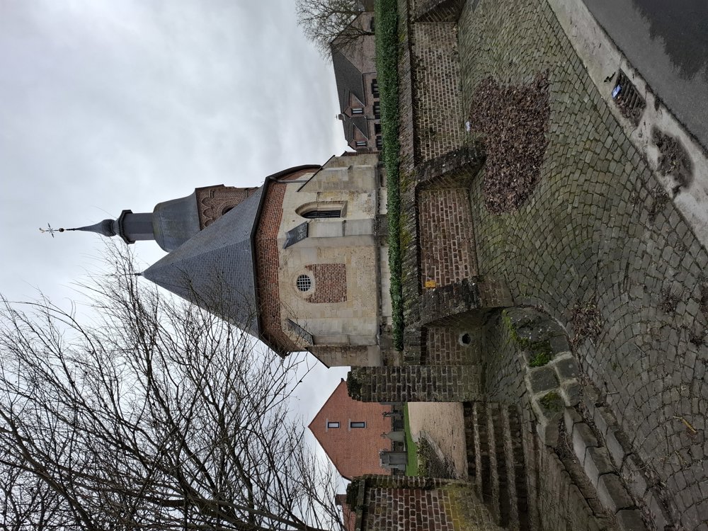
Sights: NAC tower / Mining heritage Houthalen / Church of Laak.

automatic translation

Icon nodes to follow nodes to follow

Icon start route
0 km
Icon deviation route
0.1 km
Icon deviation route
0.2 km
Icon deviation route
0.2 km
Icon deviation route
0.3 km
Icon deviation route
0.3 km
Icon deviation route
0.3 km
Icon deviation route
0.4 km
Icon deviation route
0.4 km
Icon deviation route
0.4 km
Image node 141
0.4 km
Image node 142
1.1 km
Image node TP
1.6 km
Icon deviation route
2 km
Icon deviation route
2.5 km
Icon deviation route
3.1 km
Icon deviation route
3.3 km
Icon deviation route
3.5 km
Icon deviation route
3.7 km
Icon deviation route
3.8 km
Icon deviation route
3.9 km
Image node TP
4.1 km
Image node TP
4.5 km
Icon deviation route
4.9 km
Icon deviation route
5.2 km
Icon deviation route
5.9 km
Icon deviation route
6.3 km
Icon deviation route
6.7 km
Icon deviation route
7.4 km
Icon deviation route
7.9 km
Icon deviation route
8 km
Icon deviation route
8 km
Icon deviation route
8 km
Icon deviation route
8 km
Icon deviation route
8 km
Icon stop route
8 km
This route does not have any reviews yet. Be the first!
Rate route!

Which POI do you want to show on the map?

Experimental hiking network
Unsigned icon

The route you have chosen runs (partly) along an experimental virtual hiking node network (the blue-coloured nodes and sections on the map).

You must be logged in to plan routes here.

Experimental hiking network
Unsigned icon

The route you have chosen runs (partly) along an experimental virtual hiking node network (the blue-coloured nodes and sections on the map).

These routes are not controlled in the field. Before you start hiking here, take a minute to read what an experimental hiking node network is and what rules you should follow when hiking here.

By clicking 'Accept all cookies,' you agree to the use of cookies for an enhanced user experience, website traffic analysis, and personalized advertisements. Cookie policy