Loading...

Hiking in and around Hamont

automatic translation

11.2 km • Hamont-Achel

1220 0 0/5

11.2 km 0.0 km 0.0 km
10 km
© OpenStreetMap contributors, Tracestrack

route offered by

Jan Theunis

Icon starting point Addresse starting point (approximate)

Sleutjes 36, 3930 Hamont-Achel, BE

Icon type signage of route signage

The route is fully signposted with nodes.

29 m 28.7 m 38 m 30.3 m These values indicate respectively the number of meters to rise, the highest and the lowest point in meters.
Atmosphere image 1 of route Hiking in and around Hamont Atmosphere image 2 of route Hiking in and around Hamont
© Jan Theunis

Icon description route Description

Parking: Sleutjes Hamont.

Signage: Nodes.

10% unpaved, you walk on well-accessible, usually car-free roads.

From knp 79 to knp 73, you walk in the Netherlands; the signage is then a yellow triangle with a green background.

Few forests, mostly through open plains.

Rest bench(es): among others after 4.1/6.7 and 9.1 km.

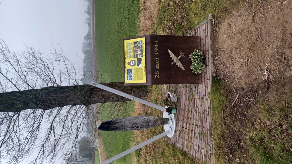
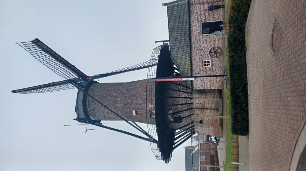
Sights: World War II Monument / Napoleon's Mill.

automatic translation

Icon nodes to follow nodes to follow

Icon start route
0 km
Icon deviation route
0 km
Image node TP
0.3 km
Image node 79
0.9 km
Image node 18
2.6 km
Image node 73
2.9 km
Image node 143
3.4 km
Image node 144
6.7 km
Image node 173
8.1 km
Image node 162
9.1 km
Image node 161
10.4 km
Image node 154
10.6 km
Image node 158
11.2 km
Icon stop route
11.2 km
This route does not have any reviews yet. Be the first!
Rate route!

Which POI do you want to show on the map?

Experimental hiking network
Unsigned icon

The route you have chosen runs (partly) along an experimental virtual hiking node network (the blue-coloured nodes and sections on the map).

You must be logged in to plan routes here.

Experimental hiking network
Unsigned icon

The route you have chosen runs (partly) along an experimental virtual hiking node network (the blue-coloured nodes and sections on the map).

These routes are not controlled in the field. Before you start hiking here, take a minute to read what an experimental hiking node network is and what rules you should follow when hiking here.

By clicking 'Accept all cookies,' you agree to the use of cookies for an enhanced user experience, website traffic analysis, and personalized advertisements. Cookie policy