Loading...

Nature Reserve "Het Wik"

automatic translation

8 km • Zonhoven

981 0 0/5

8 km 0.0 km 0.0 km
10 km
© OpenStreetMap contributors, Tracestrack

route offered by

Jan Theunis

Icon starting point Addresse starting point (approximate)

Bokrijkseweg 149, 3520 Zonhoven, BE

Icon type signage of route signage

The route is fully signposted with nodes.

46.6 m 53 m 68 m 41 m These values indicate respectively the number of meters to rise, the highest and the lowest point in meters.
Atmosphere image 1 of route Nature Reserve "Het Wik" Atmosphere image 2 of route Nature Reserve "Het Wik" Atmosphere image 3 of route Nature Reserve "Het Wik"
© Jan Theunis

Icon description route Description

Parking: Kauwbosstraat Zonhoven.

Signage: Nodes.

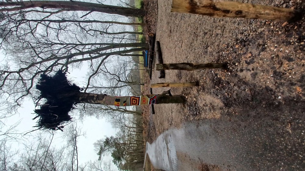
Beautiful walk in the new node network “De Wijers”.

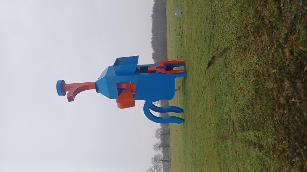
The first 700 m are on a paved path to the artwork “Room for Shroom”.

Then you continue to ‘Nature Reserve Het Wik’ and the ‘Provincial Domain Bokrijk’.

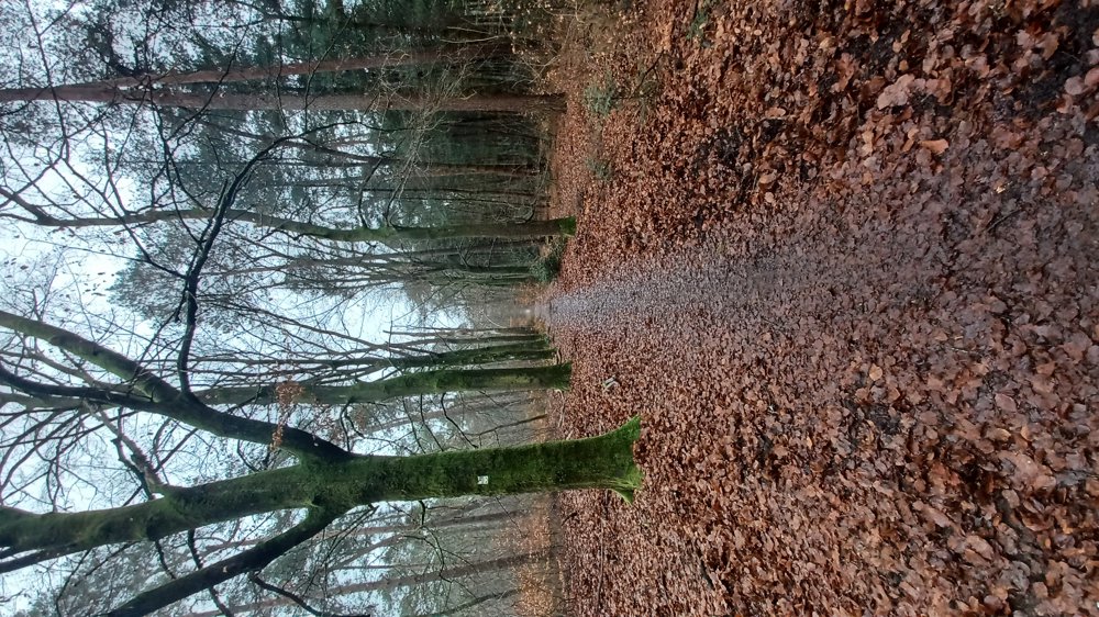
A section goes through the beautiful arboretum of Bokrijk. Varied walk through forests and fields.

Rest benches: including after 0.9/1.3/2.1/4.9/7.8 km.

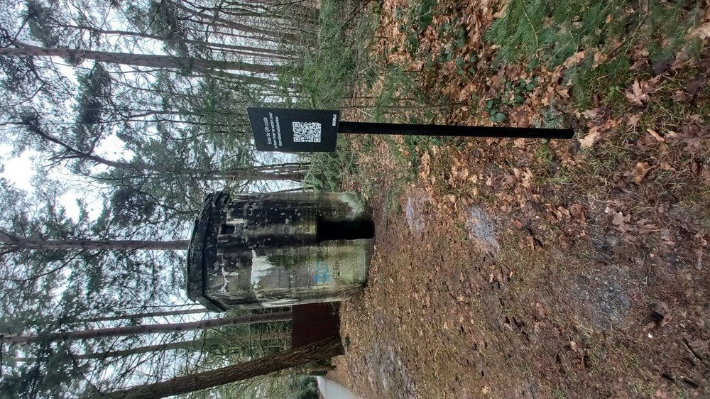
Attractions: Room for Shroom / Arboretum / WWI Observation Bunker.

Catering: On the Provincial Domain.

automatic translation

Icon nodes to follow nodes to follow

Image node TP
0 km
Image node 113
0.3 km
Image node 62
0.7 km
Image node 61
1.3 km
Image node 64
1.9 km
Image node 65
2.4 km
Image node 66
2.9 km
Image node 87
3 km
Image node 73
3.4 km
Image node 74
4 km
Image node 75
4.9 km
Image node 71
5.3 km
Image node 87
6.5 km
Image node 66
6.5 km
Image node 63
6.9 km
Image node 62
7.3 km
Image node 113
7.8 km
Image node TP
8.1 km
This route does not have any reviews yet. Be the first!
Rate route!

Which POI do you want to show on the map?

Experimental hiking network
Unsigned icon

The route you have chosen runs (partly) along an experimental virtual hiking node network (the blue-coloured nodes and sections on the map).

You must be logged in to plan routes here.

Experimental hiking network
Unsigned icon

The route you have chosen runs (partly) along an experimental virtual hiking node network (the blue-coloured nodes and sections on the map).

These routes are not controlled in the field. Before you start hiking here, take a minute to read what an experimental hiking node network is and what rules you should follow when hiking here.

By clicking 'Accept all cookies,' you agree to the use of cookies for an enhanced user experience, website traffic analysis, and personalized advertisements. Cookie policy