Loading...

From Stokrooie to the Abbey of Herkenrode

automatic translation

8.1 km • Hasselt

1480 0 0/5

8.1 km 0.0 km 0.0 km
10 km
© OpenStreetMap contributors, Tracestrack

route offered by

Jan Theunis

Icon starting point Addresse starting point (approximate)

Sint-Amandusstraat 11, 3511 Hasselt, BE

Icon type signage of route signage

The route is fully signposted with nodes.

21 m 13.2 m 30.6 m 23.5 m These values indicate respectively the number of meters to rise, the highest and the lowest point in meters.
Atmosphere image 1 of route From Stokrooie to the Abbey of Herkenrode Atmosphere image 2 of route From Stokrooie to the Abbey of Herkenrode
© Jan Theunis

Icon description route Description

Parking: Stokrooie near the church.

Signage: Nodes.

Walk in the new nodes network "De Wijers". Alternating over paved roads, field and forest paths. From Stokrooie, you walk to the beautiful Herkenrode site and further to the Albert Canal. Then along the canal and the Demer back towards the starting point.

Normally, we would have walked through the monastery park, but it is temporarily closed due to heavy rainfall.

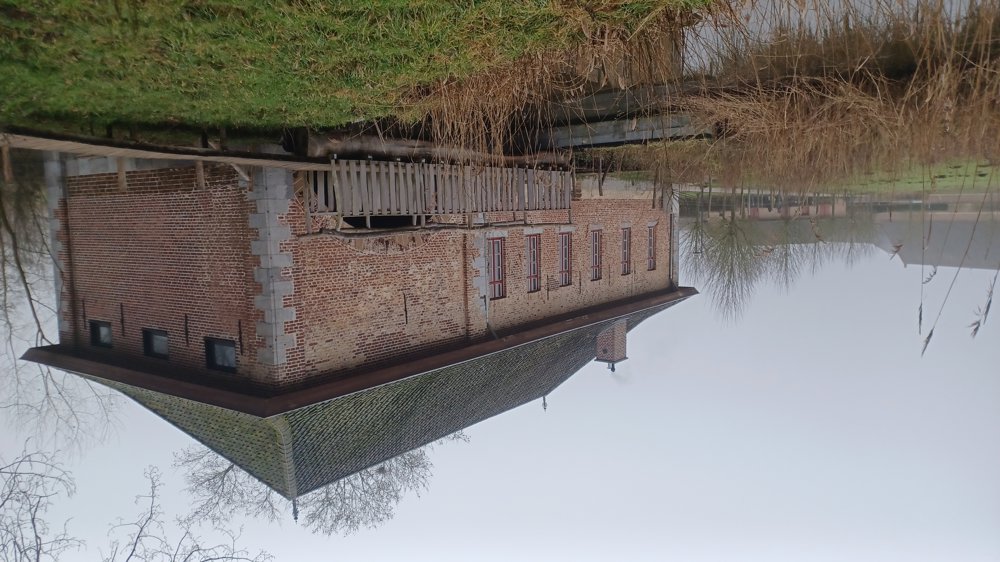
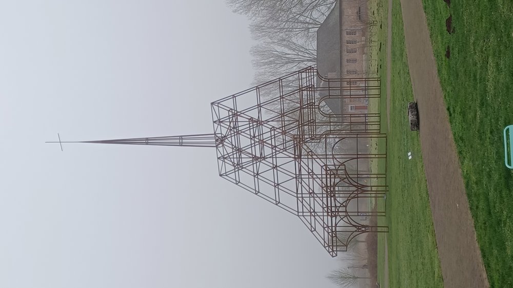
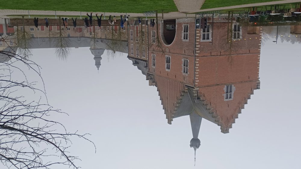
Bench(es): among others at 0.7/1.2/2.2/3.3/4.8 and 7.8 km. Sights: Abbey mill, see-through church, and the Abbey of Herkenrode. Hospitality: Stokrooie ‘Café De Jail’ and on the Abbey site.

automatic translation

Icon nodes to follow nodes to follow

Icon start route
0 km
Image node TP
0.1 km
Image node 118
0.9 km
Image node 111
1.2 km
Image node 110
1.4 km
Icon deviation route
1.6 km
Icon deviation route
1.7 km
Image node 107
1.9 km
Image node 105
2.2 km
Image node 106
2.3 km
Image node 124
3.4 km
Image node 126
5 km
Image node 121
6.5 km
Image node 119
8 km
Image node TP
8.1 km
This route does not have any reviews yet. Be the first!
Rate route!

Which POI do you want to show on the map?

Experimental hiking network
Unsigned icon

The route you have chosen runs (partly) along an experimental virtual hiking node network (the blue-coloured nodes and sections on the map).

You must be logged in to plan routes here.

Experimental hiking network
Unsigned icon

The route you have chosen runs (partly) along an experimental virtual hiking node network (the blue-coloured nodes and sections on the map).

These routes are not controlled in the field. Before you start hiking here, take a minute to read what an experimental hiking node network is and what rules you should follow when hiking here.

By clicking 'Accept all cookies,' you agree to the use of cookies for an enhanced user experience, website traffic analysis, and personalized advertisements. Cookie policy