 Hiking
 Login
Login More
More EN
EN Premium
Along the see-through church and the 'border of doubt'
automatic translation
8 km • Borgloon
7542 1 5/5

 Addresse starting point (approximate)
Trapkensstraat 1, 3840 Borgloon, BE
 signage
The route is fully signposted with thematic signs (no nodes).
 Description
Parking: Borgloon Center, Speelhof.
Signage: Junctions / Orange ball (partially).
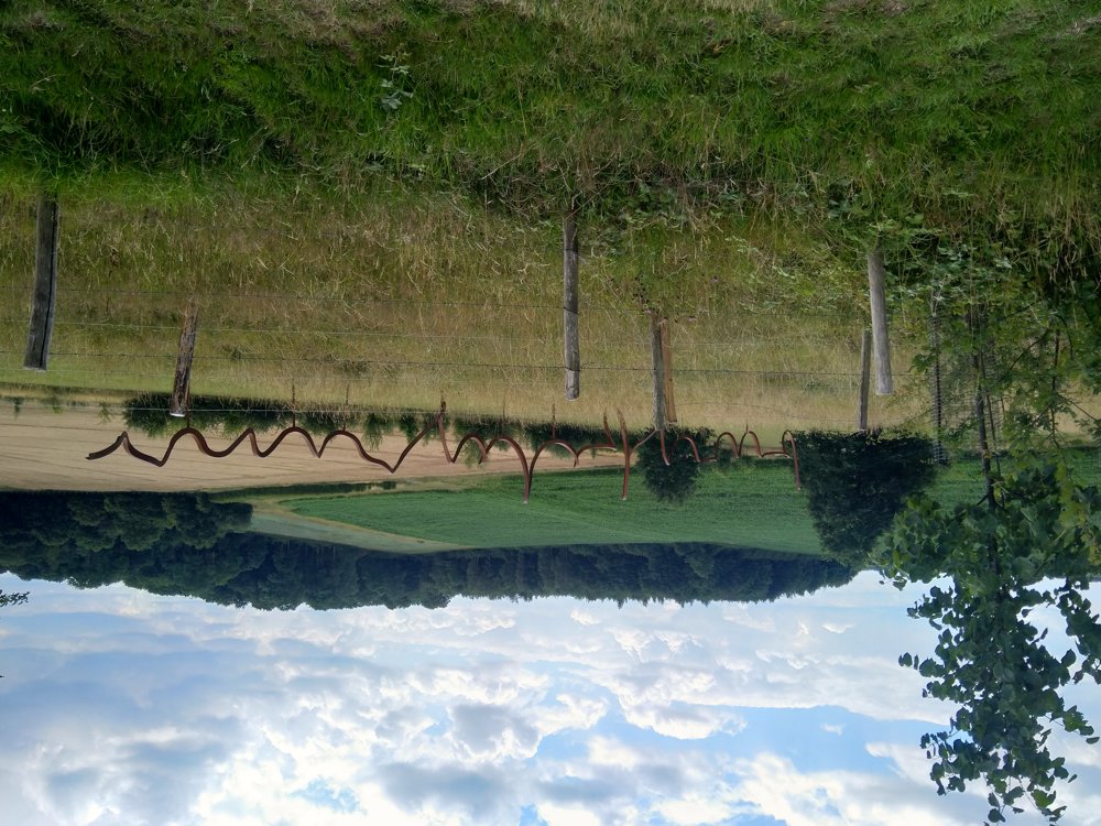
This is the walk with the orange ball, but without the urban part. Uphill and downhill through the fields and orchards around Borgloon. You pass 2 artworks. After 2.4 km, you arrive at the artwork “Twijfelgrens”. And no, this is not a piece of twisted iron; if you stand in the right position, you read ‘twijfelgrens’.
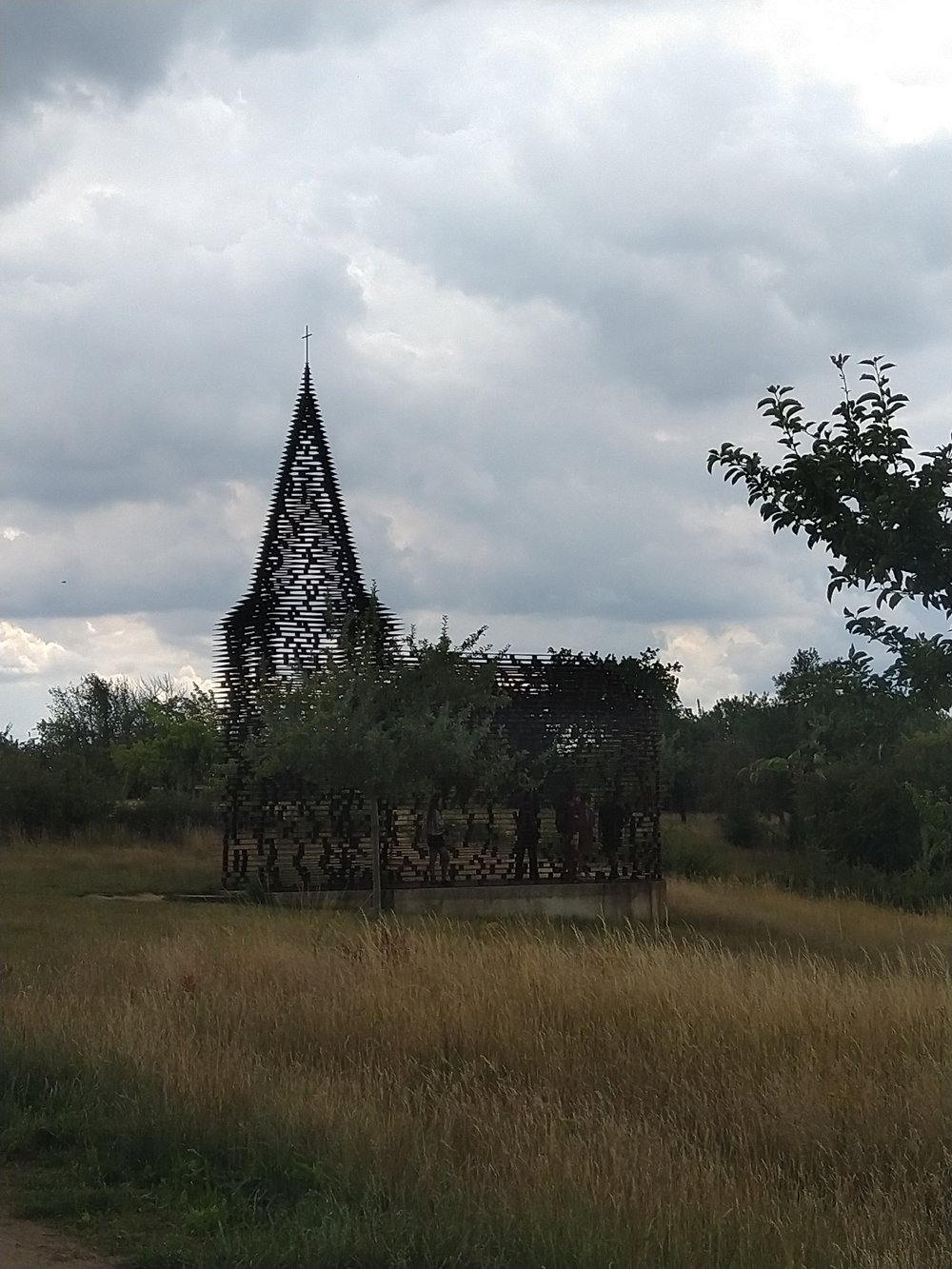
And 4.2 km further, you stand at the well-known ‘doorkijkkerkje’. The official name for this artwork is “Reading between the Lines”. It can be very busy here at times. The last part is still quite uphill.
Rest benches: among others at 1.3 / 1.8 / 2.4 / 4.4 / 5.7 and 6.6 km.
Sightseeing: “Twijfelgrens” and “Reading between the Lines”.
Catering: Borgloon Center.
automatic translation
 nodes to follow
0 km

0.1 km
0.3 km
0.5 km
0.5 km
1.6 km
1.8 km
2.7 km
3.2 km
4.6 km
6.2 km
6.5 km
7.5 km

8 km
Thursday, March 13, 2025 by N.B.Beautiful route, but I was surprised that we didn't find any of the junctions. I don't know what's going on but all the hiking nodes were apparently taken away, so we had to leave our smartphone on the whole time. The bike nodes are still there though.... Too bad anyway because I have a paying subscription.
automatic translation
Sunday, March 30, 2025 by Jan TheunisYou won't find any visible nodes here either. In this region the junctions are virtual, I'm not in favor of them, because what if your hiking app suddenly breaks down, you're hopelessly lost. And whether you have a subscription or not has nothing to do with virtual or visible nodes.
automatic translation


 Upgrade to Premium Plus
