 Hiking
 Login
Login More
More EN
EN Premium
Walking on water
automatic translation
8 km • Dilsen-Stokkem
7243 1 4/5

 Addresse starting point (approximate)
Nationaal Parklaan 1, Dilsen-Stokkem, BE
 signage
The route is not signposted. Use a GPS device or our app to follow the route through the virtual nodes.
 Description
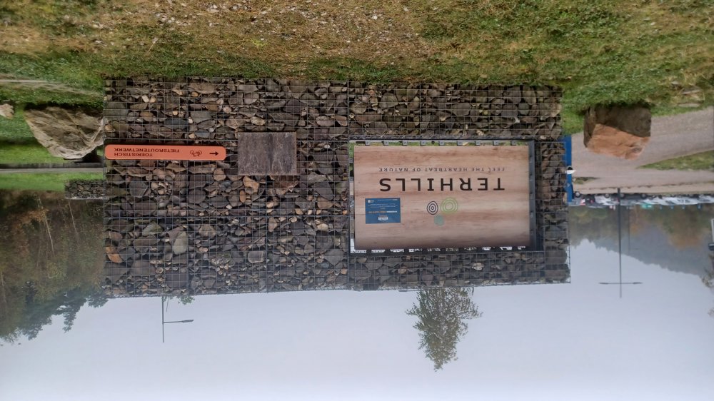
Parking: At the spacious Terhills parking, Nationaal Parklaan in Dilsen-Stokkem.
Signage: Virtual nodes, so GPS or NodeMapp app.
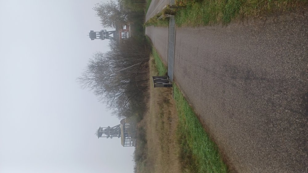
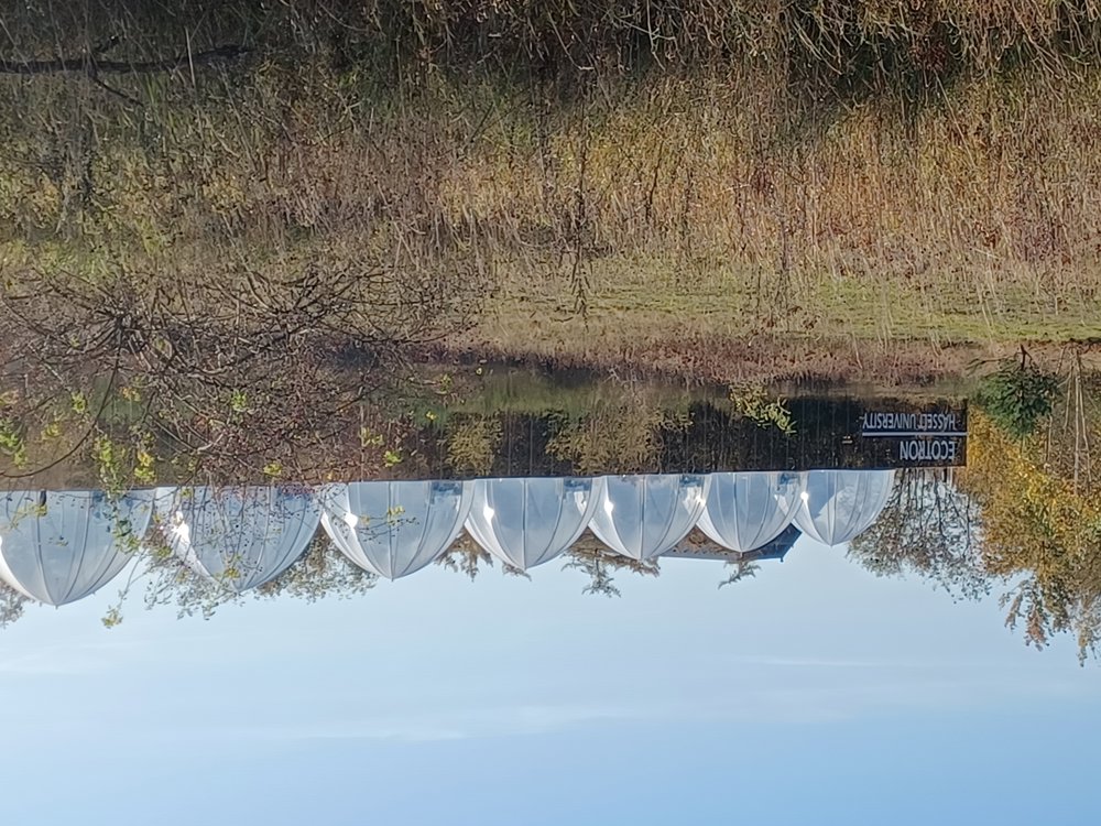
Beautiful walk with stunning pieces of nature. First, about 700 meters over asphalt along the ‘Kleine plas’, then mostly paved gravel and forest paths. Soon, the headframes of the Eisden coal mine come into view. Then, you walk past the Ecotron site, where climate change simulations are conducted.
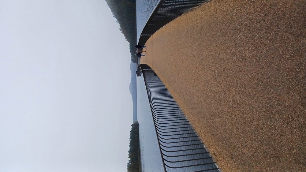
Further on, it leads to the ‘Grote plas’ with its new attraction “walking/cycling on water,” beautifully created and certainly an added value for this region. At the end, you walk through Resort Terhills.
We have kept the walk as flat as possible. Here and there, you need to go slightly uphill and once take a steep staircase.
Rest benches: e.g. at 1/2.5/4.4/5.7/6.8 and 7.6 km.
Attractions: Headframes / Ecotron / Walking on water.
Catering: Terland Restaurant (Resort Terhills)
automatic translation
 nodes to follow
0 km

0.1 km
0.2 km
0.4 km
0.5 km
1.3 km
1.5 km
1.7 km
1.9 km
2 km
2.6 km
3.2 km
3.4 km
4.3 km
4.6 km
5.3 km
5.5 km
5.6 km
5.7 km
6.7 km
6.8 km
7.7 km

8 km
Friday, March 7, 2025 by G.V.We walked this route on Wednesday 05/03/2025. We think it would be better to walk it in the opposite direction. When we arrived at the Terhills resort we had to count on a guest of the resort who had a badge to enter the resort, without a badge you cannot open the entrance gate to the resort.
automatic translation
Sunday, March 30, 2025 by Jan TheunisThat's odd, we experienced no problems walking through the resort.
automatic translation


 Upgrade to Premium Plus
