 Hiking
 Login
Login More
More EN
EN Premium
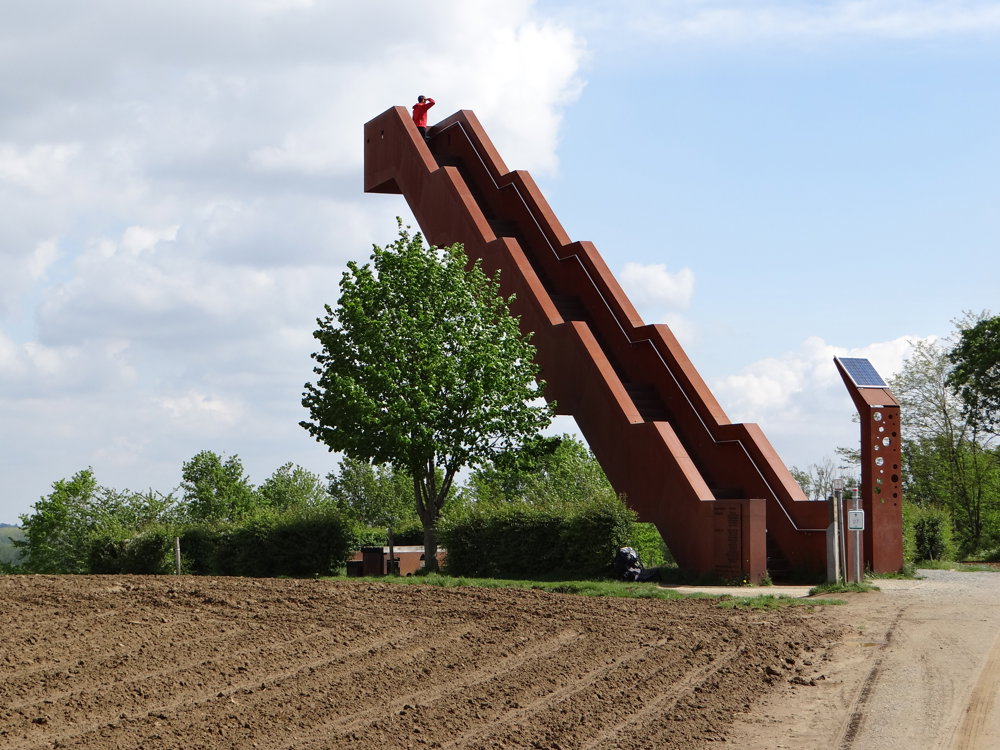
Tielt-Winge Vlooyberg Tower
automatic translation
16.7 km • Tielt-Winge
3553 0 0/5

 Addresse starting point (approximate)
Oude Pastoriestraat 22, Tielt-Winge, BE
 signage
The route is fully signposted with nodes.
 Description
Walenbos is a humid swamp forest. During the winter and after a lot of rain, the forest can become very wet, resulting in muddy paths. Keep this in mind while walking and wear appropriate footwear (boots or high, waterproof hiking shoes).
We parked the car on the spacious parking lot in Oude Pastoriestraat. Initially, we thought of walking against the clock direction, so we could climb the highlight, the Vlooyberg tower, at the end. Destiny decided otherwise and sent us directly towards the tower. In hindsight, it wasn’t a bad move, as it is a strenuous walk.
We started in the morning; then there aren't that many people who want to climb the tower.
More photos: https://photos.app.goo.gl/gbNV6g42DAhA6yQG6
Enjoy this walk,
Eddy, Rita, and Prinske
automatic translation
 nodes to follow
0 km
0.6 km
1.1 km
1.3 km
1.6 km
1.7 km
3.7 km
3.8 km
3.9 km
4.4 km
4.5 km
5.6 km
5.9 km
6.1 km
7 km
7.3 km
7.9 km
8.7 km
8.8 km
9.9 km
10.7 km
11.9 km
12.8 km
14.1 km
16 km
16.2 km
16.7 km


 Upgrade to Premium Plus
