Loading...

Erps Kwerps 13.7 km

automatic translation

13.1 km • Kortenberg

2932 0 0/5

13.1 km 0.0 km 0.0 km
10 km
© OpenStreetMap contributors, Tracestrack

route offered by

Peter D'hont

Icon starting point Addresse starting point (approximate)

Kerselarenstraat 25, 3071 Kortenberg, BE

Icon type signage of route signage

The route is fully signposted with thematic signs (no nodes).

52.7 m 80.2 m 36.6 m 14.9 m These values indicate respectively the number of meters to rise, the highest and the lowest point in meters.
Atmosphere image 1 of route Erps Kwerps 13.7 km Atmosphere image 2 of route Erps Kwerps 13.7 km Atmosphere image 3 of route Erps Kwerps 13.7 km
© Peter D'hont

Icon description route Description

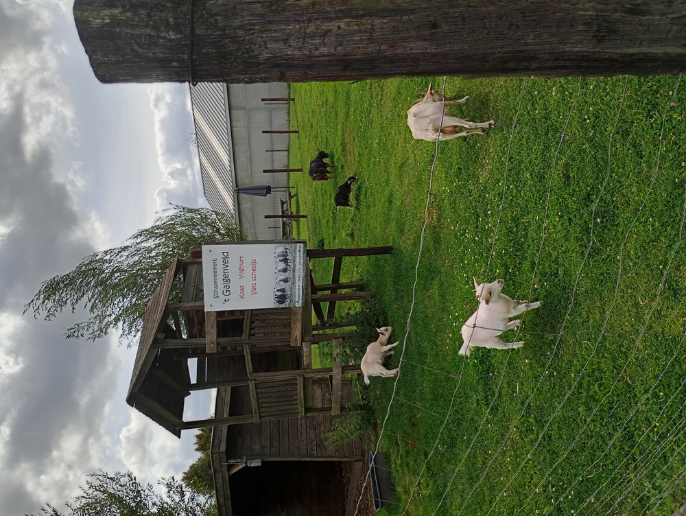
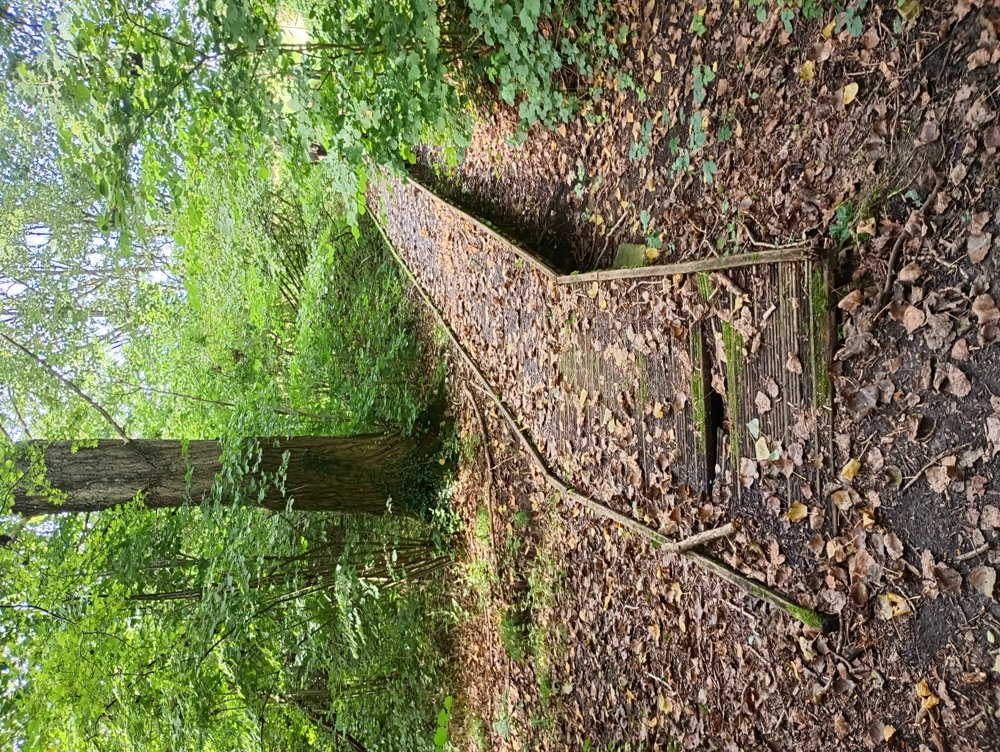
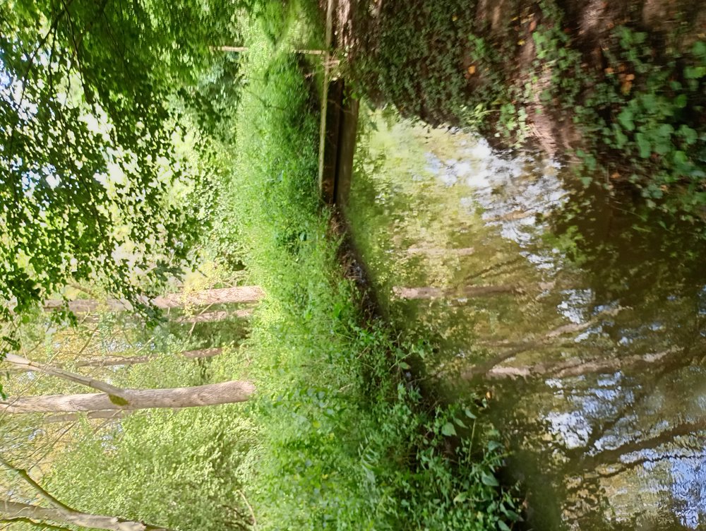
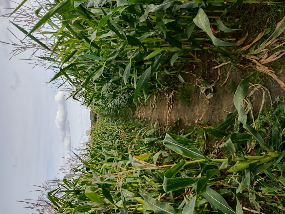
Walk in Erps-Kwerps on Unpaved Paths

Departure: Parking at Erps-Kwerps Train Station – Kerselarenstraat

13.7 km, of which 11.3 km are on unpaved footpaths, neighborhood paths, and through the woods.

This beautiful area is located a few kilometers from Brussels Airport, so overflying planes can disturb the peace. But this area still has many forests and nature reserves.

automatic translation

Icon nodes to follow nodes to follow

Image node TP
0 km
Image node 814
0.6 km
Image node 801
1 km
Image node 800
1.8 km
Image node 89
3.4 km
Image node 88
3.7 km
Image node 87
4.4 km
Image node 109
4.7 km
Icon deviation route
5 km
Icon deviation route
5.5 km
Icon deviation route
5.6 km
Icon deviation route
6.3 km
Icon deviation route
6.6 km
Icon deviation route
7.6 km
Icon deviation route
8.2 km
Icon deviation route
9 km
Icon deviation route
10.5 km
Icon deviation route
11.8 km
Icon deviation route
12.7 km
Icon stop route
13.1 km
This route does not have any reviews yet. Be the first!
Rate route!

Which POI do you want to show on the map?

Experimental hiking network
Unsigned icon

The route you have chosen runs (partly) along an experimental virtual hiking node network (the blue-coloured nodes and sections on the map).

You must be logged in to plan routes here.

Experimental hiking network
Unsigned icon

The route you have chosen runs (partly) along an experimental virtual hiking node network (the blue-coloured nodes and sections on the map).

These routes are not controlled in the field. Before you start hiking here, take a minute to read what an experimental hiking node network is and what rules you should follow when hiking here.

By clicking 'Accept all cookies,' you agree to the use of cookies for an enhanced user experience, website traffic analysis, and personalized advertisements. Cookie policy