Loading...

National Park Bosland-Kolisbos

automatic translation

7.9 km • Pelt

740 0 0/5

7.9 km 0.0 km 0.0 km

route offered by

Jan Theunis

Icon starting point Addresse starting point (approximate)

Torenstraat 26, 3910 Neerpelt, BE
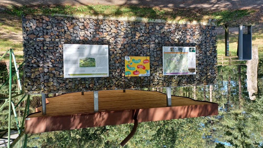
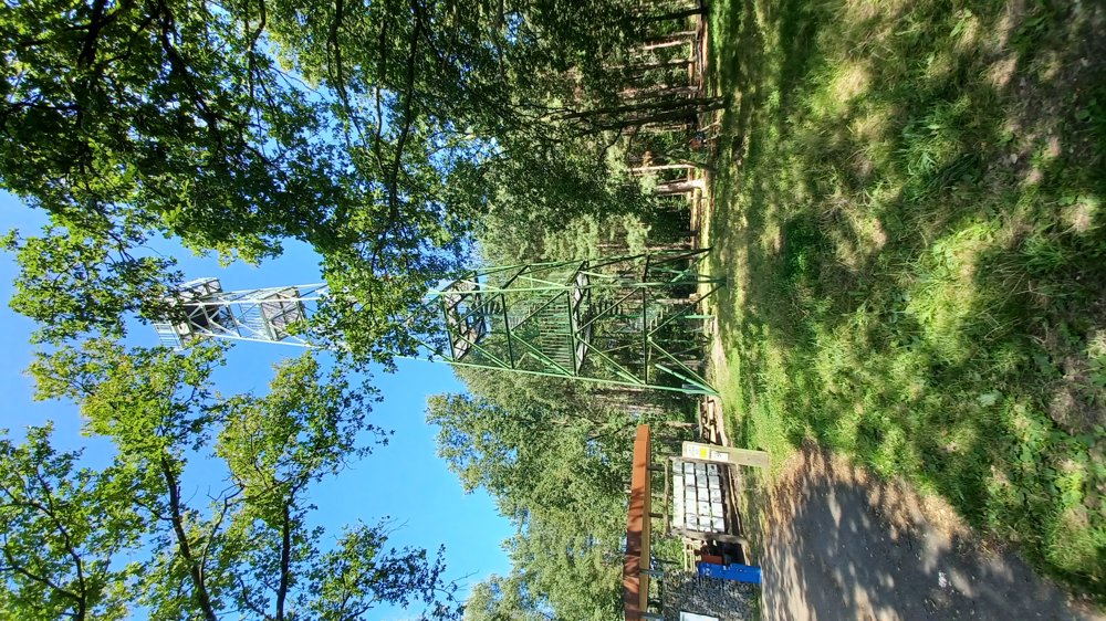
Icon type signage of route signage

The route is fully signposted with nodes.

5m 5m 5m 5m
Atmosphere image 1 of route National Park Bosland-Kolisbos
© Jan Theunis

Icon description route Description

Parking: Torenstraat Pelt Parking

Signage: Nodes.

Hiking through Bosland National Park.

On well-accessible forest paths through the quiet Kolisbos.

Eye-catcher: Observation tower.

Rest benches: among others after 1.4/5.5 and 6.1 km.

automatic translation

Icon nodes to follow nodes to follow

Icon start route
0 km
Icon deviation route
0 km
Image node TP
0.2 km
Image node 25
0.4 km
Image node 18
0.5 km
Image node 19
1.6 km
Image node 36
2.7 km
Image node 30
4.1 km
Image node 29
4.3 km
Image node 28
5.2 km
Image node 31
5.8 km
Image node 27
5.9 km
Image node 26
6.2 km
Image node 32
6.4 km
Image node 33
7.2 km
Image node 18
7.4 km
Image node 25
7.5 km
Icon deviation route
7.8 km
Icon stop route
7.9 km
This route does not have any reviews yet. Be the first!
Rate route!

Which POI do you want to show on the map?

Experimental hiking network
Unsigned icon

The route you have chosen runs (partly) along an experimental virtual hiking node network (the blue-coloured nodes and sections on the map).

You must be logged in to plan routes here.

Experimental hiking network
Unsigned icon

The route you have chosen runs (partly) along an experimental virtual hiking node network (the blue-coloured nodes and sections on the map).

These routes are not controlled in the field. Before you start hiking here, take a minute to read what an experimental hiking node network is and what rules you should follow when hiking here.