 Hiking
 Login
Login More
More EN
EN Premium
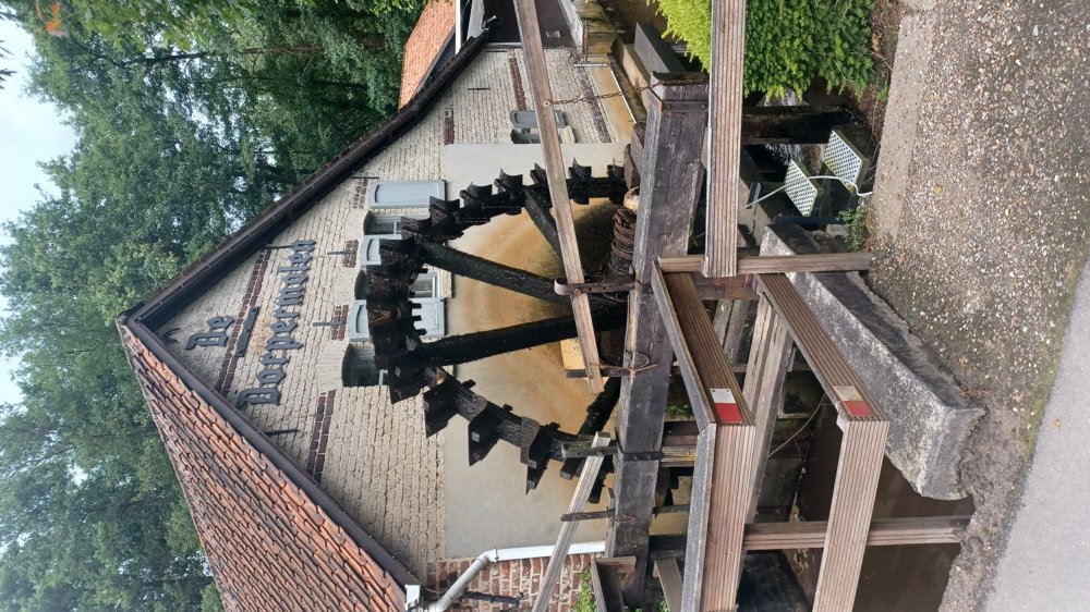
Dorpel Mill Oudsbergen
automatic translation
7.9 km • Oudsbergen
3680 0 0/5
7.9 km
0.0 km
0.0 km
10 km
© OpenStreetMap contributors, Tracestrack

 Addresse starting point (approximate)
Dorpermolenstraat 8, 3670 Meeuwen-Gruitrode, BE
 signage
The route is not signposted. Use a GPS device or our app to follow the route through the virtual nodes.
© Jan Theunis
 Description
Parking: De Dorpermolen, Dorpermolenstraat 5 Oudsbergen.
Signage: Virtual nodes, so GPS/nodes app.
Alternating forest paths and paved roads.
Refueling is possible at De Dorpermolen.
Highlight: De Dorpermolen.
Benches: among others at 1.7 / 2.6 (neglected bench) / 3.3 / 5.2 / 5.6 and 6.9 km
automatic translation
 nodes to follow
0 km

0.4 km
1.9 km
2.1 km
3 km
3.3 km
4.3 km
4.6 km
5.2 km
5.4 km
7.9 km


 Upgrade to Premium Plus
