Loading...

Jesus-Oak, through the Sonian Forest

automatic translation

22 km • Overijse

2401 0 0/5

22 km 0.0 km 0.0 km

route offered by

Jan Theunis

Icon starting point Addresse starting point (approximate)

Witherendreef 1, 3090 Overijse, BE
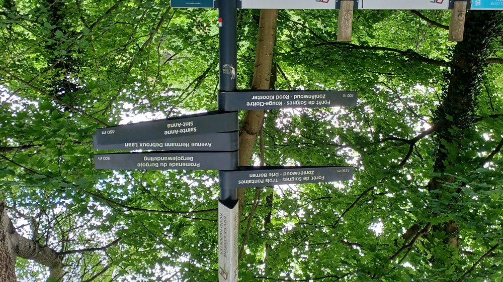
Icon type signage of route signage

The route is not signposted. Use a GPS device or our app to follow the route through the virtual nodes.

5m 5m 5m 5m
Atmosphere image 1 of route Jesus-Oak, through the Sonian Forest Atmosphere image 2 of route Jesus-Oak, through the Sonian Forest Atmosphere image 3 of route Jesus-Oak, through the Sonian Forest
© Jan Theunis

Icon description route Description

Parking: Jesus-Eik, Capucijnenstraat at the cafeteria De Bosuil.

Signposting: Virtual junction points.

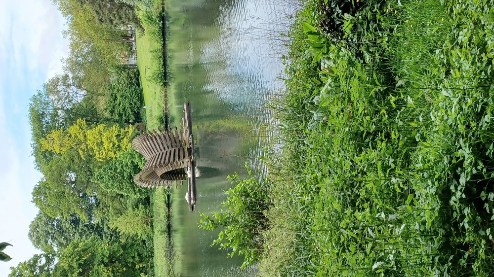
The walk goes mostly through the beautiful Sonian Forest.

Highlights: Rouge Cloître and the Sonian Forest.

Rest and picnic benches: (km) 1.5 / 2.9 / 5.8 Mill Pond / 8.1 Seny Park / 8.5 Reuken Park / 9.9 / 11.9 / 12.5 / 13.5 / 18.3 / 18.8

automatic translation

Icon nodes to follow nodes to follow

Icon start route
0 km
Icon deviation route
0.1 km
Icon deviation route
0.2 km
Icon deviation route
1.1 km
Icon deviation route
1.5 km
Icon deviation route
1.9 km
Icon deviation route
2.3 km
Icon deviation route
2.7 km
Icon deviation route
3 km
Icon deviation route
3.7 km
Icon deviation route
4.7 km
Icon deviation route
5.6 km
Icon deviation route
5.9 km
Icon deviation route
6.8 km
Icon deviation route
7.1 km
Icon deviation route
7.2 km
Icon deviation route
7.5 km
Icon deviation route
7.8 km
Icon deviation route
8.1 km
Icon deviation route
8.5 km
Icon deviation route
8.6 km
Icon deviation route
8.7 km
Icon deviation route
9.1 km
Icon deviation route
9.4 km
Icon deviation route
9.8 km
Icon deviation route
10.3 km
Icon deviation route
10.6 km
Icon deviation route
10.9 km
Image node TP
11.2 km
Image node 101
11.6 km
Image node 102
12.4 km
Image node 105
14.2 km
Icon deviation route
15.5 km
Image node 18
16.5 km
Image node 19
16.8 km
Image node 13
18.5 km
Image node 14
19.6 km
Image node 15
20 km
Image node 425
21.2 km
Icon deviation route
21.8 km
Icon deviation route
22 km
Icon stop route
22 km
This route does not have any reviews yet. Be the first!
Rate route!

Which POI do you want to show on the map?

Experimental hiking network
Unsigned icon

The route you have chosen runs (partly) along an experimental virtual hiking node network (the blue-coloured nodes and sections on the map).

You must be logged in to plan routes here.

Experimental hiking network
Unsigned icon

The route you have chosen runs (partly) along an experimental virtual hiking node network (the blue-coloured nodes and sections on the map).

These routes are not controlled in the field. Before you start hiking here, take a minute to read what an experimental hiking node network is and what rules you should follow when hiking here.