 Hiking
 Login
Login More
More EN
EN Premium
Around the pearl of the Pajottenland Gooik
automatic translation
21 km • Roosdaal
5510 0 0/5

 Addresse starting point (approximate)
Koning Albertstraat 171, 1760 Roosdaal, Belgium
 signage
The route is fully signposted with nodes.
 Description
From Onze-Lieve-Vrouw Lombeek, you quickly pass, rolling on the Pajotten hills, some old castles such as Rokkenborch and Saffelberg. Also, the small Stevenisten church and the protected Saint Peter's Church with classified organ in Leerbeek or the Saint Nicholas Church as the oldest functional building of Gooik deserve your attention.
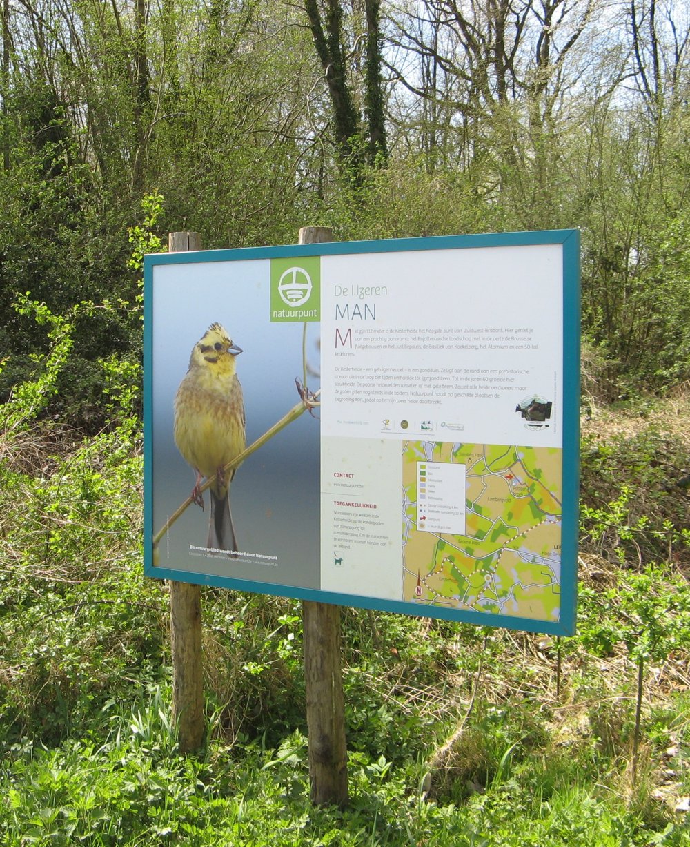
An important place is the versatile Kesterheide with its Iron Man (foundation for Belgian topographic maps), Pervivo park (in honor of children with metabolic diseases), the mausoleum of Staf De Clercq (Flemish nationalist leader), the protected fauna and flora and even NATO communication antennas.
Enjoy beautiful farms in Sint-Kwintens-Lennik on your way or The 3 hammers of Gooik, the official symbol of the Pearl of Pajottenland. But certainly do not forget to visit the folk café with brewery of the former Gooik lords in De Cam.
automatic translation
 nodes to follow
0 km
0.3 km
0.8 km
1.2 km
2.1 km
2.4 km
3.7 km
5 km
5.5 km
5.8 km
6.4 km
7 km
8 km
8.2 km
8.7 km
9.9 km
10 km
10.9 km
11.2 km
11.9 km
12.4 km
13 km
13.7 km
13.7 km
13.7 km
13.8 km
14.5 km
14.9 km
15.5 km
16 km
17.2 km
17.3 km
17.8 km
18.6 km
18.7 km
20.2 km
20.3 km
20.7 km
21 km


 Upgrade to Premium Plus
