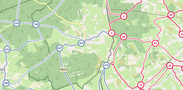
The information on our map is indicative and may differ from the actual situation. Local traffic regulations always take precedence.


Red, numbered circles are signposted nodes on intersections of hiking routes. The purple variants represent virtual nodes without signs on the terrain, to be followed via our app or GPS. The blue variants are experimental nodes without signs on the terrain, also to be followed via our app or GPS.

Small circles without numbers have no signs on the terrain. They are only intended as tools for planning a route without further significance.


Red lines are signposted routes between nodes. Purple lines are non-signposted routes, to be followed via our app or GPS. Blue lines are experimental, non-signposted routes, also to be followed via our app or GPS.


Red lines with white dashed lines indicate unpaved sections of signposted routes. Purple lines with white dashed lines mark unpaved sections on non-signposted routes. Blue lines with dashed lines mark unpaved sections on experimental, non-signposted routes.

Colored zones on the map, varying in color, provide information about that area when clicked, useful for planning your route such as diversions, works, hunting areas, etc. Some zones are inaccessible for route planning.


These icons indicate starting points of suggested routes. By clicking on them, you can consult the route(s).

By clicking on the icon indicated above to the right of the route planner, you will have access to a selection menu with interesting places. Each type of interesting place has a unique icon that you can display on the map.

If you select interesting places as described earlier, you may encounter the above icon on the map, which groups several nearby interesting places together. By clicking on this icon, the map zooms in, allowing you to view each of these places individually.

 Hiking
 Login
Login More
More EN
EN Premium


 Upgrade to Premium Plus


 Official route


