 Hiking
 Login
Login More
More EN
EN Premium
Müllerthal: Tufa Spring and Schiessentümpel
automatic translation
9.3 km • Consdorf
950 0 0/5

 Addresse starting point (approximate)
Mullerthal Schiessentümpel, Consdorf, LU
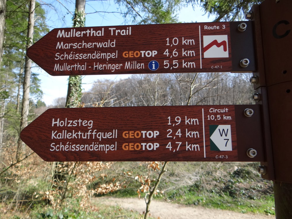
 signage
The route is partially signposted with thematic signs (no nodes). Use a GPS device or our app to follow the route.
 Description
We did this walk on 14/04/2025 (13,411 steps).
It is partially marked with W7 in one direction. We parked at the Schiessentümpel parking lot.
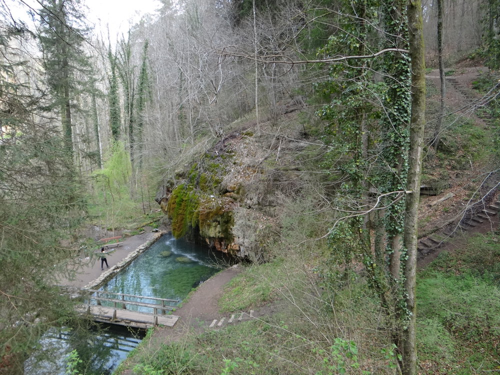
This route allows you to enjoy several highlights that the Müllerthal has to offer. First, one follows a stretch of the Black Ernz valley to then ascend through the idyllic Gluedbaach valley and descend back to the Black Ernz. This southern loop is almost 6 km. The tufa spring can be seen in this loop. Those who aren't very adventurous can just do this loop.
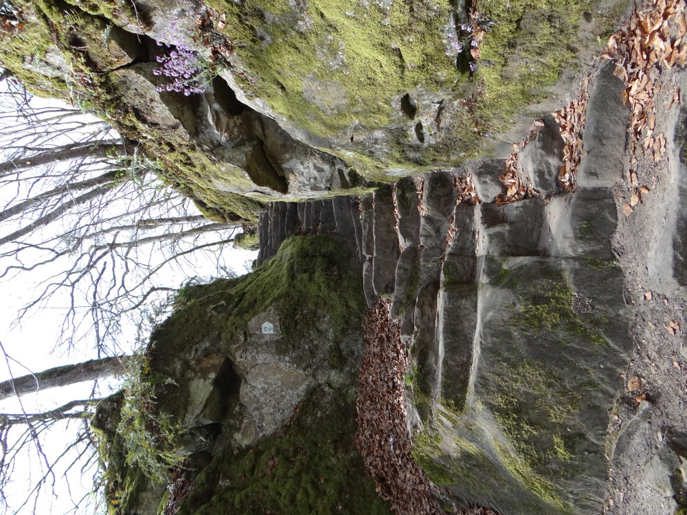
The northern loop is quite adventurous. After the southern loop, you take a short stretch of the CR 121 to go up a rising path at the left of the bench. A bit further, we had to climb over some large boulders. So be careful! Due to works, it's a bit tricky to find which path to take.
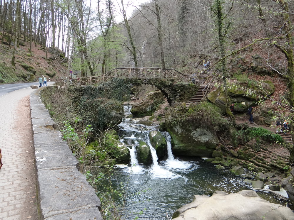
On this loop, you pass by the Schiessentümpel waterfall.
More photos: https://photos.app.goo.gl/GnfWveboQ6G5S3UM9
Happy hiking,
E, R & P
automatic translation


 Upgrade to Premium Plus
