Loading...

Lamorteau-Torgny

automatic translation

11 km • Rouvroy

450 0 0/5

11 km 0.0 km 0.0 km
10 km
© OpenStreetMap contributors, Tracestrack

route offered by

Eddy & Rita

Icon starting point Addresse starting point (approximate)

Rue De l'Eglise 5, 6767, BE

Icon type signage of route signage

The route is partially signposted with thematic signs (no nodes). Use a GPS device or our app to follow the route.

252.6 m 311.2 m 368.1 m 192.3 m These values indicate respectively the number of meters to rise, the highest and the lowest point in meters.
Atmosphere image 1 of route Lamorteau-Torgny Atmosphere image 2 of route Lamorteau-Torgny Atmosphere image 3 of route Lamorteau-Torgny
© Eddy & Rita

Icon description route Description

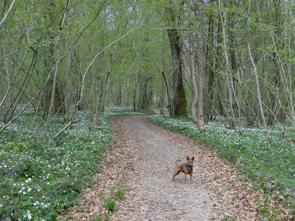
We did this magnificent walk on 04/09/2025 (14,906 steps).

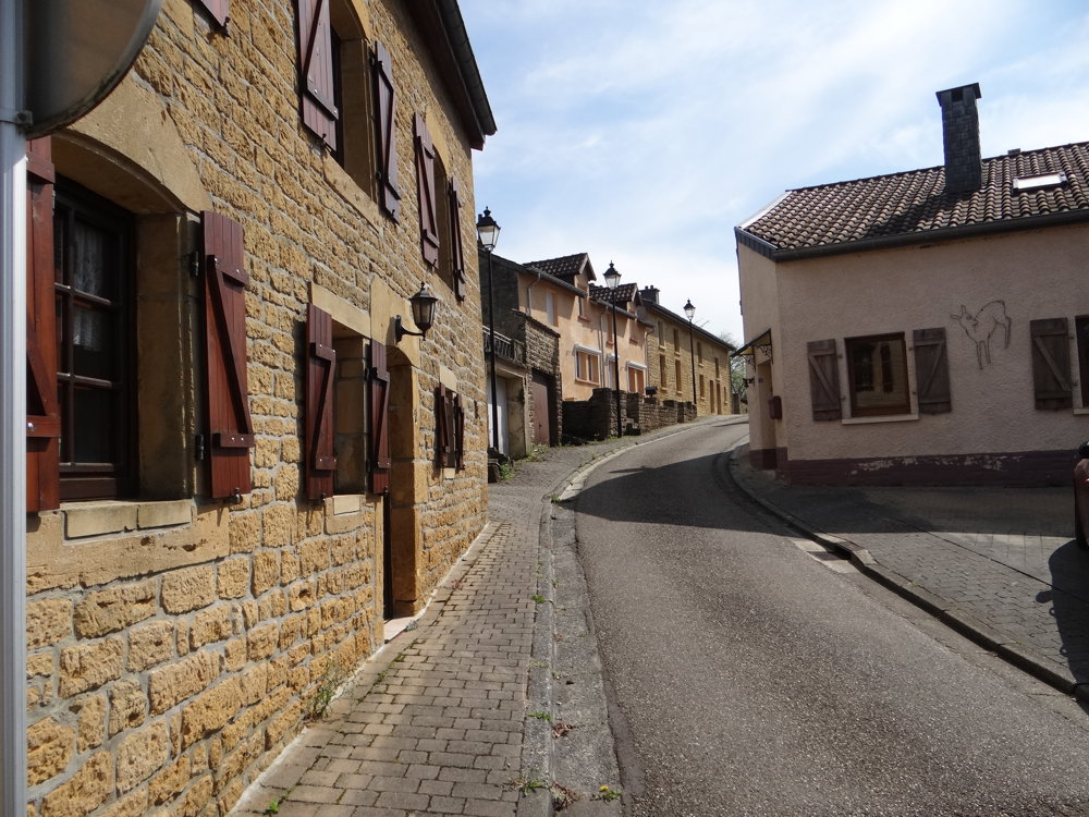
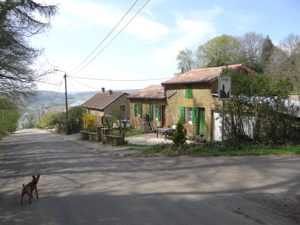
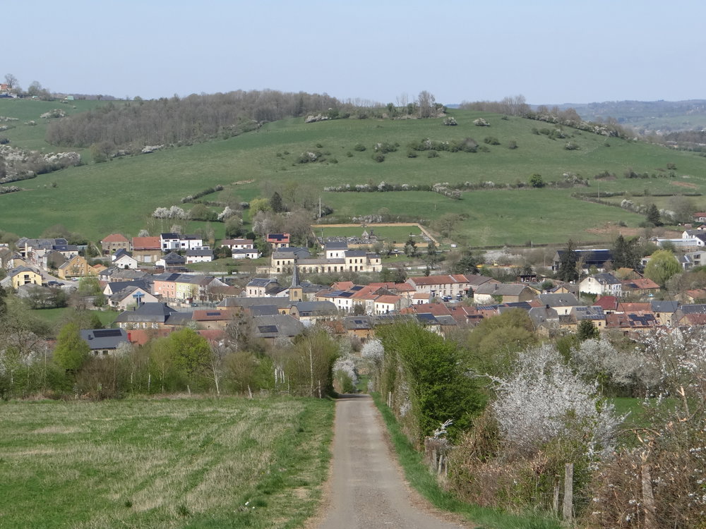
This is a walk that has it all. Beautiful forests with an undergrowth of thousands of wood anemones and small periwinkles, creating a spectacle of white and purple. Steep paths that make the hike quite challenging. Distant views that make you dizzy. And on top of that, the villages of Lamorteau and Torgny, the southernmost village of Belgium, where time has stood still.

Due to its privileged geographical location on the slope, Torgny enjoys an exceptionally warm and dry microclimate, making you feel as if you are in the south of France.

This walking loop is worth every step.

More photos: https://photos.app.goo.gl/weuncrixf8rHruYj8

Happy walking,

Eddy, Rita and Prinske

automatic translation

Icon nodes to follow nodes to follow

Icon start route
0 km
Icon deviation route
0.2 km
Icon deviation route
0.8 km
Image node TP
0.9 km
Image node 265
2.4 km
Image node 156
3.5 km
Image node 546
4.2 km
Image node 596
5 km
Image node 218
6.3 km
Icon deviation route
7.3 km
Image node TP
7.4 km
Image node 240
7.9 km
Image node 914
8.2 km
Image node 474
8.5 km
Image node 356
9.9 km
Image node 516
10.8 km
Image node 592
10.9 km
Icon stop route
11 km
This route does not have any reviews yet. Be the first!
Rate route!

Which POI do you want to show on the map?

Experimental hiking network
Unsigned icon

The route you have chosen runs (partly) along an experimental virtual hiking node network (the blue-coloured nodes and sections on the map).

You must be logged in to plan routes here.

Experimental hiking network
Unsigned icon

The route you have chosen runs (partly) along an experimental virtual hiking node network (the blue-coloured nodes and sections on the map).

These routes are not controlled in the field. Before you start hiking here, take a minute to read what an experimental hiking node network is and what rules you should follow when hiking here.

By clicking 'Accept all cookies,' you agree to the use of cookies for an enhanced user experience, website traffic analysis, and personalized advertisements. Cookie policy