 Hiking
 Login
Login More
More EN
EN Premium
Auto-pedestrian Schoenfels
automatic translation
8.9 km • Mersch
110 0 0/5

 Addresse starting point (approximate)
Rue Du Village 2, 7473 Mersch, LU
 signage
The route is fully signposted with thematic signs (no nodes).
 Description
Markings in both directions: blue diamond on white background
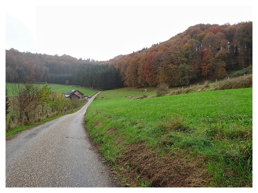
‘Schoenfels’ is a small village situated on the ‘Mamer’. The walk starts at the church and quickly goes uphill along a paved road. Once in the forest, there is more climbing to do, followed by a descent into the valley of the ‘Eisch’.
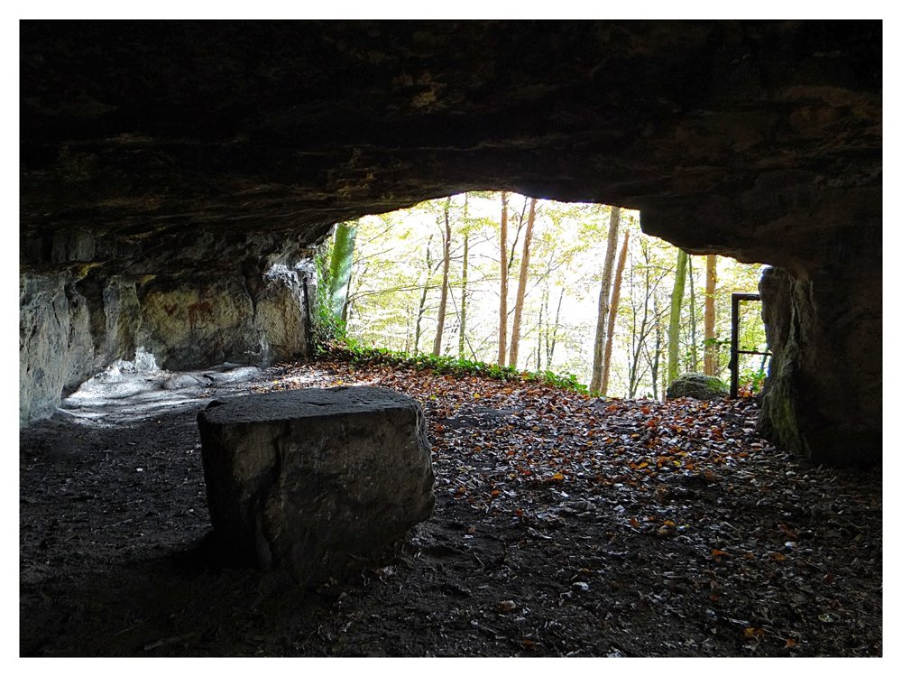
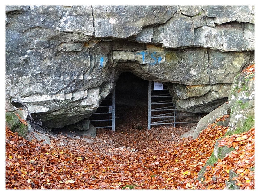
In the ‘Reckenerwald’ we pass by beautiful rock formations where caves are found that provide shelter to bats. To protect the bats, these caves are closed in winter with gates. During the other seasons, the caves are open. Adventurous hikers can explore them using a flashlight.
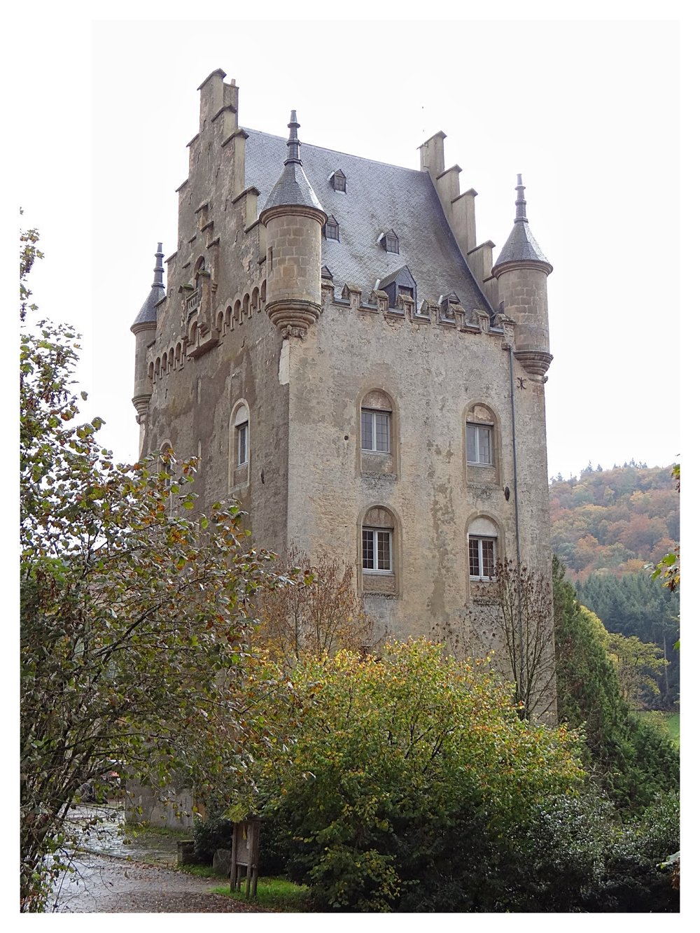
Schoenfels also has a beautiful castle that is unfortunately a bit dilapidated. It cannot be visited. The only downside to this walk is the noise from the nearby busy road, but this is made up for by the beautiful surroundings.
More photos: https://goo.gl/photos/AdX9iN13bVuPX5bs7
Happy hiking,
Eddy, Rita, and Prinske
automatic translation


 Upgrade to Premium Plus
