Loading...

From Lier station to Kessel

automatic translation

10.4 km • Lier

900 0 0/5

10.4 km 0.0 km 0.0 km

route offered by

Eddy & Rita

Icon starting point Addresse starting point (approximate)

Leopoldplein 32, Lier, BE

Icon type signage of route signage

The route is partially signposted with nodes. Use a GPS device or our app to follow the route through virtual nodes.

5m 5m 5m 5m These values indicate respectively the number of meters to rise, the highest and the lowest point in meters.
Atmosphere image 1 of route From Lier station to Kessel Atmosphere image 2 of route From Lier station to Kessel Atmosphere image 3 of route From Lier station to Kessel
© Eddy & Rita

Icon description route Description

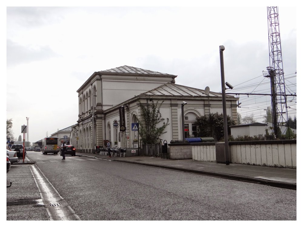
From the station, we walked to the Lier ramparts, remnants of the former city walls.

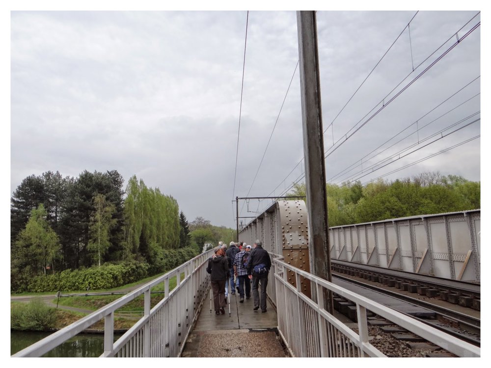
To follow a short stretch of the 'Kleine Nete' and cross the railway bridge to follow the towpath along the 'Netekanaal'.

After the Netekanaal, the valley of the Kleine Nete comes back into play. We leave the Kleine Nete to head via Vogelzangstraat towards the Provincial Green Domain Kesselse Heide.

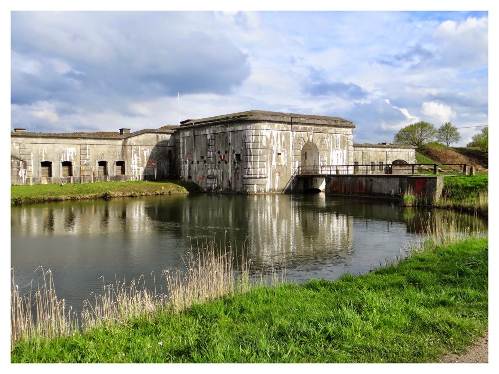
Once through the beautiful nature area, you pass the Fort of Kessel and walk towards the Kessel stop.

Great walk!

More photos: https://photos.app.goo.gl/piuisqLeReajZhcK9

Enjoy your walk,

Eddy, Rita, and Prinske

automatic translation

Icon nodes to follow nodes to follow

Image node TP
0 km
Image node 36
0.3 km
Image node 90
0.9 km
Image node 90
0.9 km
Image node 6
1.7 km
Image node 99
1.8 km
Image node 7
2 km
Image node 98
2.1 km
Image node 94
2.5 km
Image node 86
2.6 km
Image node 78
3.3 km
Image node 77
4.3 km
Image node 75
5.3 km
Image node 75
5.3 km
Image node 74
5.4 km
Image node 57
6 km
Image node 50
7.1 km
Image node 51
7.4 km
Image node 52
8 km
Image node 52
8.1 km
Image node 56
8.3 km
Image node 55
8.5 km
Image node 65
8.8 km
Image node 61
8.9 km
Image node 61
8.9 km
Image node 61
8.9 km
Image node 63
9.3 km
Image node 62
9.4 km
Image node 67
9.6 km
Image node TP
10.4 km
This route does not have any reviews yet. Be the first!
Rate route!

Which POI do you want to show on the map?

Experimental hiking network
Unsigned icon

The route you have chosen runs (partly) along an experimental virtual hiking node network (the blue-coloured nodes and sections on the map).

You must be logged in to plan routes here.

Experimental hiking network
Unsigned icon

The route you have chosen runs (partly) along an experimental virtual hiking node network (the blue-coloured nodes and sections on the map).

These routes are not controlled in the field. Before you start hiking here, take a minute to read what an experimental hiking node network is and what rules you should follow when hiking here.

By clicking 'Accept all cookies,' you agree to the use of cookies for an enhanced user experience, website traffic analysis, and personalized advertisements. Cookie policy