Goesdorf: along the slopes of the Sûre

automatic translation

6.8 km • Goesdorf

70 0 0/5

6.8 km 0.0 km 0.0 km
10 km
© OpenStreetMap contributors, Tracestrack

route offered by

Eddy & Rita

Icon starting point Addresse starting point (approximate)

Op Der Driicht 1, 9653 Goesdorf, LU

Icon type signage of route signage

The route is not signposted. Use a GPS device or our app to follow the route.

160.6 m 172.1 m 482.9 m 343.7 m These values indicate respectively the number of meters to rise, the highest and the lowest point in meters.
Atmosphere image 1 of route Goesdorf: along the slopes of the Sûre Atmosphere image 2 of route Goesdorf: along the slopes of the Sûre Atmosphere image 3 of route Goesdorf: along the slopes of the Sûre
© Eddy & Rita

Icon description route Description

This is the Auto-pédestre Goesdorf.

Markings in both directions, blue diamond on a white background. The car can find a spot at the town hall of Goesdorf.

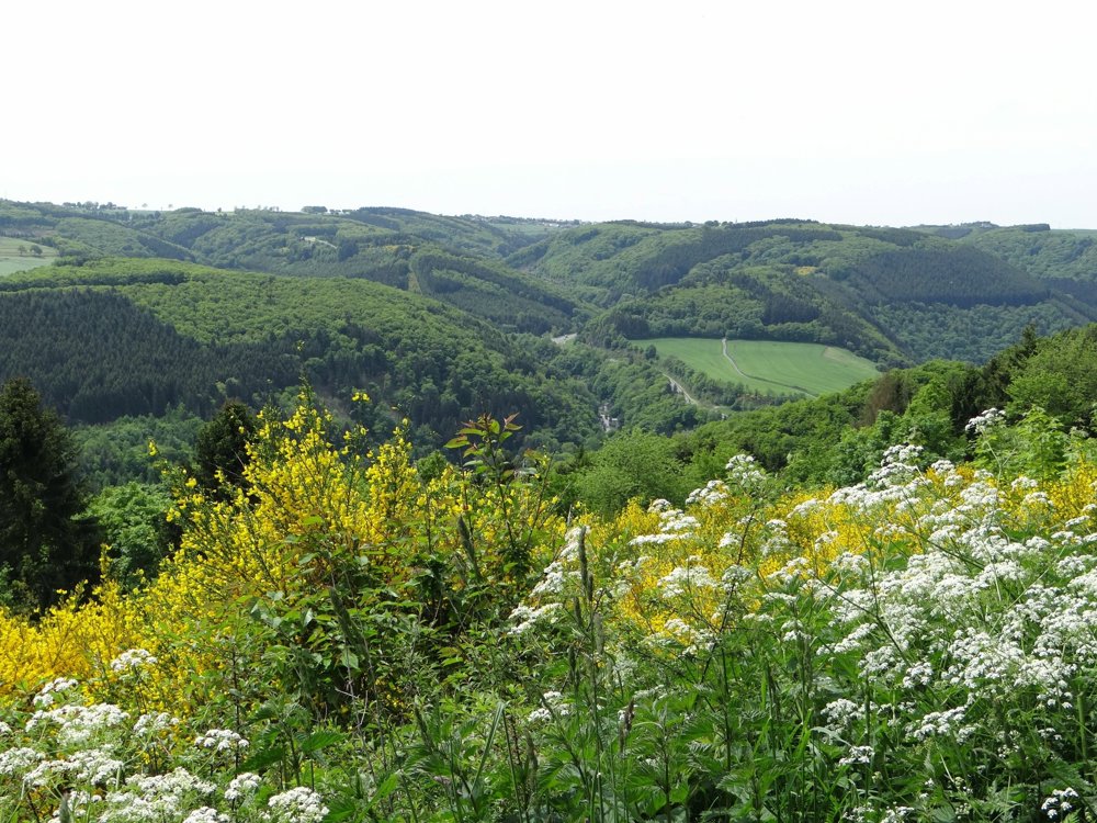
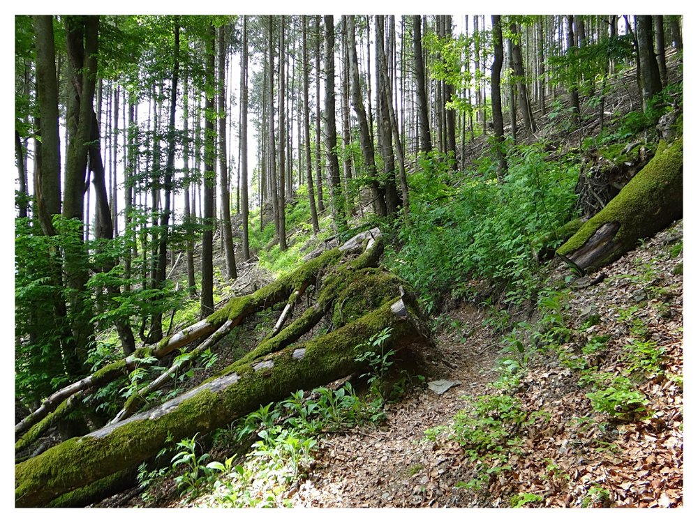
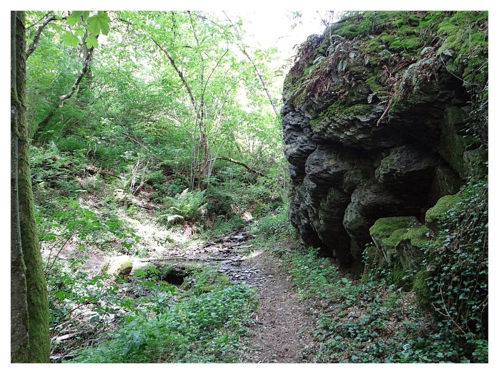
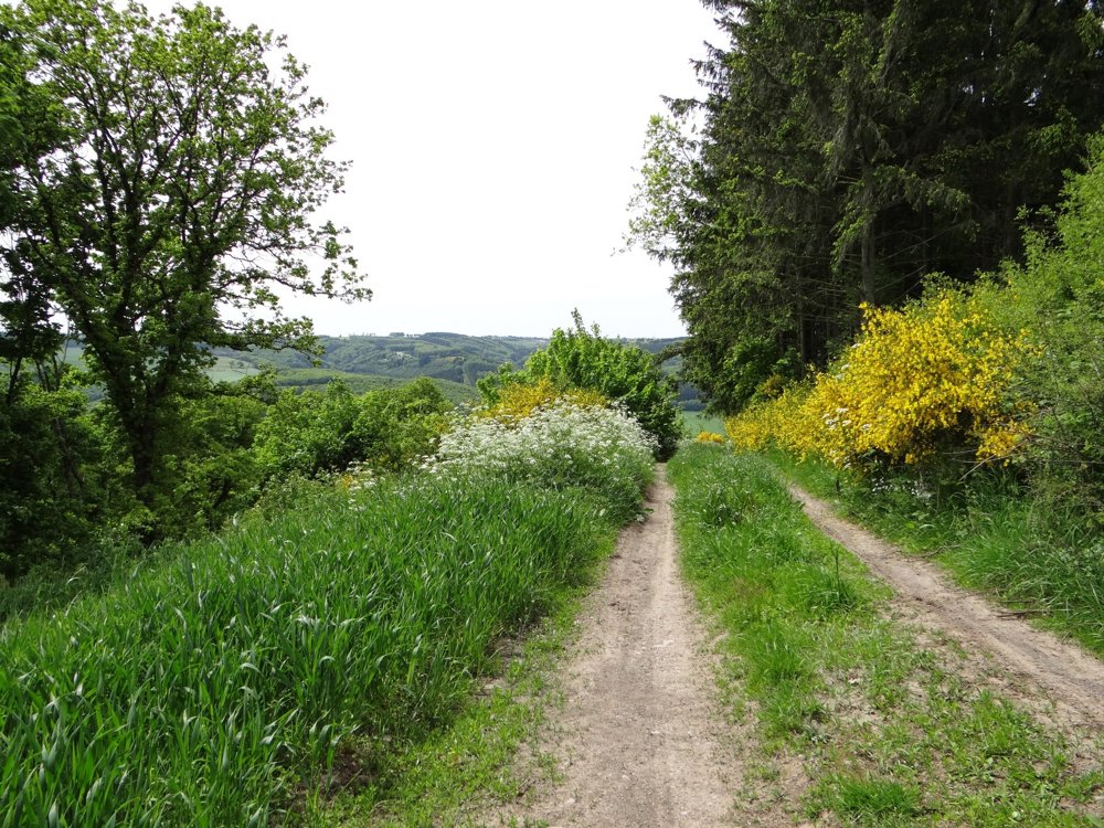
From there, we set off on foot into the valley of the Sûre and past the even deeper 'Weiler Bockholtz'. We go along the narrow paths of the wooded slopes of the Sûre from where we have beautiful views over the valley.

Through pine forests and oak woods, we return to Goesdorf with yet more beautiful views over the villages of 'Heiderscheid' and 'Eschdorf'.

More photos: https://photos.app.goo.gl/41xqPrntr5FkVPi58

Happy hiking,

Eddy, Rita, and Prinske

automatic translation

This route does not have any reviews yet. Be the first!
Rate route!

Which POI do you want to show on the map?

Experimental hiking network
Unsigned icon

The route you have chosen runs (partly) along an experimental virtual hiking node network (the blue-coloured nodes and sections on the map).

You must be logged in to plan routes here.

Experimental hiking network
Unsigned icon

The route you have chosen runs (partly) along an experimental virtual hiking node network (the blue-coloured nodes and sections on the map).

These routes are not controlled in the field. Before you start hiking here, take a minute to read what an experimental hiking node network is and what rules you should follow when hiking here.

By clicking 'Accept all cookies,' you agree to the use of cookies for an enhanced user experience, website traffic analysis, and personalized advertisements. Cookie policy