Loading...

Éislek Trail Vianden

automatic translation

9.2 km • Vianden

250 0 0/5

9.2 km 0.0 km 0.0 km
10 km
© OpenStreetMap contributors, Tracestrack

route offered by

Eddy & Rita

Icon starting point Addresse starting point (approximate)

Rue Du Vieux Marché 42, 9419 Vianden, LU
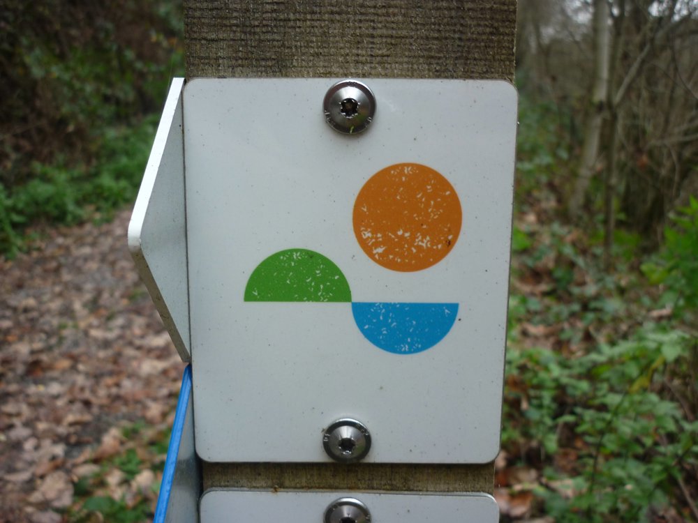
Icon type signage of route signage

The route is fully signposted with thematic signs (no nodes).

372.1 m 364.5 m 496.5 m 207.2 m These values indicate respectively the number of meters to rise, the highest and the lowest point in meters.
Atmosphere image 1 of route Éislek Trail Vianden Atmosphere image 2 of route Éislek Trail Vianden Atmosphere image 3 of route Éislek Trail Vianden
© Eddy & Rita

Icon description route Description

The walk starts at the free parking area near the Our. It is very well signposted in both directions.

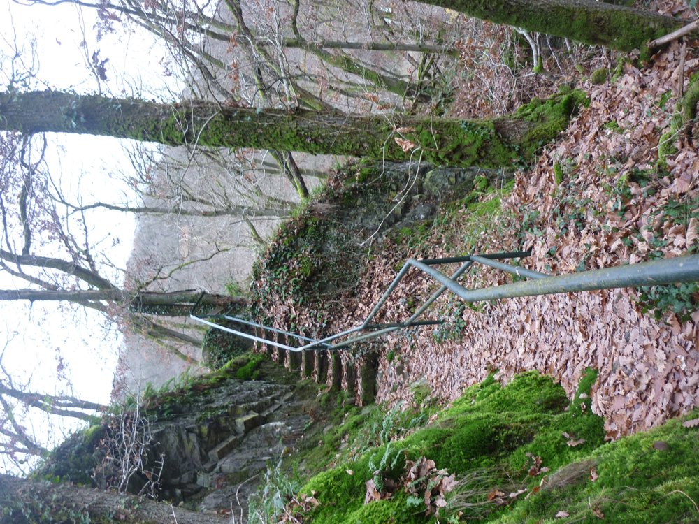
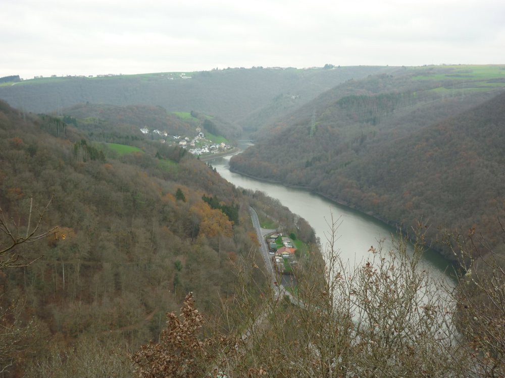
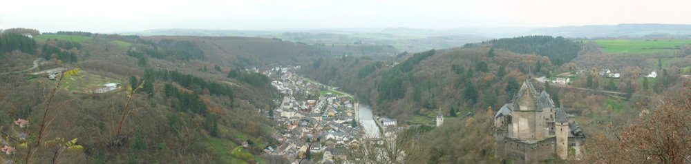
During the ascent and descent of this hike, you can enjoy the breathtaking scenery. Sometimes the Our Valley lies at your feet, then you see Falkenstein Castle in the distance, and during the descent, Vianden shows itself from its best side with the castle and the river. There is even the possibility to go down into the valley with the chairlift.

In winter, the chairlift is closed.

Due to the narrow paths along the slopes of the Our Valley, we recommend considering this hike carefully if there is snow. Walking sticks and sturdy footwear are not a luxury!

More photos: https://photos.app.goo.gl/pH5b9efx96pofsUd7

And for the rest? Just enjoy!

Eddy, Rita, and Prinske

automatic translation

This route does not have any reviews yet. Be the first!
Rate route!

Which POI do you want to show on the map?

Experimental hiking network
Unsigned icon

The route you have chosen runs (partly) along an experimental virtual hiking node network (the blue-coloured nodes and sections on the map).

You must be logged in to plan routes here.

Experimental hiking network
Unsigned icon

The route you have chosen runs (partly) along an experimental virtual hiking node network (the blue-coloured nodes and sections on the map).

These routes are not controlled in the field. Before you start hiking here, take a minute to read what an experimental hiking node network is and what rules you should follow when hiking here.

By clicking 'Accept all cookies,' you agree to the use of cookies for an enhanced user experience, website traffic analysis, and personalized advertisements. Cookie policy