Loading...

Bourscheid local route BS5

automatic translation

9.8 km • Bourscheid

220 0 0/5

9.8 km 0.0 km 0.0 km
10 km
© OpenStreetMap contributors, Tracestrack

route offered by

Eddy & Rita

Icon starting point Addresse starting point (approximate)

Groussgaass 1, 9140 Bourscheid, LU

Icon type signage of route signage

The route is fully signposted with thematic signs (no nodes).

251 m 287.3 m 468.9 m 251.5 m These values indicate respectively the number of meters to rise, the highest and the lowest point in meters.
Atmosphere image 1 of route Bourscheid local route BS5 Atmosphere image 2 of route Bourscheid local route BS5 Atmosphere image 3 of route Bourscheid local route BS5
© Eddy & Rita

Icon description route Description

Markings in both directions with BS5

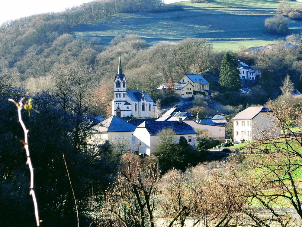
We parked opposite hotel St-Fiacre and began our walk counterclockwise. We followed the valley of the 'Roupersbaach' to the village of 'Welscheid', where the stream flows into the 'Wark'.

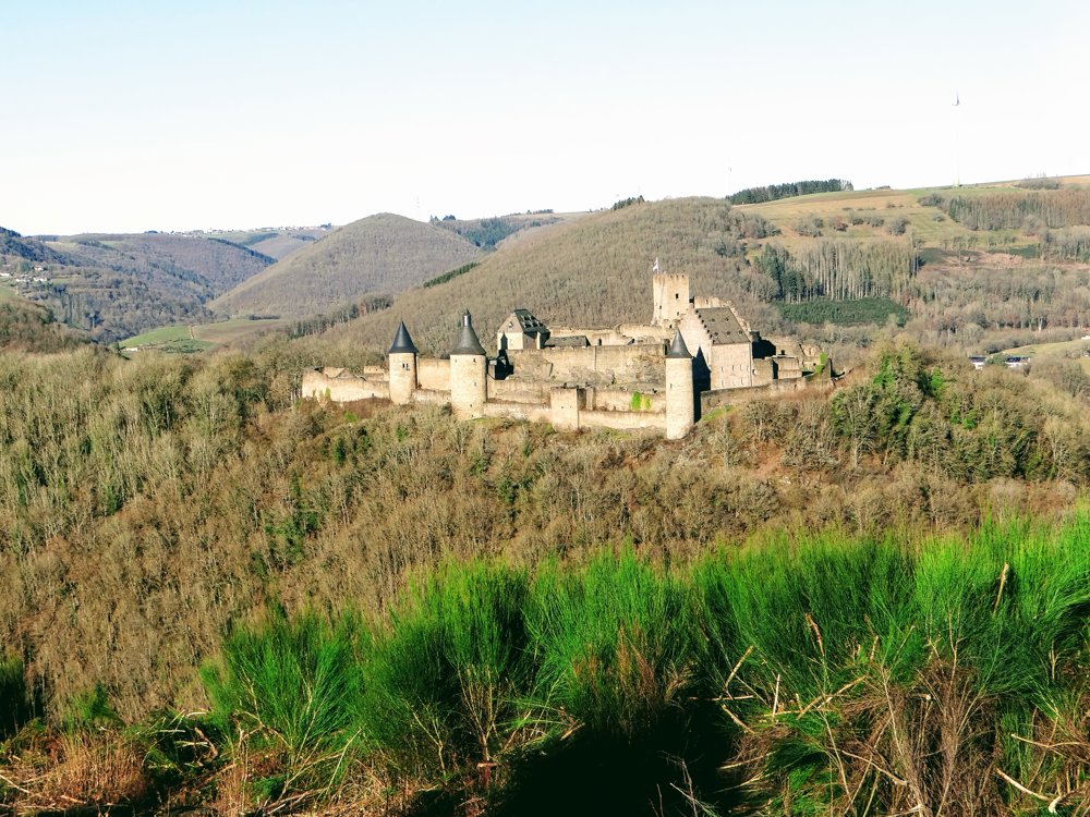
After a gradual climb and a steep ascent, we crossed the CR348 and descended to 'Michelau'. In winter, with no leaves on the trees, we enjoyed beautiful views of the village and the Sûre. Further on, we were treated to lovely views of the castle of Bourscheid.

We ascended, enjoying the views of Bourscheid, the valleys, and the castle, to eventually pick up the car again in Bourscheid.

More photos: https://photos.app.goo.gl/GxZsXUsqDLYfePWv5

Happy hiking!!!

Eddy, Rita and Prinske

automatic translation

This route does not have any reviews yet. Be the first!
Rate route!

Which POI do you want to show on the map?

Experimental hiking network
Unsigned icon

The route you have chosen runs (partly) along an experimental virtual hiking node network (the blue-coloured nodes and sections on the map).

You must be logged in to plan routes here.

Experimental hiking network
Unsigned icon

The route you have chosen runs (partly) along an experimental virtual hiking node network (the blue-coloured nodes and sections on the map).

These routes are not controlled in the field. Before you start hiking here, take a minute to read what an experimental hiking node network is and what rules you should follow when hiking here.

By clicking 'Accept all cookies,' you agree to the use of cookies for an enhanced user experience, website traffic analysis, and personalized advertisements. Cookie policy