Loading...

The rural Goor and Schriek

automatic translation

11.2 km • Heist-op-den-Berg

1901 1 3.5/5

11.2 km 0.0 km 0.0 km
10 km
© OpenStreetMap contributors, Tracestrack

route offered by

Wilfried Lambrechts

Icon starting point Addresse starting point (approximate)

Pastoor Mellaertsstraat 1, 2220 Heist-op-den-Berg, BE

Icon type signage of route signage

The route is not signposted. Use a GPS device or our app to follow the route.

19.3 m 14.8 m 13.3 m 8.5 m These values indicate respectively the number of meters to rise, the highest and the lowest point in meters.
Atmosphere image 1 of route The rural Goor and Schriek Atmosphere image 2 of route The rural Goor and Schriek Atmosphere image 3 of route The rural Goor and Schriek
© Wilfried Lambrechts

Icon description route Description

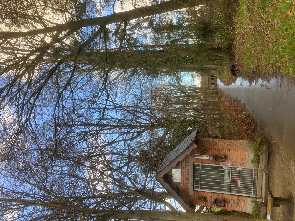
Park for free in Heist-Goor at the church (alternative: Schriek at the church).

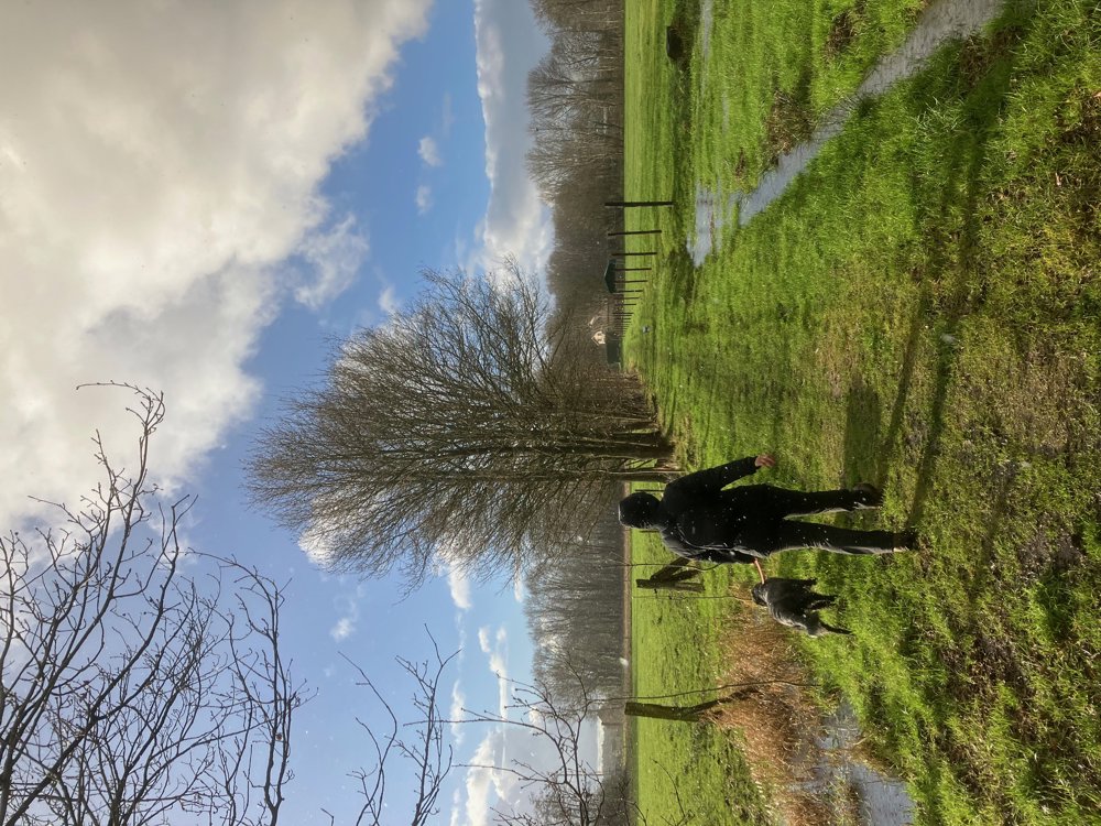
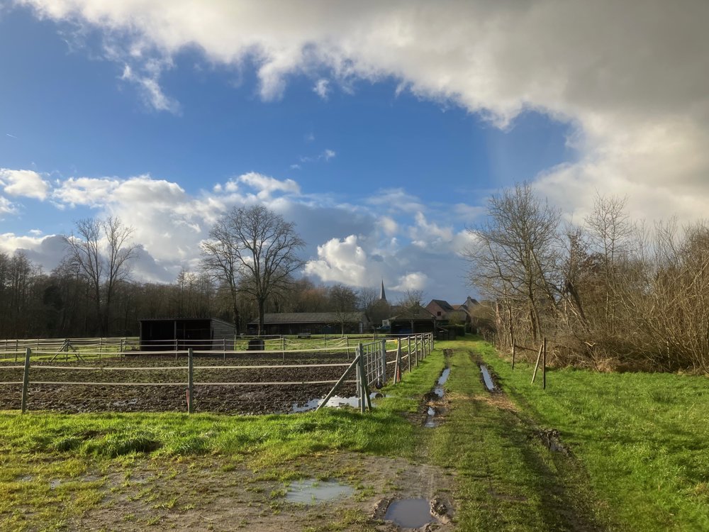
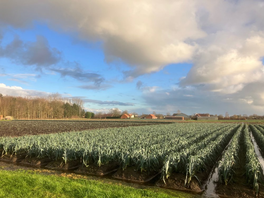
Through quiet streets, field and neighborhood roads (about 30% unpaved), you explore these two rural villages, both part of the municipality of Heist-op-den-Berg. Here and there, you will find additional information on panels of the "resilient villages" campaign.

You pass parks, chapels, grassland, agricultural areas, here and there a residential zone, but also the historic Schriek castle domain, of which only two farms now remain. The main connecting roads are avoided as much as possible, giving you a view of various authentic farms, both old and new. In some places, part of the harvest is still sold on-site through a small shop or more modern vending machines.

You will find hospitality businesses in the village centers. Dogs are welcome on a leash. In wet weather, high hiking boots are necessary.

automatic translation

This route has 1 review(s).
Rate route!

Tuesday, January 7, 2025 by Karel Van der Kuylenbeautiful very quiet neighborhood roads Only in 1 place had to take small detour due to flooding
automatic translation

Which POI do you want to show on the map?

Experimental hiking network
Unsigned icon

The route you have chosen runs (partly) along an experimental virtual hiking node network (the blue-coloured nodes and sections on the map).

You must be logged in to plan routes here.

Experimental hiking network
Unsigned icon

The route you have chosen runs (partly) along an experimental virtual hiking node network (the blue-coloured nodes and sections on the map).

These routes are not controlled in the field. Before you start hiking here, take a minute to read what an experimental hiking node network is and what rules you should follow when hiking here.

By clicking 'Accept all cookies,' you agree to the use of cookies for an enhanced user experience, website traffic analysis, and personalized advertisements. Cookie policy