Loading...

Auto-pedestrian Scheidgen

automatic translation

7.6 km • Consdorf

390 0 0/5

7.6 km 0.0 km 0.0 km
10 km
© OpenStreetMap contributors, Tracestrack

route offered by

Eddy & Rita

Icon starting point Addresse starting point (approximate)

Route d'Echternach 22, 6250 Consdorf, LU

Icon type signage of route signage

The route is fully signposted with thematic signs (no nodes).

184.6 m 137.2 m 374.9 m 284.5 m These values indicate respectively the number of meters to rise, the highest and the lowest point in meters.
Atmosphere image 1 of route Auto-pedestrian Scheidgen Atmosphere image 2 of route Auto-pedestrian Scheidgen Atmosphere image 3 of route Auto-pedestrian Scheidgen
© Eddy & Rita

Icon description route Description

Marker: blue flag on white background.

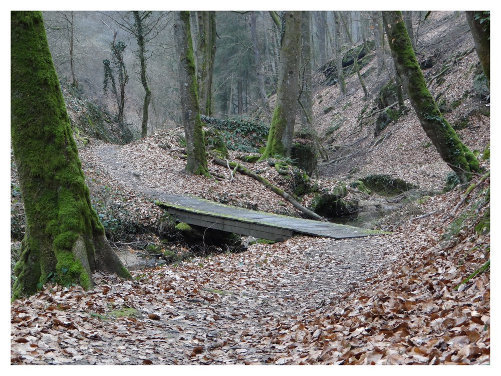
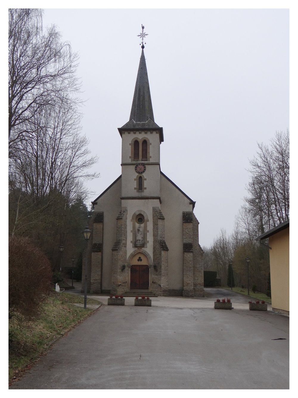
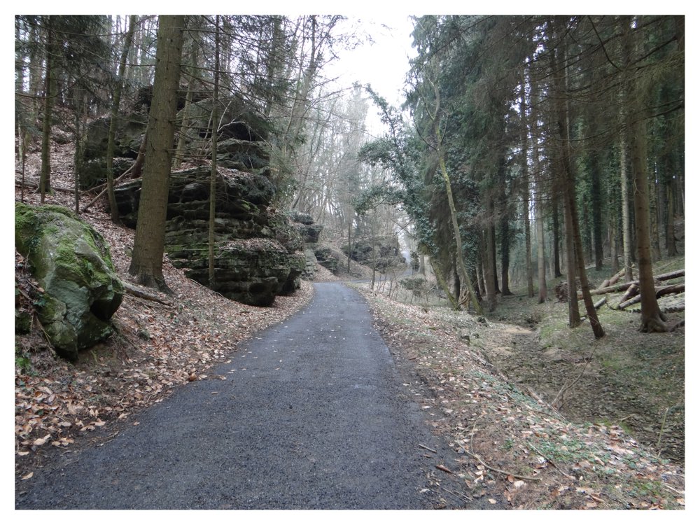
Beautiful walk in 'Little Switzerland' at the entrance of the 'Müllerthal', starting at the church of 'Scheidgen'. Just left of the church, we immediately enter the forest and walk over the rock formation 'Armeslay' to the valley 'Ponteschgrëndchen'.

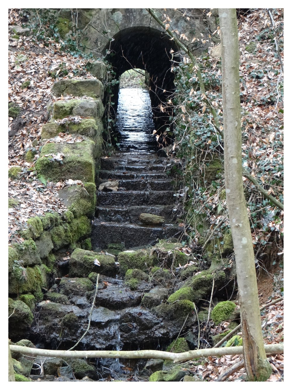
We walk through the 'Ponteschgrëndchen' with its beautiful rock formations, among which the 'Einsiedelei' is particularly noteworthy. To return to 'Scheidgen', we follow the streams 'Deisterbaach' and 'Staebaach', which we cross several times via small bridges.

More photos: https://photos.app.goo.gl/SBeCGoaX86VdBQ918

Happy hiking, Eddy, Rita and Prinske

automatic translation

This route does not have any reviews yet. Be the first!
Rate route!

Which POI do you want to show on the map?

Experimental hiking network
Unsigned icon

The route you have chosen runs (partly) along an experimental virtual hiking node network (the blue-coloured nodes and sections on the map).

You must be logged in to plan routes here.

Experimental hiking network
Unsigned icon

The route you have chosen runs (partly) along an experimental virtual hiking node network (the blue-coloured nodes and sections on the map).

These routes are not controlled in the field. Before you start hiking here, take a minute to read what an experimental hiking node network is and what rules you should follow when hiking here.

By clicking 'Accept all cookies,' you agree to the use of cookies for an enhanced user experience, website traffic analysis, and personalized advertisements. Cookie policy