Loading...

A 'waw walk' from Bettendorf (Luxembourg)

automatic translation

12.5 km • Bettendorf

431 1 5/5

12.5 km 0.0 km 0.0 km
10 km
© OpenStreetMap contributors, Tracestrack

route offered by

Jacques Peyskens

Icon starting point Addresse starting point (approximate)

Cité Hannert Dem Schlass 18, 9353 Bettendorf, LU
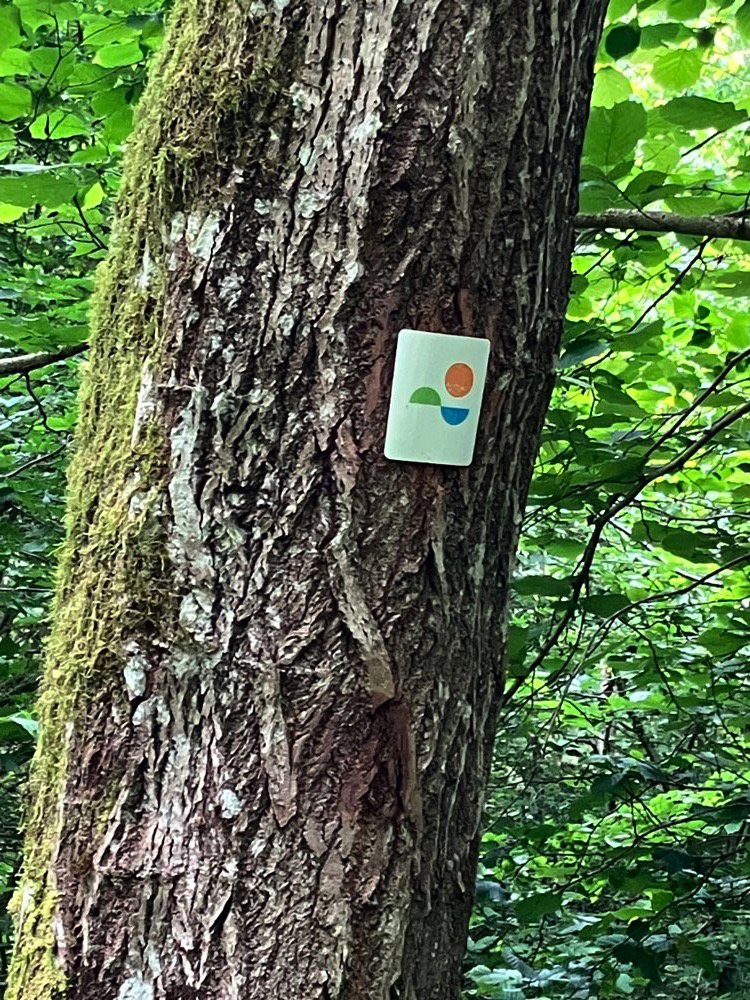
Icon type signage of route signage

The route is fully signposted with thematic signs (no nodes).

294.5 m 274.3 m 444.4 m 185.9 m These values indicate respectively the number of meters to rise, the highest and the lowest point in meters.
Atmosphere image 1 of route A 'waw walk' from Bettendorf (Luxembourg) Atmosphere image 2 of route A 'waw walk' from Bettendorf (Luxembourg)
© Jacques Peyskens

Icon description route Description

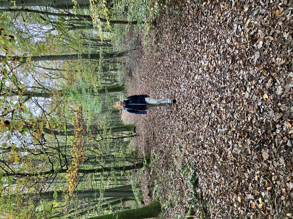
This walk is highly rewarding due to the constant variety of paths, panoramas, and wooded stretches.

It is best to start from the parking lot along the N19, just outside Bettendorf coming from Diekirch. There are also some benches and the possibility to have a picnic.

In a clockwise direction, you first cross Bettendorf and then follow the dike along the Sûre for a while. The path then crosses the N19, and a not insignificant climb then leads to the ridge of the Fouerbierg.

From now on, you can truly enjoy expansive views, lovely forest paths, and silence. There is a section with old trenches and foxholes, as a defensive line was located here in WWII. Several benches can also be found along the route.

automatic translation

This route has 1 review(s).
Rate route!

Saturday, February 22, 2025 by Eddy & RitaIndeed, like all Éislek Trails, a waw hike. Our photo album on this trail can be found at this link: https://photos.app.goo.gl/yrdrcXFJJGMp7iec6
automatic translation

Which POI do you want to show on the map?

Experimental hiking network
Unsigned icon

The route you have chosen runs (partly) along an experimental virtual hiking node network (the blue-coloured nodes and sections on the map).

You must be logged in to plan routes here.

Experimental hiking network
Unsigned icon

The route you have chosen runs (partly) along an experimental virtual hiking node network (the blue-coloured nodes and sections on the map).

These routes are not controlled in the field. Before you start hiking here, take a minute to read what an experimental hiking node network is and what rules you should follow when hiking here.

By clicking 'Accept all cookies,' you agree to the use of cookies for an enhanced user experience, website traffic analysis, and personalized advertisements. Cookie policy