Loading...

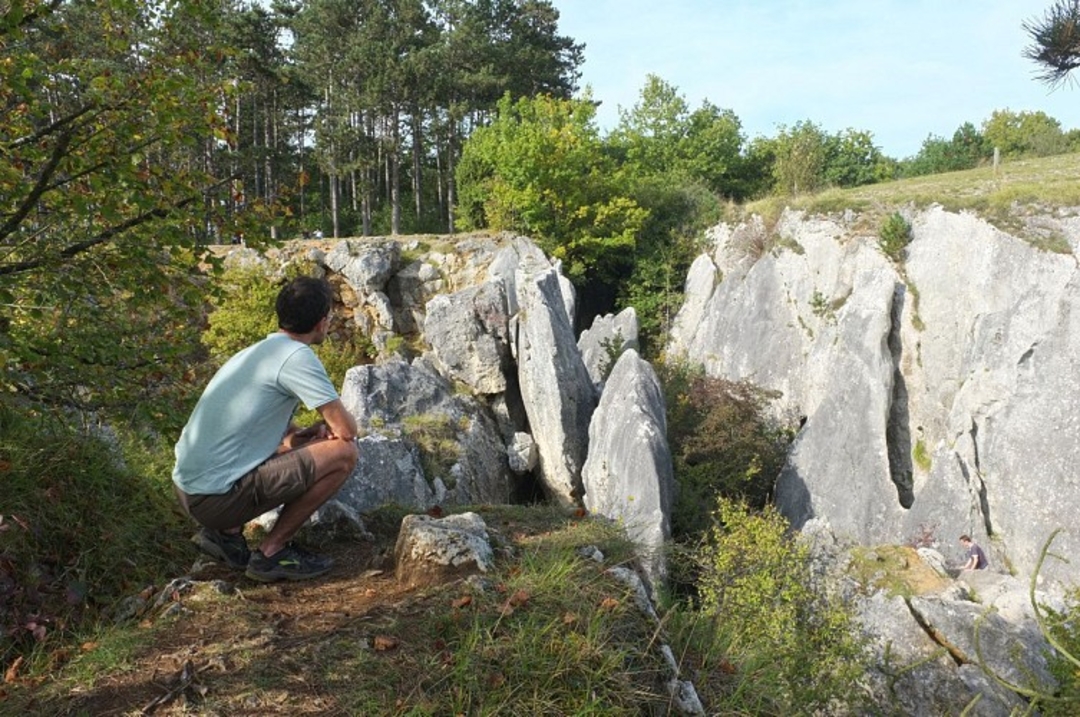
Nismes and the 'Fondry des Chiens' gorge

16.1 km • Nismes

Icon official route official route

9236 1 5/5

16.1 km 0.0 km 0.0 km
10 km
© OpenStreetMap contributors, Tracestrack

route offered by

Badge of official route

more info

Icon starting point Addresse starting point (approximate)

Rue Vieille-Eglise 5,5670 Nismes, BE

Icon type signage of route signage

The route is signposted with thematic signs (no nodes). You can use a GPS device or our app to follow the route through the virtual nodes.

321.5 m 316.9 m 261.3 m 143.8 m These values indicate respectively the number of meters to rise, the highest and the lowest point in meters.
© Pierre Pauquay

Icon description route Description

In the south of the province of Namur, the sun, when warming the calcareous soil, sees a real carpet of flowers blooming... The Fondry des Chiens, a natural sinkhole, might very well remind you of the Verdon gorges in miniature.

Exceptional flora, sparkling river, impressive panorama and even a steam railway complete this lovely walk.

Icon nodes to follow nodes to follow

Image node 24
0 km
Image node 21
0.1 km
Image node 20
0.4 km
Image node 23
0.6 km
Image node 470
2 km
Image node 335
3.5 km
Image node 17
5 km
Image node 19
5.9 km
Image node 619
7.1 km
Image node 866
7.8 km
Image node 15
9.1 km
Image node 14
11 km
Image node 161
11.1 km
Image node 13
11.2 km
Image node 12
13.1 km
Image node 11
13.4 km
Image node 321
13.5 km
Image node 8
13.5 km
Image node 9
13.6 km
Image node 909
14 km
Image node 744
14.2 km
Image node 134
14.5 km
Image node 5
15 km
Image node 4
15.1 km
Image node 3
15.3 km
Image node 1
15.8 km
Image node 718
15.9 km
Image node 24
16.1 km
This route has 1 review(s).
Rate route!

Friday, January 10, 2025 by L.V.Beautiful hike with lots of variety: some tough inclines, pleasant villages, forest trails, impressive views. We did this hike on 4/1/2025 and route in app completely matched what we found in the field. Experiment succeeded :-) Highly recommended!
automatic translation

Which POI do you want to show on the map?

Experimental hiking network
Unsigned icon

The route you have chosen runs (partly) along an experimental virtual hiking node network (the blue-coloured nodes and sections on the map).

You must be logged in to plan routes here.

Experimental hiking network
Unsigned icon

The route you have chosen runs (partly) along an experimental virtual hiking node network (the blue-coloured nodes and sections on the map).

These routes are not controlled in the field. Before you start hiking here, take a minute to read what an experimental hiking node network is and what rules you should follow when hiking here.

By clicking 'Accept all cookies,' you agree to the use of cookies for an enhanced user experience, website traffic analysis, and personalized advertisements. Cookie policy