 Hiking
 Login
Login More
More EN
EN Premium
All shades of green from Herentals-North (train?)
automatic translation
12.4 km • Herentals
6073 3 3.3/5

 Addresse starting point (approximate)
Vorselaarsebaan 50, 2200 Herentals, BE
 signage
The route is fully signposted with nodes.
 Description
Park at Netepark or come by train.
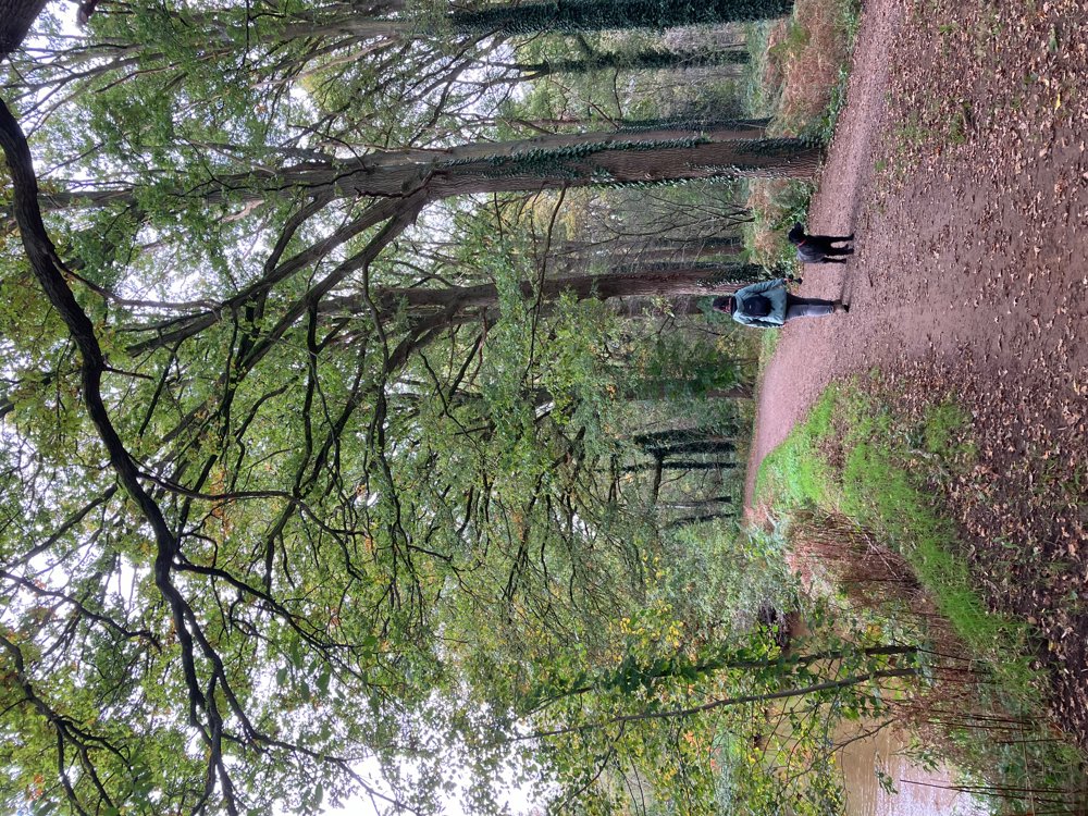
You start along the banks of the Kleine Nete and continue your way through the surrounding deciduous forests with several clearings. In autumn, the mushrooms here are numerous and diverse.
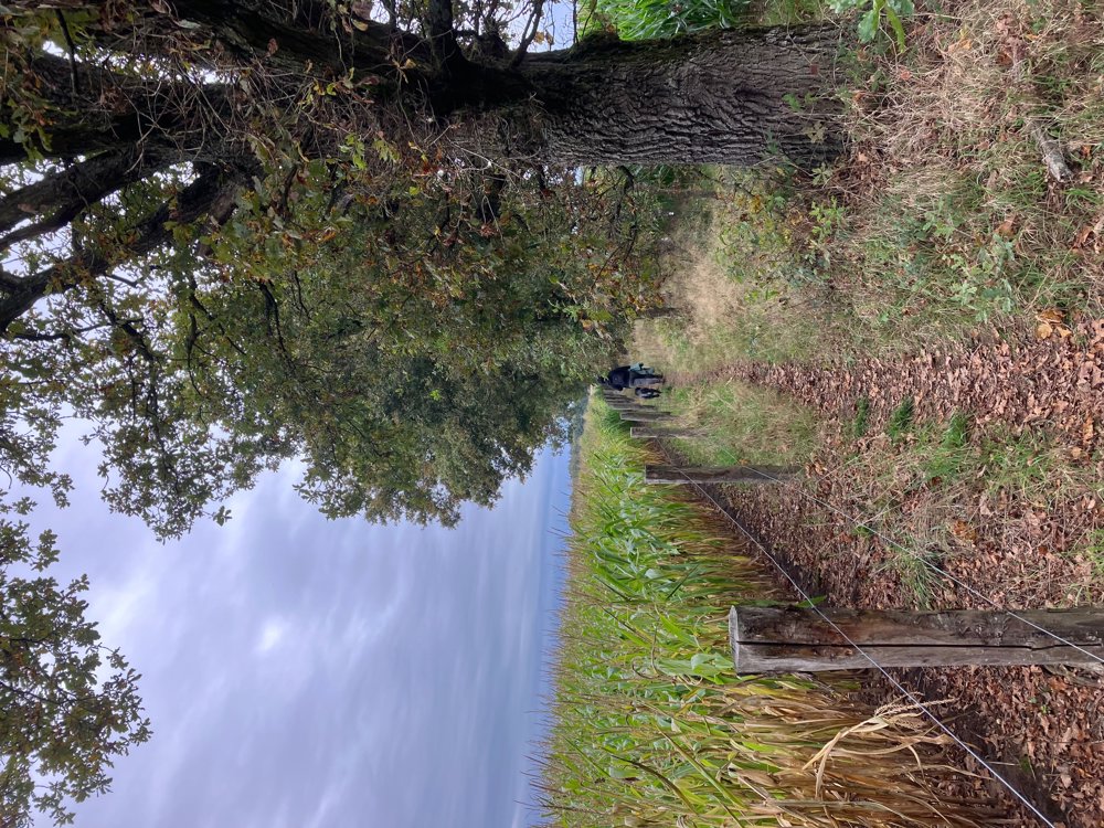
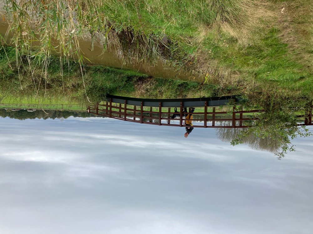
From dry bank to muddy forest path, country lanes, farm roads, sand dunes... everything is included. The vegetation changes from deciduous to coniferous forests, passes open fields, meadows, quiet roads, field edges... Plenty of variety during this walk. You even pass an idyllic little bridge over the Aa or can search for an elevated viewpoint over the Kempense Heuvelrug.
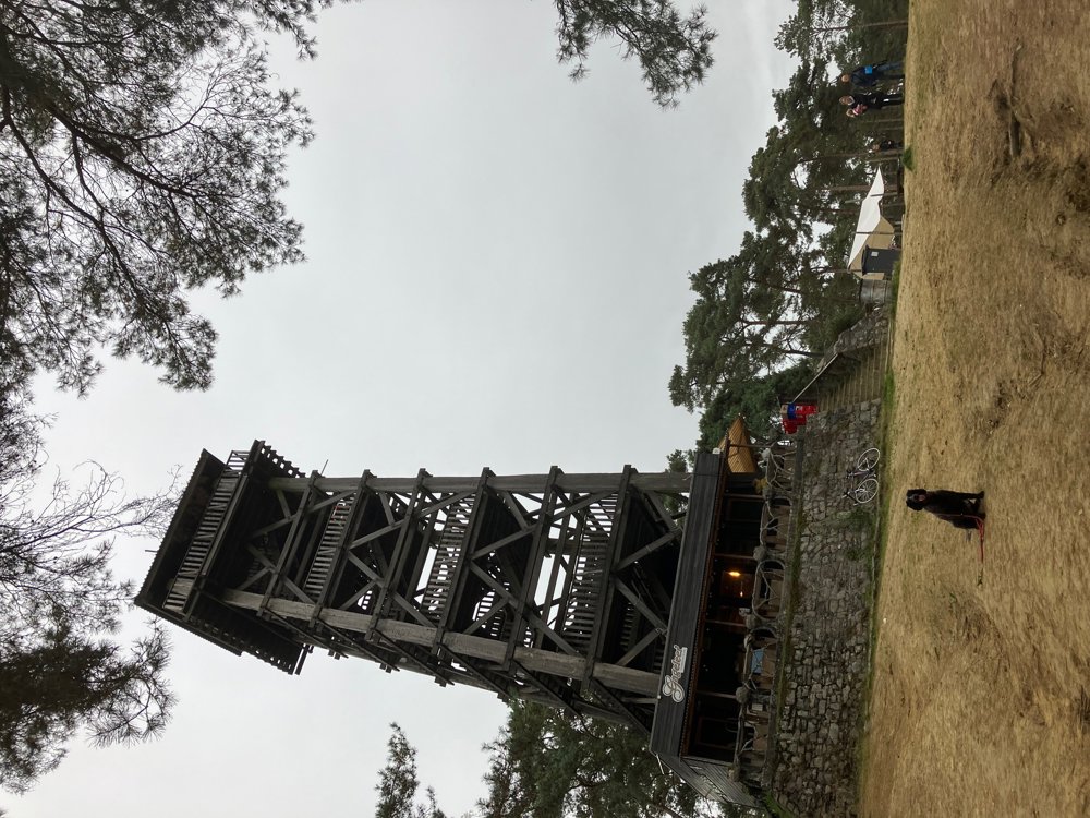
This "Toeristentoren" is also the only place to get a drink on the way, located at junction 10, not far from the end. In this sand-rich natural area, you can easily extend your walk a little further, take a play break for the children in the designated areas, or follow a centuries-old way of the cross.
High walking boots recommended. Dogs welcome on a leash.
automatic translation
 nodes to follow
0 km
0.8 km
0.9 km
1.8 km
2.2 km
3.4 km
3.5 km
4.8 km
4.9 km
5.9 km
6.6 km
6.8 km
6.9 km
7.4 km
7.7 km
8.1 km
8.6 km
8.6 km
9.4 km
9.4 km
9.5 km
10.2 km
10.5 km
10.6 km
10.9 km
11.3 km
12.4 km
Sunday, January 19, 2025 by D.W.this morning one of the worst experiences with hiking nodes - starting point not correct - after half an hour of searching 97 found - left towards 25 - but never arrived - the signs are blank - all colors have disappeared and thus illegible - finally after a good hour "wandering around" went back to car
automatic translation
Sunday, January 19, 2025 by W.L.Very unfortunate. Tip: use the app and check where you are with the "blue dot " and you are immediately on the right track even if a pole disappears after forest work. But I will pass it on.
automatic translation
Monday, January 20, 2025 by Yannick MertensFrom the province, we know that in this region signs are regularly vandalized. In the sense that strangers often pull off the stickers. I fear, when I read your post, that this will also be such a case. We at Wandelknooppunt will therefore report this from the province.
automatic translation
Sunday, November 17, 2024 by I.V.Very nice hike! caution some signs towards 25 have disappeared, but we found our way!
automatic translation
Sunday, October 27, 2024 by W.V.Very nice route!
automatic translation


 Upgrade to Premium Plus
