Loading...

Premium Walk "The Leudal"

automatic translation

14.2 km • Leudal

50 0 0/5

14.2 km 0.0 km 0.0 km

route offered by

Jan Theunis

Icon starting point Addresse starting point (approximate)

Busschopsweg 9, 6093AA Leudal, NL
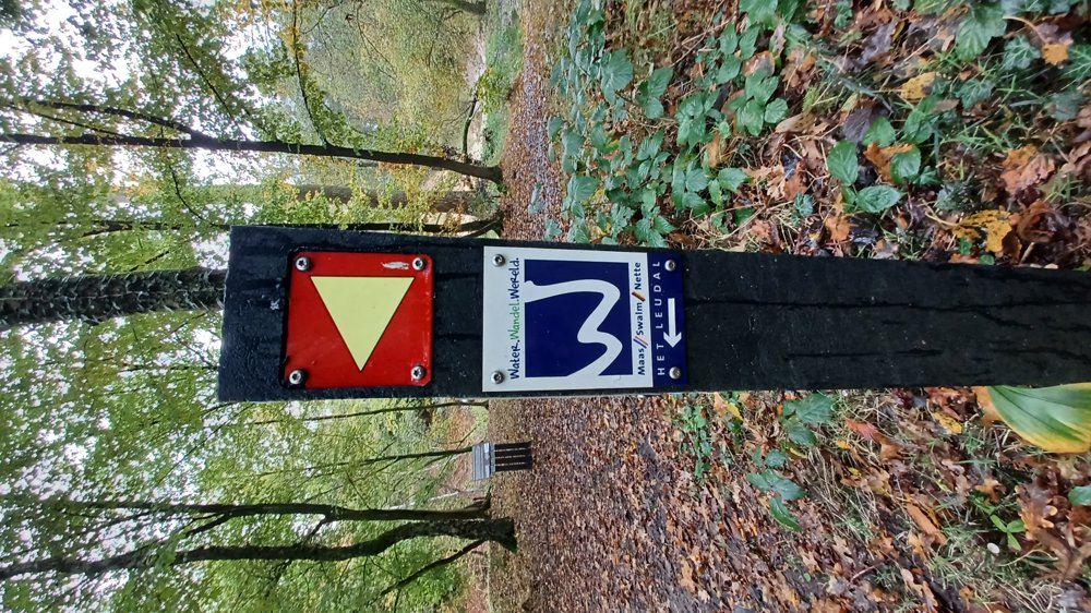
Icon type signage of route signage

The route is fully signposted with thematic signs (no nodes).

5m 5m 5m 5m
Atmosphere image 1 of route Premium Walk "The Leudal" Atmosphere image 2 of route Premium Walk "The Leudal" Atmosphere image 3 of route Premium Walk "The Leudal"
© Jan Theunis

Icon description route Description

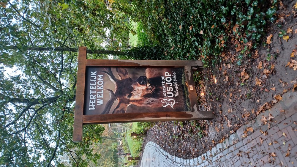
Parking: Heythuysen (NL) Parking lot Restaurant De Busjop, Busschopweg 9

Signage: signs with a white "W" on a blue background.

Very beautiful walk along, among others, the Roggelsebeek and Leubeek.

You mostly walk on narrow forest paths and the signage is excellent.

This is one of the Premium walks in the Netherlands and received 70 points from the Deutsches Wanderinstitut.

Benches: among others at 2.3/7.7/8.1 and 12.9 km.

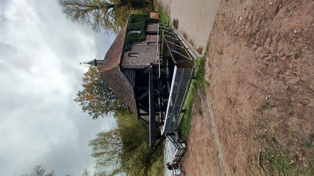
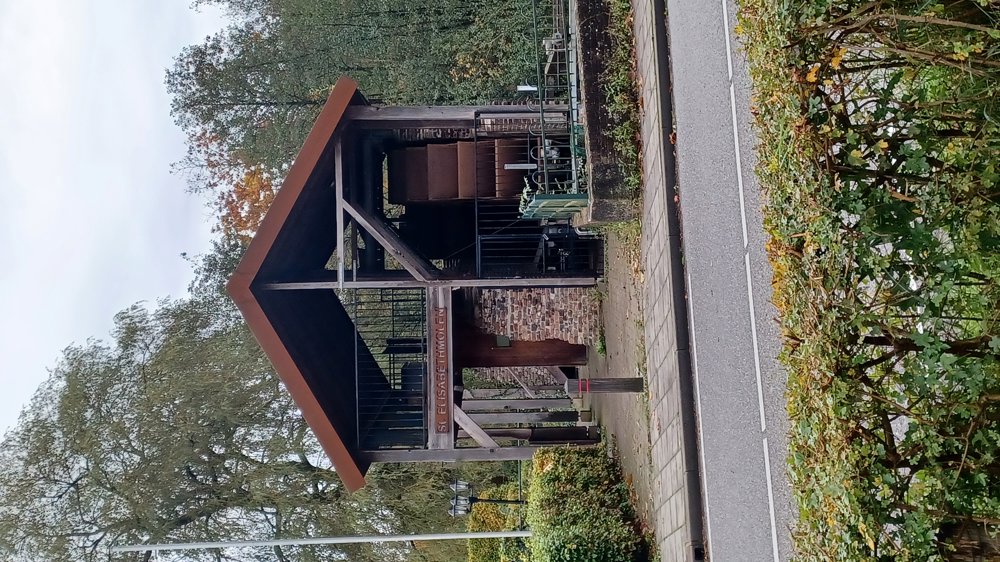
Attractions: The Leumolen and the St. Elisabethmolen.

Catering: at the starting point Restaurant De Busjop and next to the St. Elisabethmolen.

automatic translation

Icon nodes to follow nodes to follow

Icon start route
0 km
Image node 91
0.1 km
Image node 20
0.6 km
Image node 20
0.6 km
Image node 22
2.2 km
Image node 26
2.4 km
Image node 48
2.5 km
Image node 46
2.9 km
Image node 47
3.3 km
Image node 8
3.7 km
Image node 13
4.1 km
Image node 11
4.5 km
Image node 11
4.5 km
Image node 62
6 km
Image node 63
6.2 km
Image node 50
6.5 km
Image node 51
6.6 km
Image node 53
7.3 km
Image node 56
7.7 km
Image node 61
8 km
Image node 58
8.2 km
Image node 24
8.7 km
Image node 27
8.8 km
Image node 27
8.9 km
Icon deviation route
9.1 km
Icon deviation route
9.1 km
Image node TP
9.5 km
Image node 7
10 km
Image node 5
10.3 km
Image node 6
10.5 km
Image node 26
10.9 km
Image node 1
11.1 km
Image node 79
11.8 km
Image node 78
12.1 km
Image node 96
12.7 km
Image node 94
13.1 km
Image node 94
13.1 km
Image node 92
13.6 km
Image node 91
14 km
Image node 91
14 km
Icon deviation route
14.1 km
Icon stop route
14.1 km
This route does not have any reviews yet. Be the first!
Rate route!

Which POI do you want to show on the map?

Experimental hiking network
Unsigned icon

The route you have chosen runs (partly) along an experimental virtual hiking node network (the blue-coloured nodes and sections on the map).

You must be logged in to plan routes here.

Experimental hiking network
Unsigned icon

The route you have chosen runs (partly) along an experimental virtual hiking node network (the blue-coloured nodes and sections on the map).

These routes are not controlled in the field. Before you start hiking here, take a minute to read what an experimental hiking node network is and what rules you should follow when hiking here.