 Hiking
 Login
Login More
More EN
EN Premium
Devil's Hole & ‘Weilerbach Castle’
automatic translation
14.3 km • Eifelkreis Bitburg-Prüm
420 0 0/5

 Addresse starting point (approximate)
Weilerbacher Straße 37, 54668 Südeifel, DE
 signage
The route is not signposted. Use a GPS device or our app to follow the route.
 Description
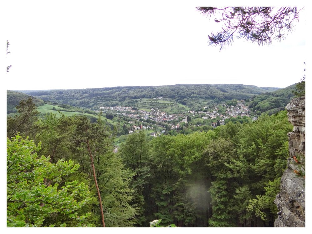
The walk goes through the ‘Naturpark Südeifel’. The altitude differences are not too difficult to overcome.
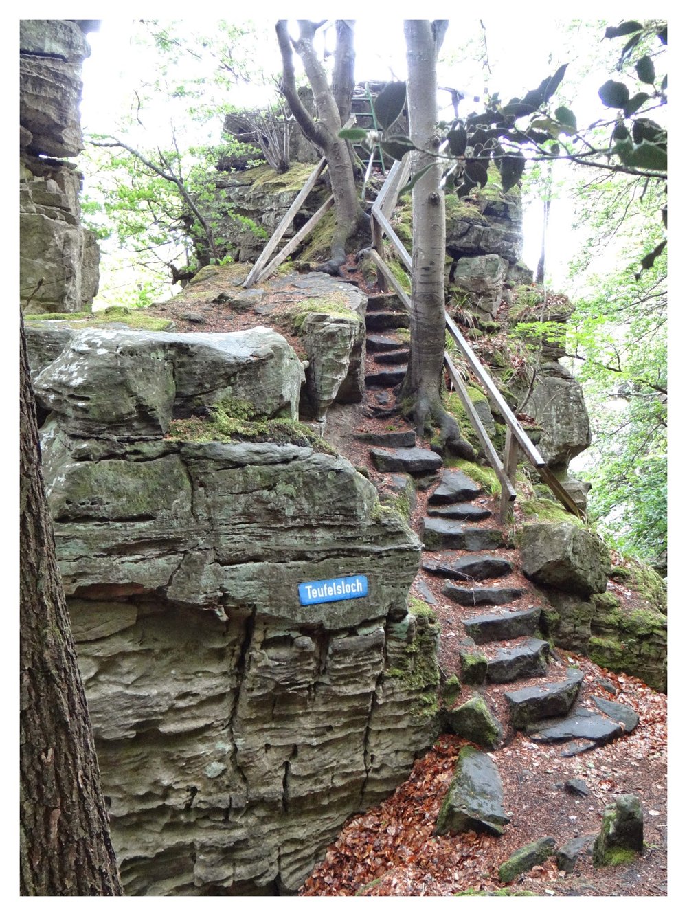
At ‘Teufelsloch’, a viewpoint that can be reached via a staircase and from where you descend further to a lower path, you have to be careful. In winter, the stairs can be treacherously slippery.
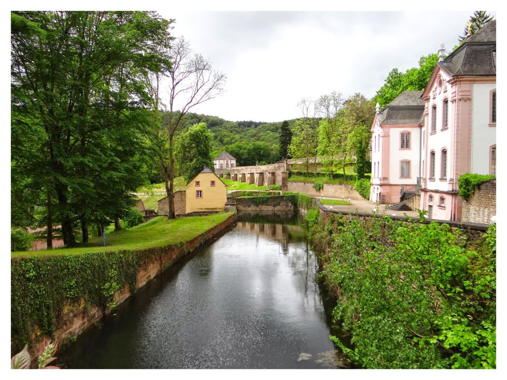
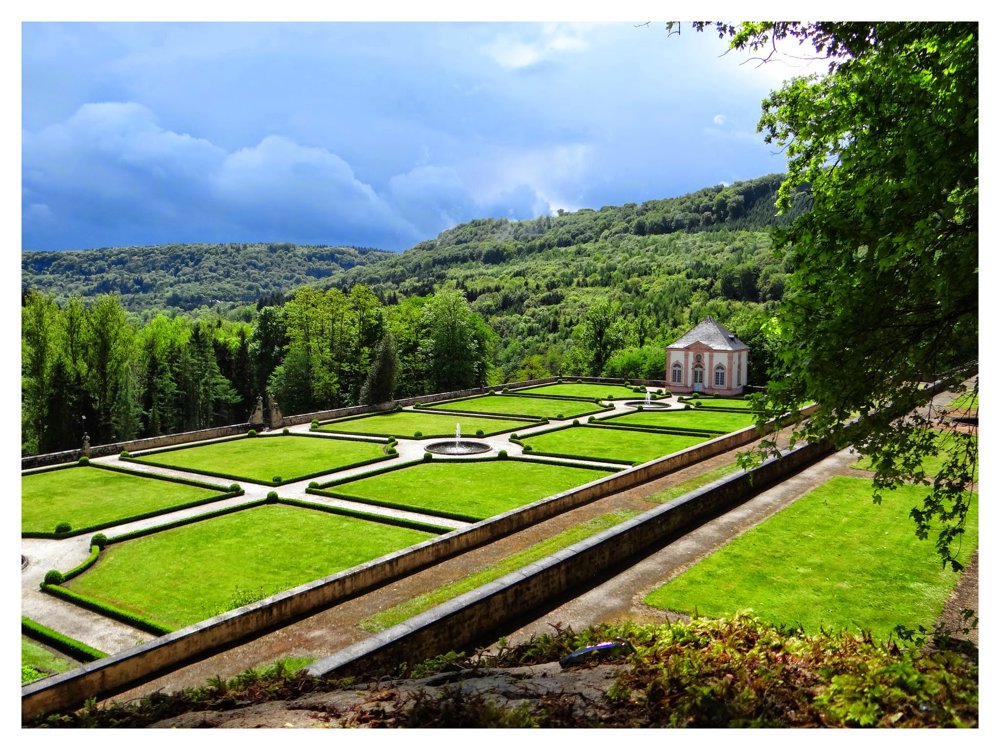
The walk also passes by the ‘Weilerbach Schloss’. An old iron factory where a beautiful castle was built later. The castle cannot be visited, but one can walk freely in the elevated garden. Throughout the walk, you frequently encounter narrow rocky paths.
At ‘Teufelsloch’, you have to pass through a narrow crevice to continue the walk. In short, due to the many beauties, a wonderful day hike. We took about 6 hours.
Combination of different markings.
More photos: https://photos.app.goo.gl/psFQKyVW9uSBN3Cj7
Enjoy this walk, Eddy, Rita, and Prinske
automatic translation


 Upgrade to Premium Plus
