 Hiking
 Login
Login More
More EN
EN Premium
Mullerthal Combination
automatic translation
12.5 km • Waldbillig
400 0 0/5

 Addresse starting point (approximate)
Rue Des Rochers 2A, 6245 Waldbillig, LU
 signage
The route is not signposted. Use a GPS device or our app to follow the route.
 Description
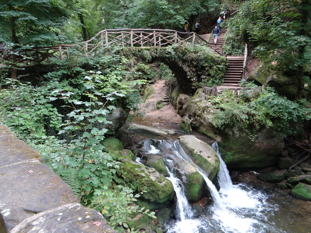
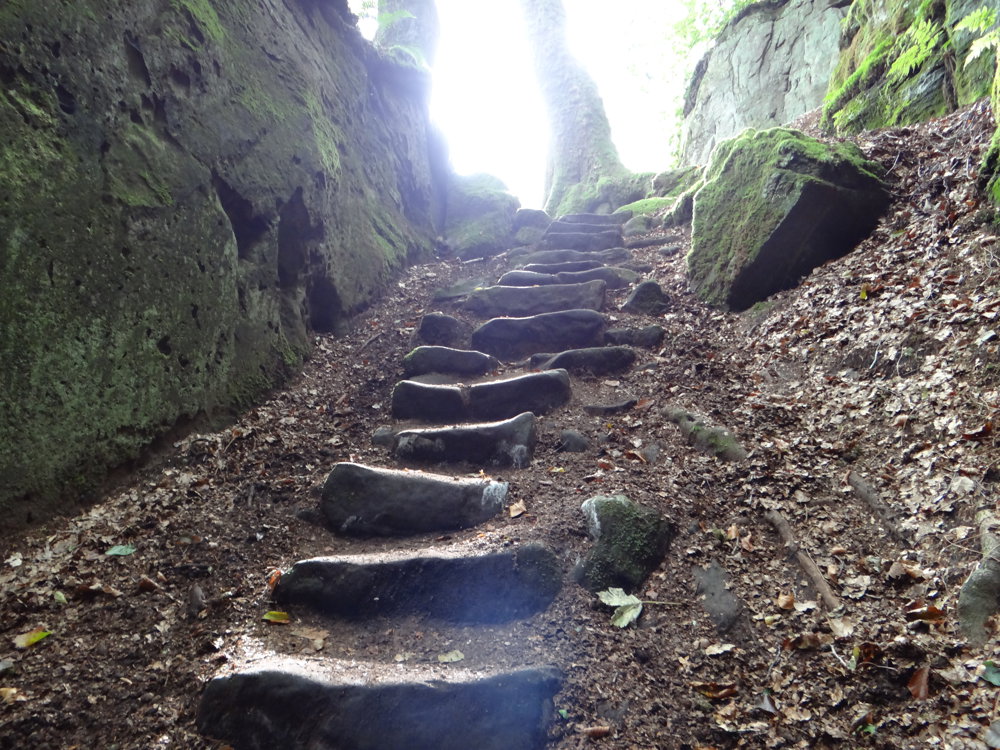
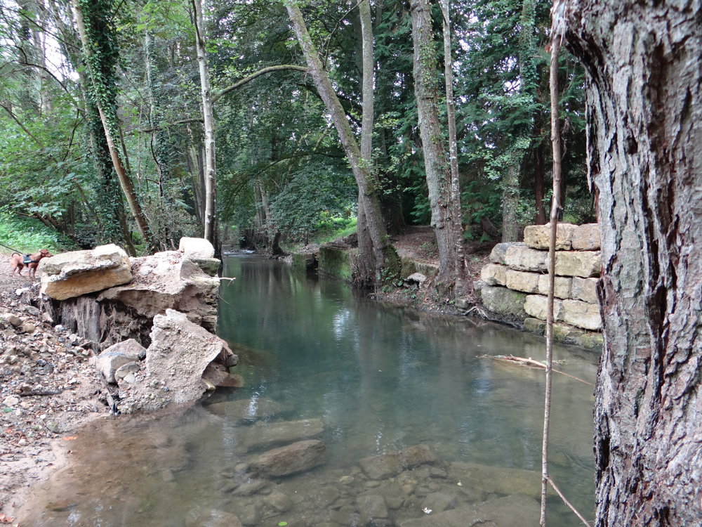
For this walk, we chose a combination of the Mullerthal Trail, the Auto-Pédestre route Consdorf-Mullerthal, local walks, and an unmarked path through the picturesque valley of the Consdrëferbach.
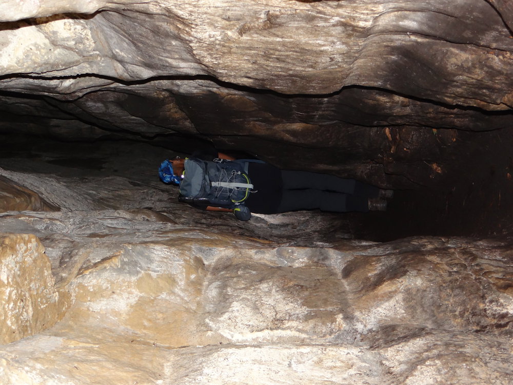
This walk is a real treat for nature lovers. It leads you through beautiful forests and winding paths to rock formations and through narrow crevices. Some sections are only a good thirty centimeters wide. The Rittergang and the Déiwepëtz are the two narrowest passages of the Mullerthal. Passing each other in the corridors is not possible. It is best to bring a flashlight, as the Déiwepëtz passage is pitch dark in some spots.
You also pass by the Schiessentümpel. This is a waterfall on the Black Ernz near the village of Mullerthal in the east of the Grand Duchy of Luxembourg. It is the highest waterfall in Luxembourg. Plan to take a half-day for this walk, as there is much to experience and see.
photos: https://photos.app.goo.gl/iqjGindN9bVYXQKw8
automatic translation


 Upgrade to Premium Plus
