 Hiking
 Login
Login More
More EN
EN Premium
Auto-pedestrian Consdorf-Mullerthal
automatic translation
9.5 km • Consdorf
730 0 0/5

 Addresse starting point (approximate)
Rue Burgkapp 35, 6211 Consdorf, LU
 signage
The route is fully signposted with thematic signs (no nodes).
 Description
Attention! Temporary change: https://www.visitluxembourg.com/nl/routes/rondwandelroute-consdorf
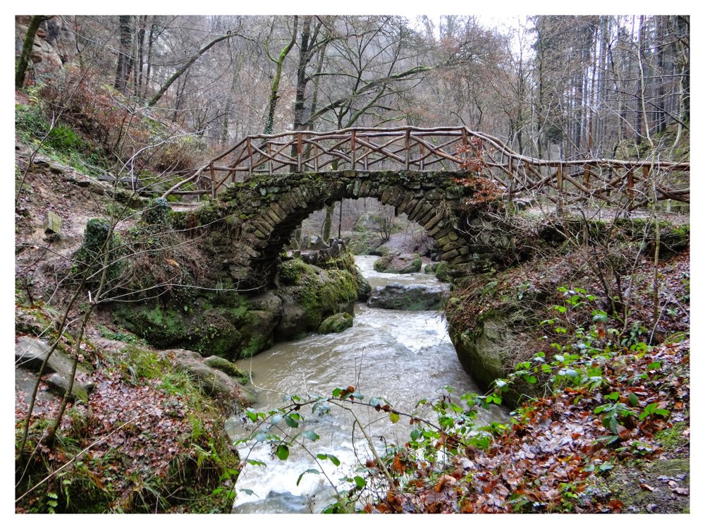
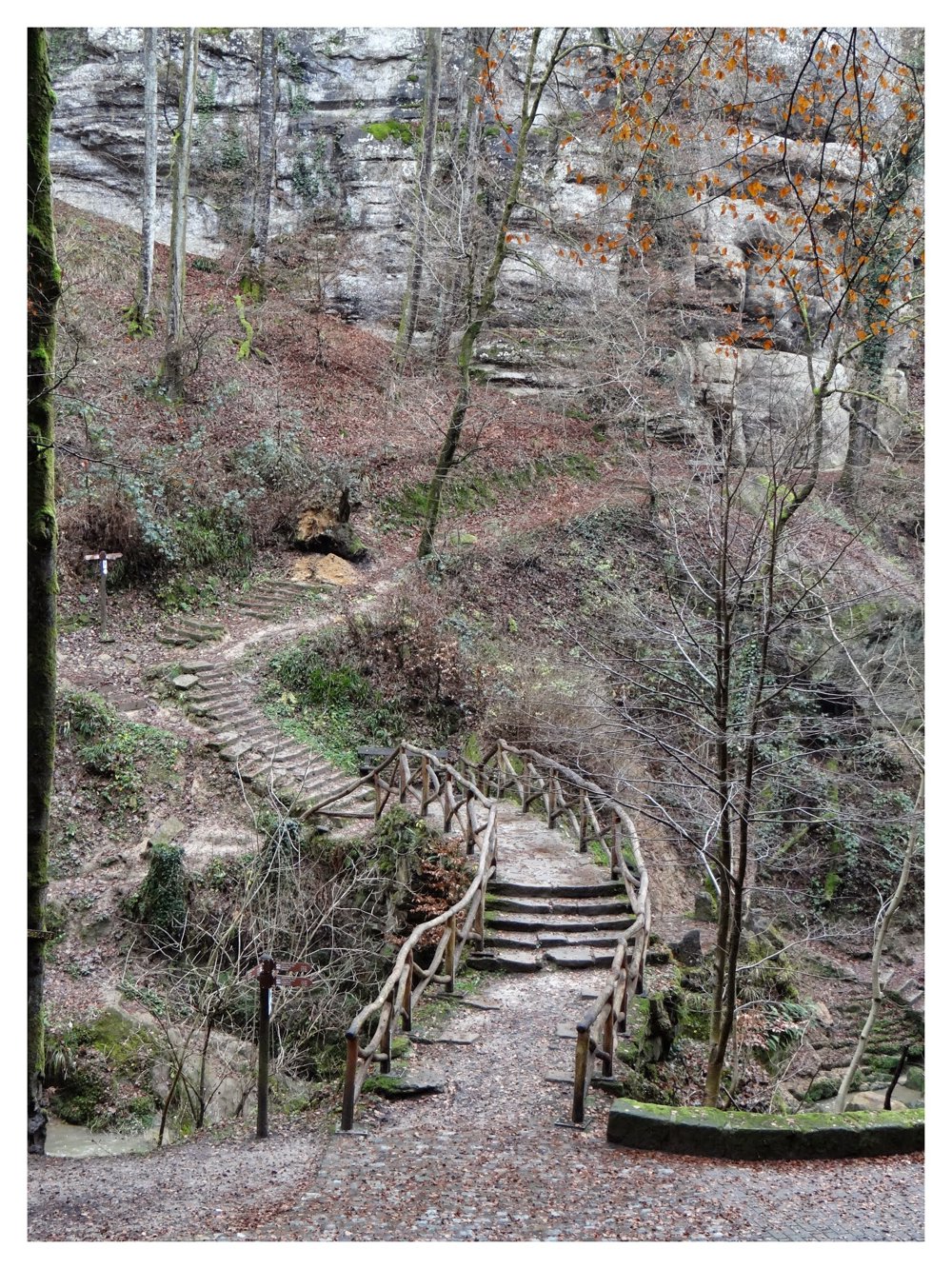
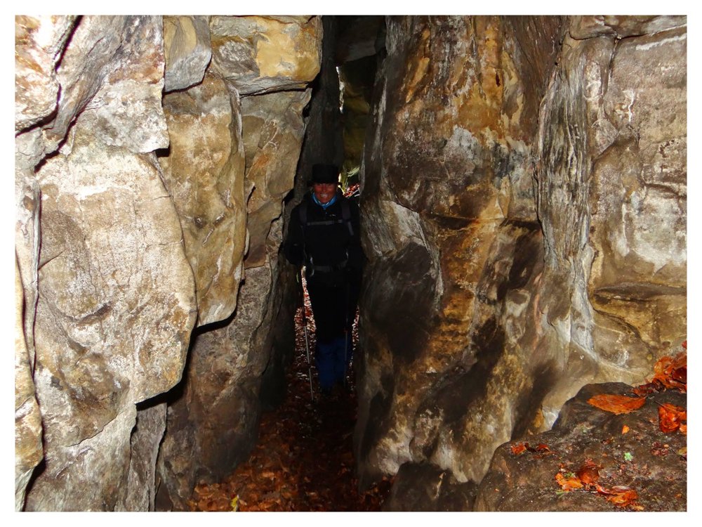
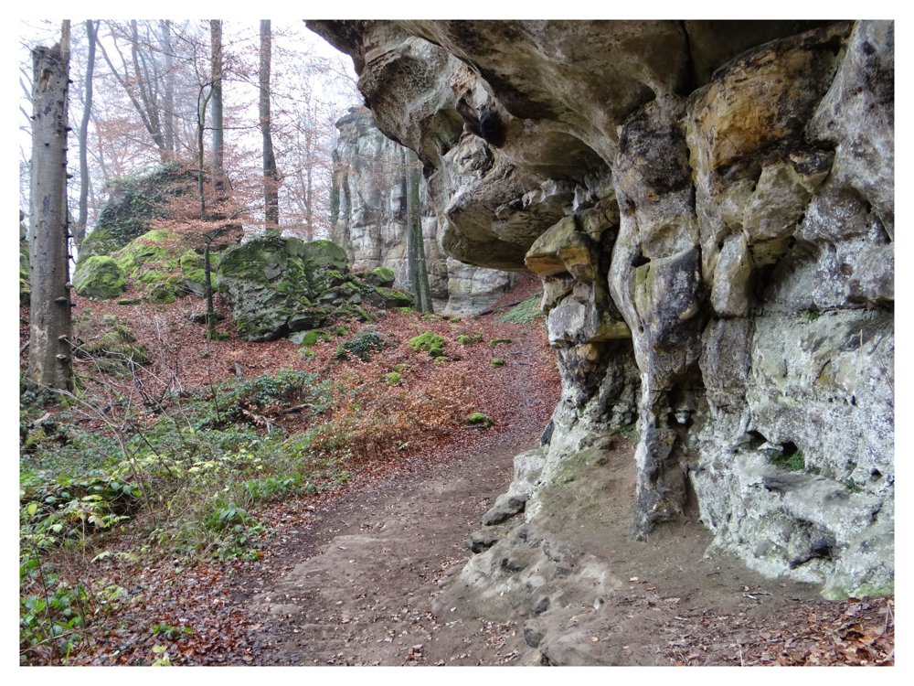
Beautiful hike in Little Switzerland. Approximately nine kilometers, but quite challenging. Many stairs and narrow passages between the rocks. Can be dangerous in rain and certainly in winter with freezing weather.
This hike is a variation of the ‘Mullerthal Trail’. On an information board, one can read the following about these hiking loops: Walking through rock crevices, forests, and sun-drenched valleys, wild little streams along the way - all this together forms the fantastic world along the Mullerthal Trail. Faces and figures can be recognized in the rocks – and in some places, the light moss is proof of the unique power of nature. If you know the legends and myths of this area, you might almost believe to see a fairy slipping through the forest here and there.
More photos: https://photos.app.goo.gl/yMh6RXCJdrgtHKS36
Enjoy this hike,
Eddy, Rita, and Prinske
automatic translation


 Upgrade to Premium Plus
