Loading...

Auto Pedestrian Luxembourg

automatic translation

6 km • Luxembourg

260 0 0/5

6 km 0.0 km 0.0 km
10 km
© OpenStreetMap contributors, Tracestrack

route offered by

Eddy & Rita

Icon starting point Addresse starting point (approximate)

Boulevard Franklin D. Roosevelt 29, 2450 Luxembourg, LU

Icon type signage of route signage

The route is fully signposted with thematic signs (no nodes).

103.4 m 117 m 318.5 m 244.4 m These values indicate respectively the number of meters to rise, the highest and the lowest point in meters.
Atmosphere image 1 of route Auto Pedestrian Luxembourg Atmosphere image 2 of route Auto Pedestrian Luxembourg Atmosphere image 3 of route Auto Pedestrian Luxembourg
© Eddy & Rita

Icon description route Description

This is a beautiful walk that is signposted in one direction. The markers are not always easy to find, so it is best to take a GPS track and/or map with you.

Definitely set aside an afternoon for this, as there is plenty to see. Dogs are welcome, but they must be leashed.

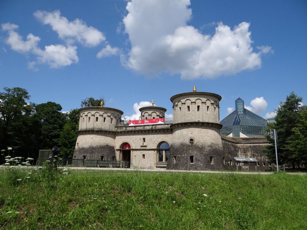
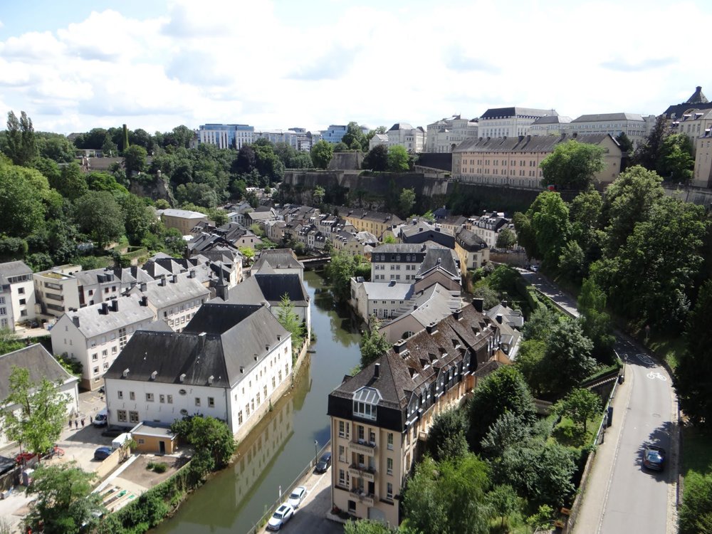
Discover the beauty of Luxembourg City with its former brewery districts Grund and Clausen.

We descend into the Pétrusse Valley and follow the stream to the mouth of the Alzette, which we cross.

We climb the rock steps to the Rumm Plateau and walk through the districts of Grund and Clausen, crossing the Alzette again before starting the climb back to the city center.

More photos: https://photos.app.goo.gl/mYWHfXRWB2v9dQFdA

Happy hiking,
Eddy, Rita, and Prinske

automatic translation

This route does not have any reviews yet. Be the first!
Rate route!

Which POI do you want to show on the map?

Experimental hiking network
Unsigned icon

The route you have chosen runs (partly) along an experimental virtual hiking node network (the blue-coloured nodes and sections on the map).

You must be logged in to plan routes here.

Experimental hiking network
Unsigned icon

The route you have chosen runs (partly) along an experimental virtual hiking node network (the blue-coloured nodes and sections on the map).

These routes are not controlled in the field. Before you start hiking here, take a minute to read what an experimental hiking node network is and what rules you should follow when hiking here.

By clicking 'Accept all cookies,' you agree to the use of cookies for an enhanced user experience, website traffic analysis, and personalized advertisements. Cookie policy