 Hiking
 Login
Login More
More EN
EN Premium
Walk of the Cats
automatic translation
4.7 km • Nord
8251 0 0/5

 Addresse starting point (approximate)
Chemin De l'Abbaye 70, 59270 Berthen, FR
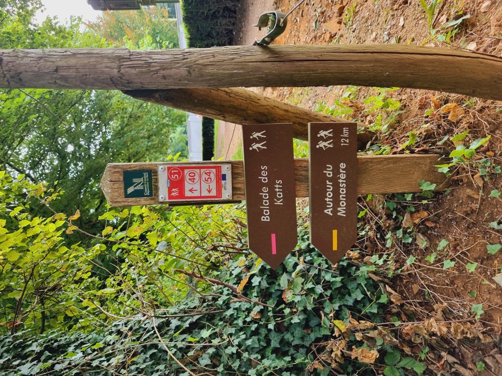
 signage
The route is fully signposted with nodes.
 Description
Tip for a fun trip just over the border with France.
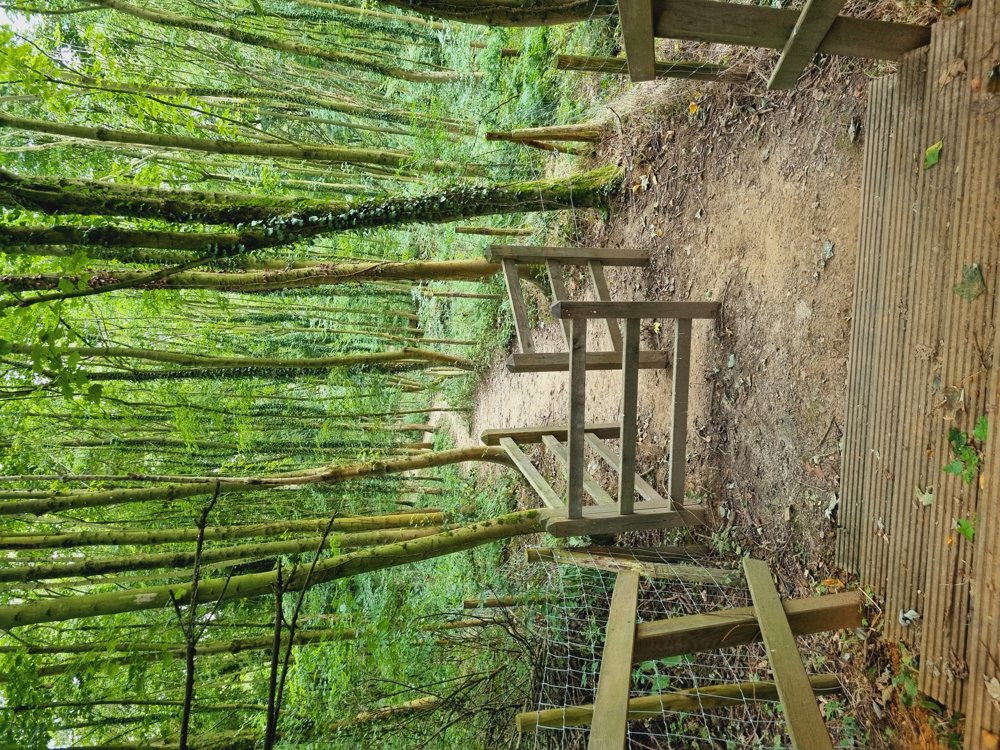
Enjoy the rolling landscapes and beautiful forest from the Katsberg🌳. At the top of the hill, there is an abbey that is still active.
It's best to do this during the summer for the best views🏞. Several hikes are possible, I chose the long version myself.
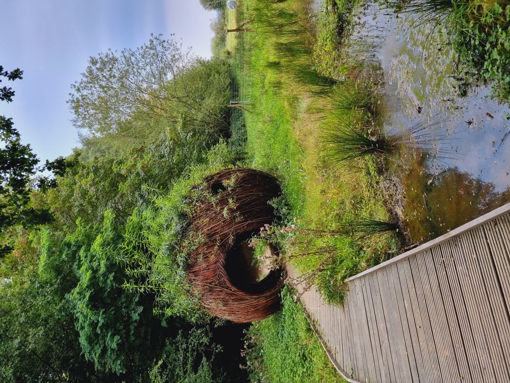
🛖 The artwork is located between junctions 50 and 24. There is a sign where you need to deviate from the route. I found the forest there very fairy-tale like🧚♀️.
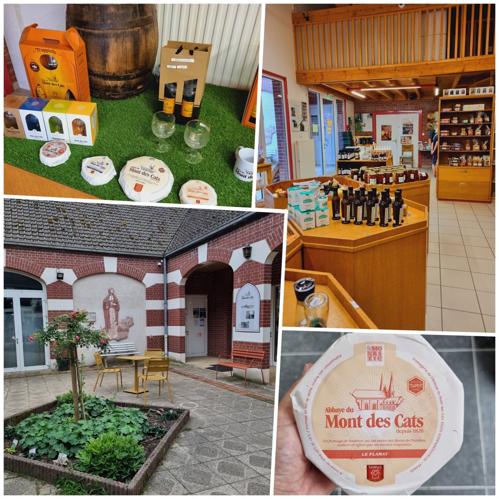
🧀🍺After the hike, definitely visit the abbey shop. They sell, among other things, delicious cheese and beer that the monks still produce to this day.
🍺🍴 Au Grand Estaminet du Mont des Cats
Enjoy it!
Sarah
🔢 51-54-55-40-56-39-43-50-24-23-26-25-27-33-34-54-51
or
🪧 Follow the brown signs labeled 'Balade des Katts'
📏 5km
👩🏫 My rating: 7/10
🐾 Dogs on leash welcome
👶🏻 Not stroller-friendly
👩🦽 Not wheelchair-friendly
🅿️ 10, Chem. de l'Abbaye, Berthen
[France]
(Free)
automatic translation
 nodes to follow
0 km
0.5 km
0.5 km
0.7 km
0.8 km
1 km
1.1 km
1.1 km
1.4 km
1.6 km
1.8 km
2.3 km
2.7 km
3.3 km
3.6 km
3.8 km
4.2 km
4.7 km


 Upgrade to Premium Plus
