 Hiking
 Login
Login More
More EN
EN Premium
Along the Warche. Challenging climbs and descents.
automatic translation
14 km • Malmedy
2870 0 0/5

 Addresse starting point (approximate)
Route de la Vallée 36, BE
 signage
The route is partially signposted with thematic signs (no nodes). Use a GPS device or our app to follow the route.
 Description
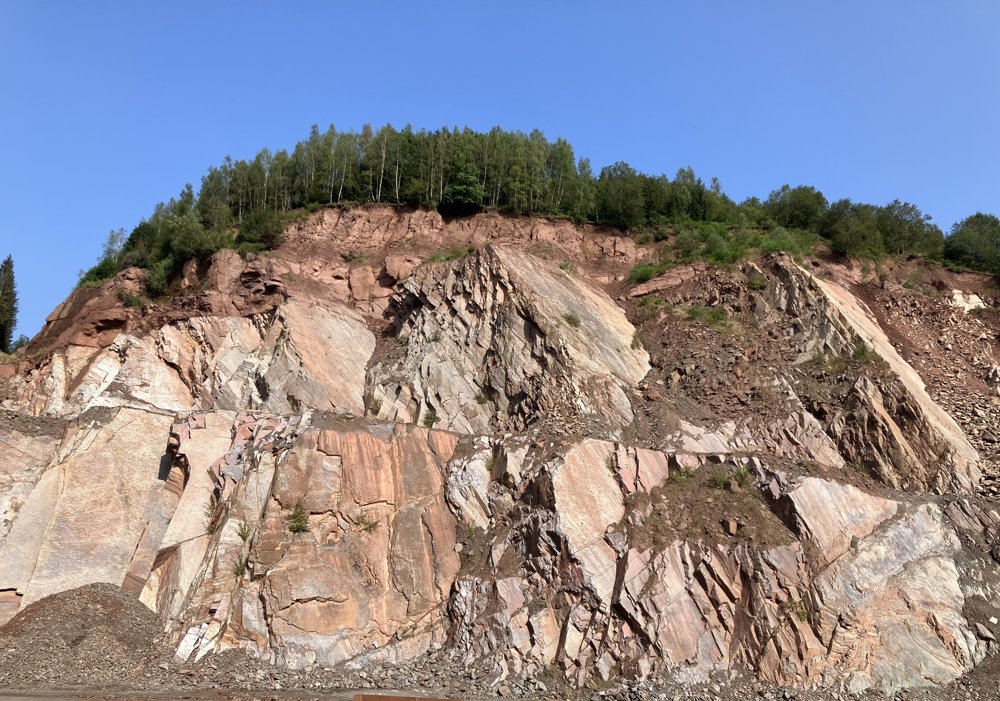
This is a rather strenuous hike with a possible starting point in Bévercé (Malmedy) at the Du Moulin campsite, where with a bit of luck, a parking space can also be found (recommended). A second possible starting point is the church of Xhoffraix, where there is also parking available. If starting from the Du Moulin campsite, you first pass by a quarry.
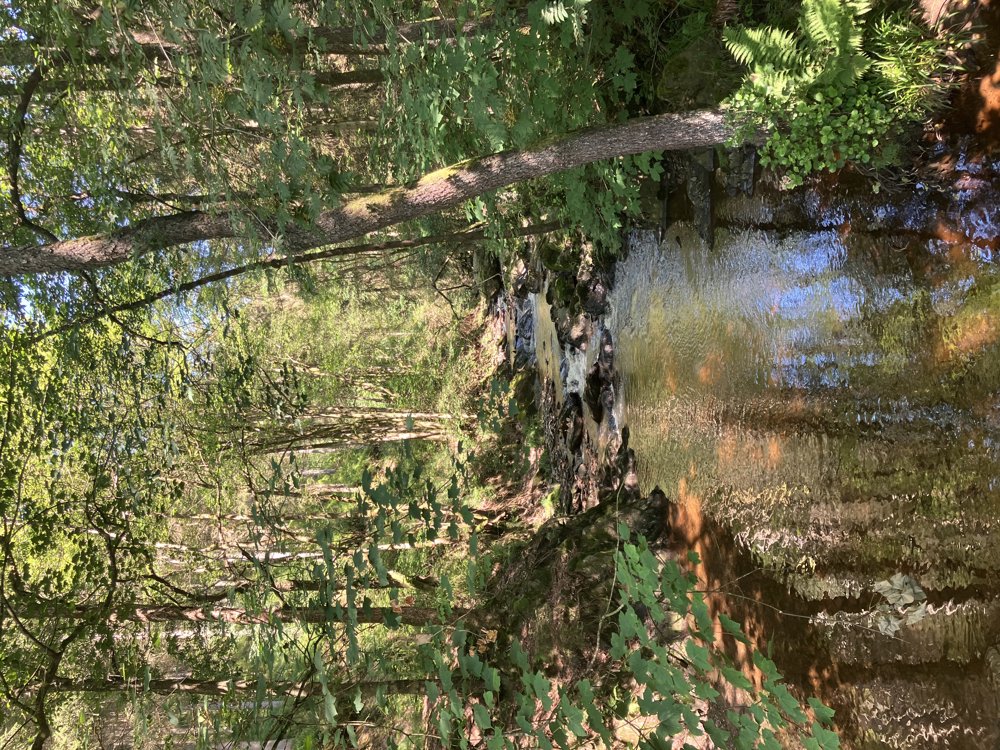
Afterwards, a steep climb follows through partially cleared forests to the center of the village of Xhoffraix. After Xhoffraix, there is a flat section before a fairly steep descent into the deep Warche valley. It is delightful to follow the river for a while until reaching a crossing. From there, another steep climb follows.
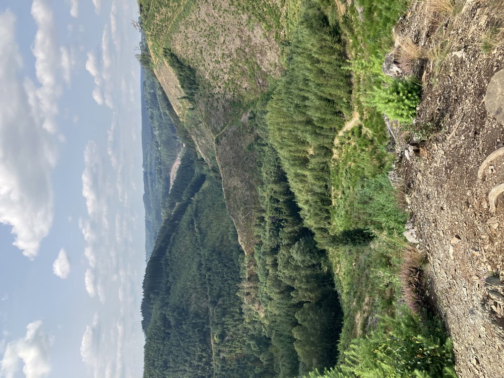
We now walk along a ridge parallel to the Warche, from where there are beautiful views. The very varied hiking route ultimately leads back to the Du Moulin campsite. We recommend sturdy footwear and good physical condition. It is absolutely not advisable to do the hike in wet weather, freezing temperatures, or snowfall due to the slopes and the terrain.
automatic translation


 Upgrade to Premium Plus
