 Hiking
 Login
Login More
More EN
EN Premium
Mills Lakes - The Measure
automatic translation
5.5 km • Mol
1.2460 0 0/5
5.5 km
0.0 km
0.0 km
10 km
© OpenStreetMap contributors, Tracestrack
route offered by
Toerisme Provincie Antwerpen
 Addresse starting point (approximate)
Postelsesteenweg 71, Ecocentrum De Goren
 signage
The route is fully signposted with nodes.
© Visit Mol
 Description
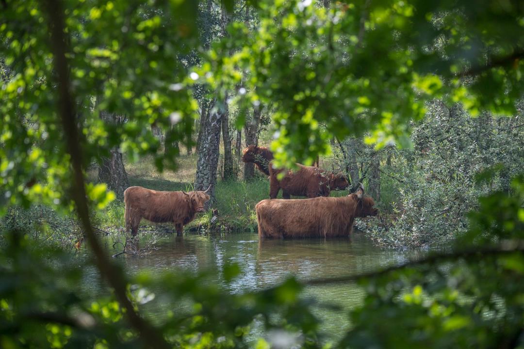
Poplar plantings and sprite pits currently define the look of The Maat. With any luck, you may encounter Scottish highland cattle, which roam freely here. Through their grazing behavior, these imposing animals maintain the varied landscape.
automatic translation
 nodes to follow
0 km
0.1 km
0.3 km
0.6 km
0.8 km
1.1 km
2 km
2.1 km
2.2 km
2.6 km
2.9 km
3.2 km
3.3 km
4 km
4.1 km
4.1 km
5 km
5.2 km
5.4 km
5.5 km


 Upgrade to Premium Plus
