 Hiking
 Login
Login More
More EN
EN Premium
From Arendonk center to 'de Liereman'
automatic translation
22.3 km • Arendonk
4280 0 0/5

 Addresse starting point (approximate)
Vrijheid 29, 2370 Arendonk, BE
 signage
The route is fully signposted with nodes.
 Description
Parking: Arendonk, Park Deroissart.
Signage: Junction points.
Start in the center of Arendonk, then head towards Heikant sports park and further towards the Dessel-Schoten canal. This section along the canal seems like a boring stretch of 4 km, but that is not the case at all. A beautiful and peaceful piece of nature.
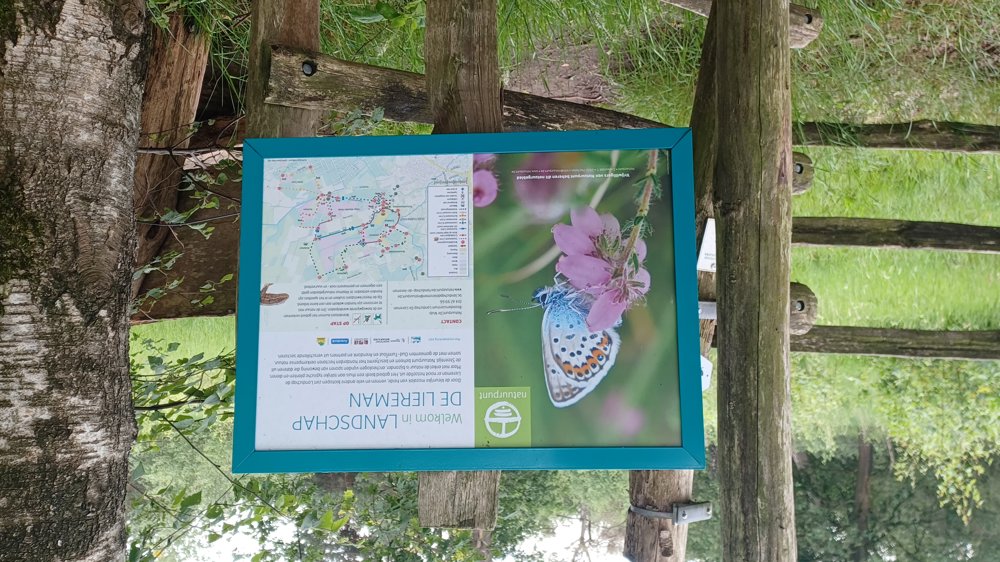
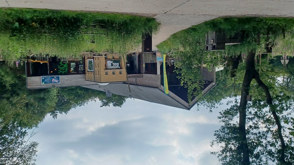
Continue to the nature reserve and visitor center 'de Liereman'.
PS:
Between junctions 67 and 51 there are construction works and you cannot walk through. At junction 67, go to 'Vrijheid' street and then left to 'Begijnhof', and you will return to junction 51.
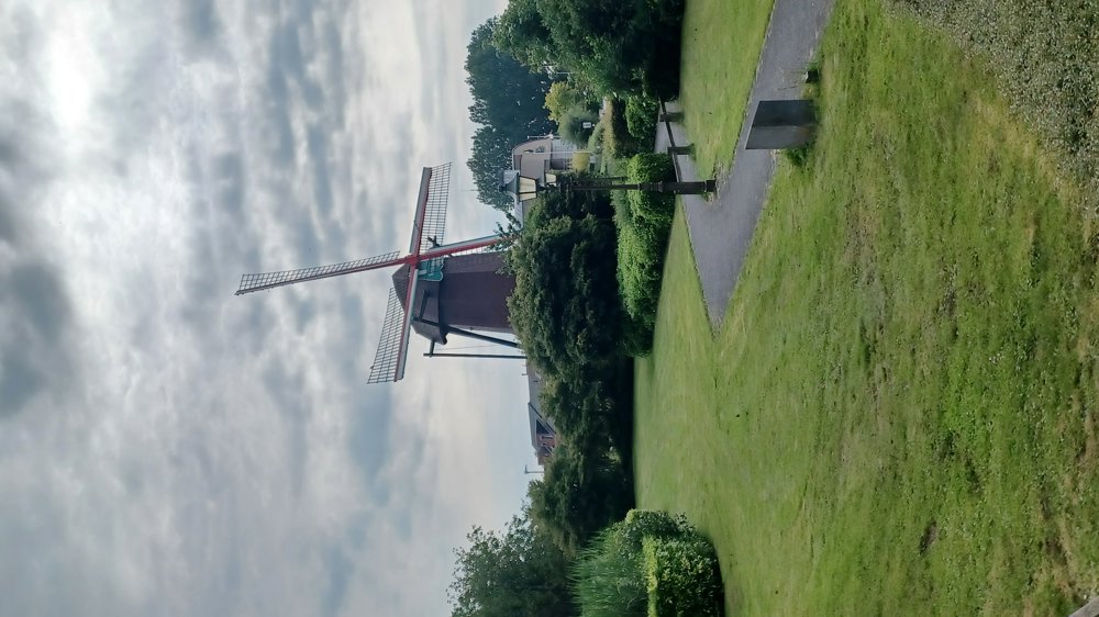
Highlights: Toremansmolen, Observation tower in the 'de Liereman' nature reserve, Visitor center 'de Liereman'.
Rest and dining benches: There are several rest benches and places to eat, including after 1 km / 7.3 km 'Brug 6 Koffiehuis' / 10.7 km / 12 km / 13.4 km / visitor center / 14.9 km / 16.5 km /
automatic translation
 nodes to follow
0 km
0.3 km
0.5 km
0.8 km
1 km
1.1 km
1.7 km
2.2 km
2.2 km
2.2 km
3 km
3.7 km
4.9 km
7.3 km
8.9 km
10 km
10.8 km
12 km
12.6 km
13.4 km
13.5 km
13.6 km
13.7 km

13.8 km
13.9 km
14 km
14.2 km
14.3 km
14.3 km
15.3 km
15.6 km
15.6 km
15.8 km
15.9 km
16.8 km
17.7 km
18.1 km
18.9 km
19.8 km
20.2 km
20.6 km
21.3 km
21.3 km
21.3 km
21.9 km
22.2 km
22.3 km


 Upgrade to Premium Plus
