Loading...

The beautiful Kravaal Forest

automatic translation

10.6 km • Aalst

1.0045 2 4.8/5

10.6 km 0.0 km 0.0 km
10 km
© OpenStreetMap contributors, Tracestrack

route offered by

Marc Verelst

Icon starting point Addresse starting point (approximate)

Putstraat 96, 9310 Aalst, BE

Icon type signage of route signage

The route is fully signposted with nodes.

121.4 m 121.4 m 82.5 m 40.3 m These values indicate respectively the number of meters to rise, the highest and the lowest point in meters.
Atmosphere image 1 of route The beautiful Kravaal Forest Atmosphere image 2 of route The beautiful Kravaal Forest Atmosphere image 3 of route The beautiful Kravaal Forest
© Marc Verelst

Icon description route Description

Parking is available near the football field of café Bij Stinne, known from the series FC De Kampioenen.

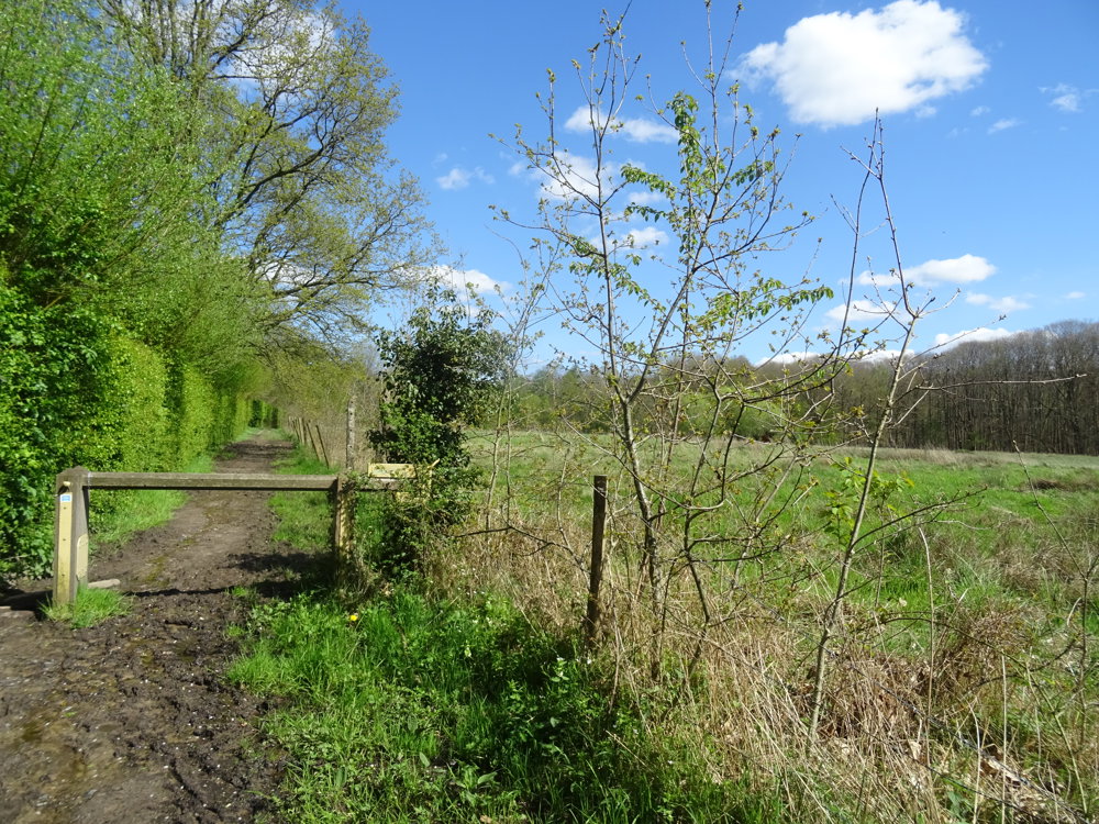
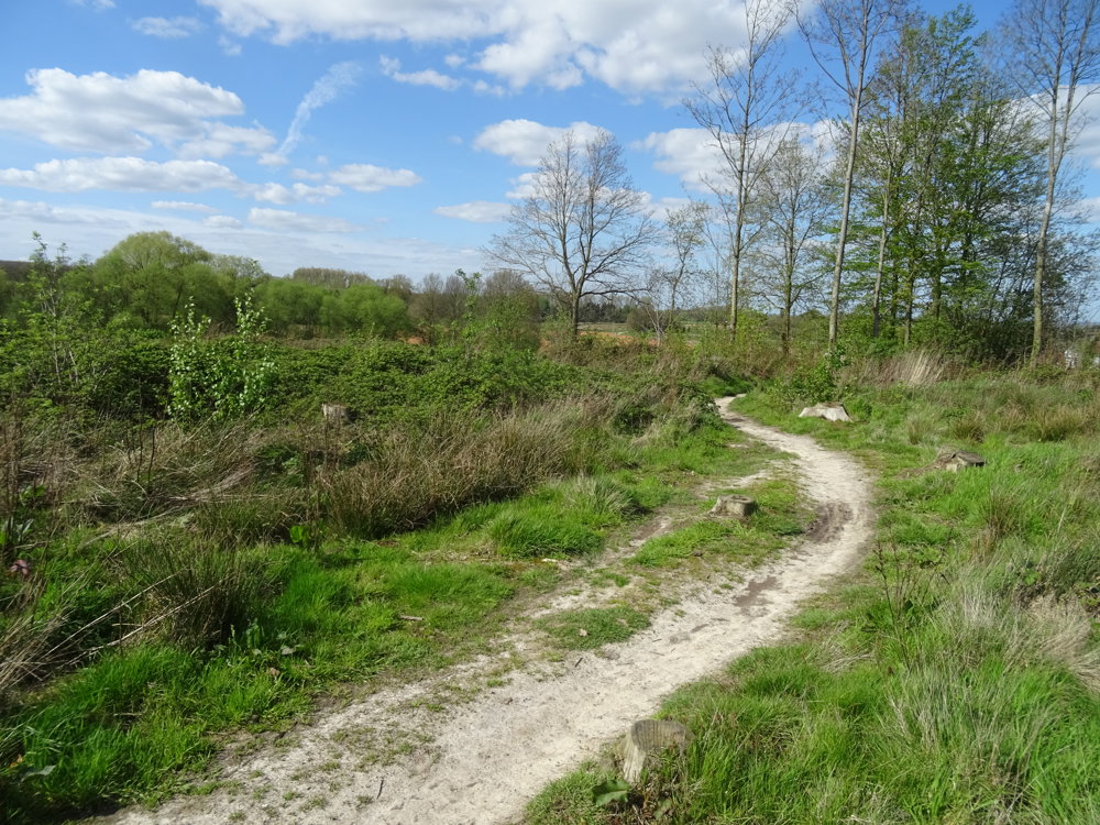
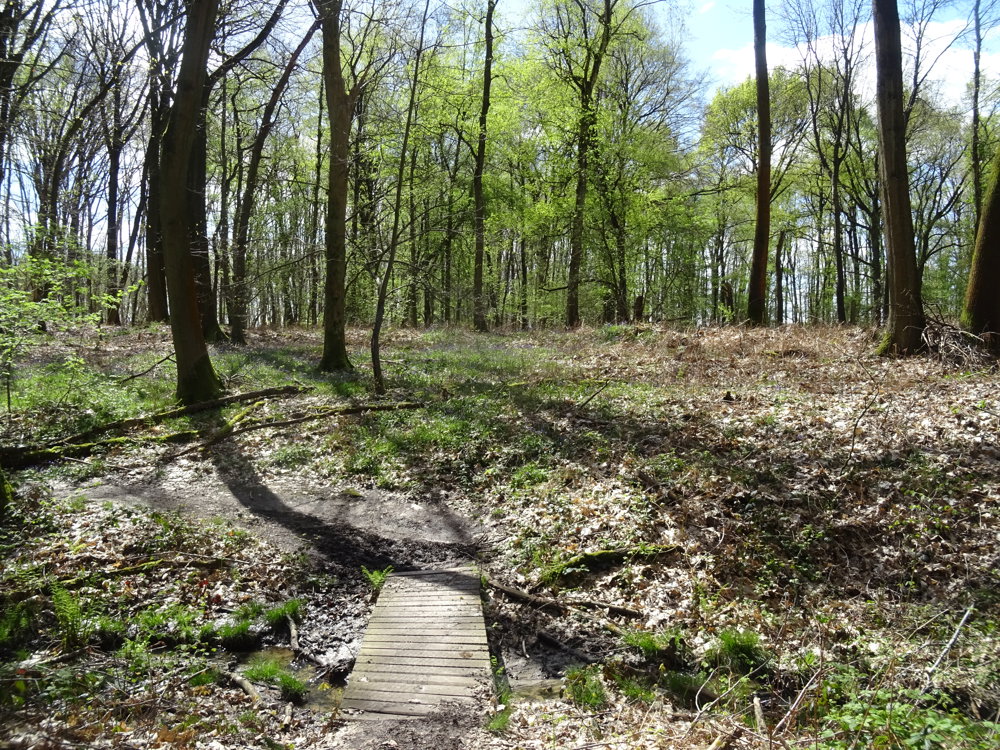
The walk is almost entirely unpaved. In spring, the hyacinths are in bloom. It's a walk suitable for every season.

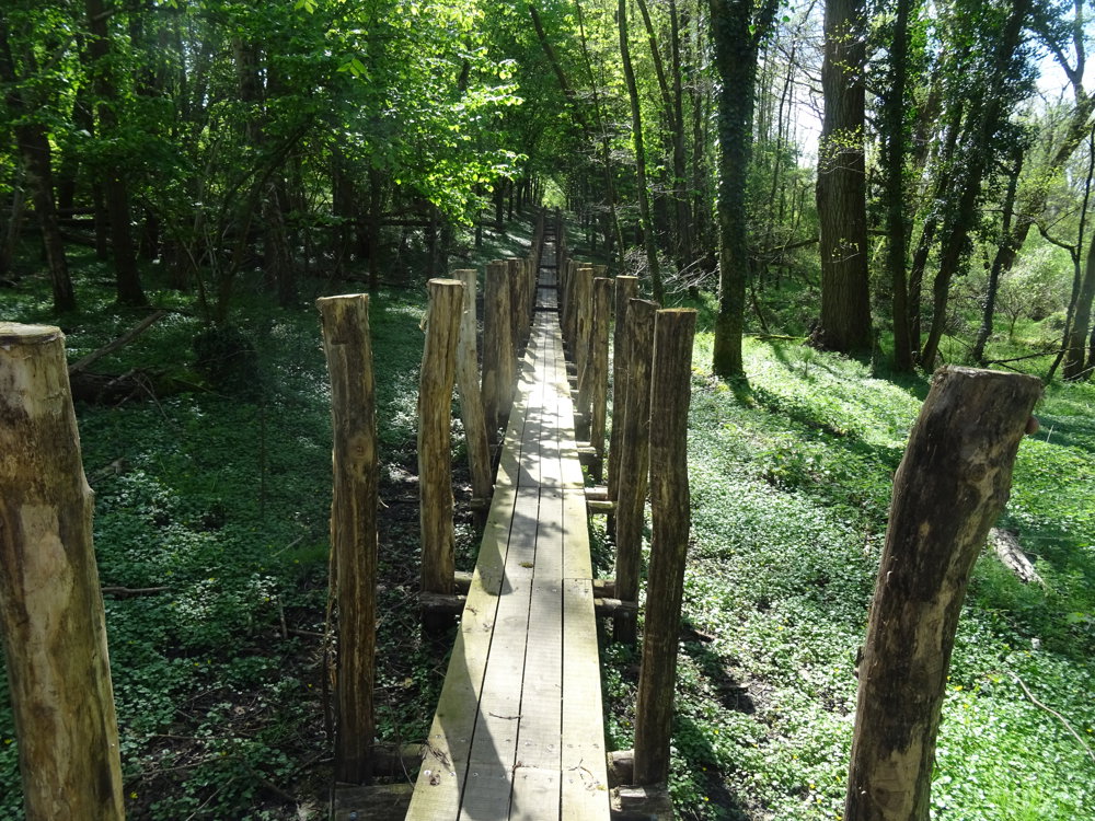
The highlight is the recently constructed boardwalk.

automatic translation

Icon nodes to follow nodes to follow

Image node 47
0 km
Image node 98
0.2 km
Image node 48
0.4 km
Image node 250
1 km
Image node 251
2.2 km
Image node 27
3.5 km
Image node 70
4.4 km
Image node 71
4.6 km
Image node 716
5.6 km
Image node 74
5.9 km
Image node 75
6.1 km
Image node 33
6.8 km
Image node 34
7.3 km
Image node 35
7.9 km
Image node 73
8.9 km
Image node 72
9.1 km
Image node 50
9.4 km
Image node 51
9.8 km
Image node 98
10.4 km
Image node 47
10.6 km
This route has 2 review(s).
Rate route!

Monday, April 14, 2025 by W.G.highly recommended! Too bad it was a little too early for the flowering of the wood hyacinths
automatic translation

Saturday, October 19, 2024 by L.T.Fun hike in all seasons. Many unpaved paths that can look a bit muddy in wet periods. Small change: junction 27 was moved to the corner Schaapheuzel/Bosstraat. This makes the hike a few hundred meters longer.
automatic translation

Which POI do you want to show on the map?

Experimental hiking network
Unsigned icon

The route you have chosen runs (partly) along an experimental virtual hiking node network (the blue-coloured nodes and sections on the map).

You must be logged in to plan routes here.

Experimental hiking network
Unsigned icon

The route you have chosen runs (partly) along an experimental virtual hiking node network (the blue-coloured nodes and sections on the map).

These routes are not controlled in the field. Before you start hiking here, take a minute to read what an experimental hiking node network is and what rules you should follow when hiking here.

By clicking 'Accept all cookies,' you agree to the use of cookies for an enhanced user experience, website traffic analysis, and personalized advertisements. Cookie policy