Loading...

Wild Garlic Hiking Trail

automatic translation

9.8 km • Ninove

8001 2 3.8/5

9.8 km 0.0 km 0.0 km
10 km
© OpenStreetMap contributors, Tracestrack

route offered by

Carlos Vermassen

Icon starting point Addresse starting point (approximate)

Bevingen 8, 9403 Ninove, Belgium

Icon type signage of route signage

The route is fully signposted with nodes.

139.8 m 153.9 m 109.1 m 20 m These values indicate respectively the number of meters to rise, the highest and the lowest point in meters.
Atmosphere image 1 of route Wild Garlic Hiking Trail Atmosphere image 2 of route Wild Garlic Hiking Trail Atmosphere image 3 of route Wild Garlic Hiking Trail
© Carlos Vermassen

Icon description route Description

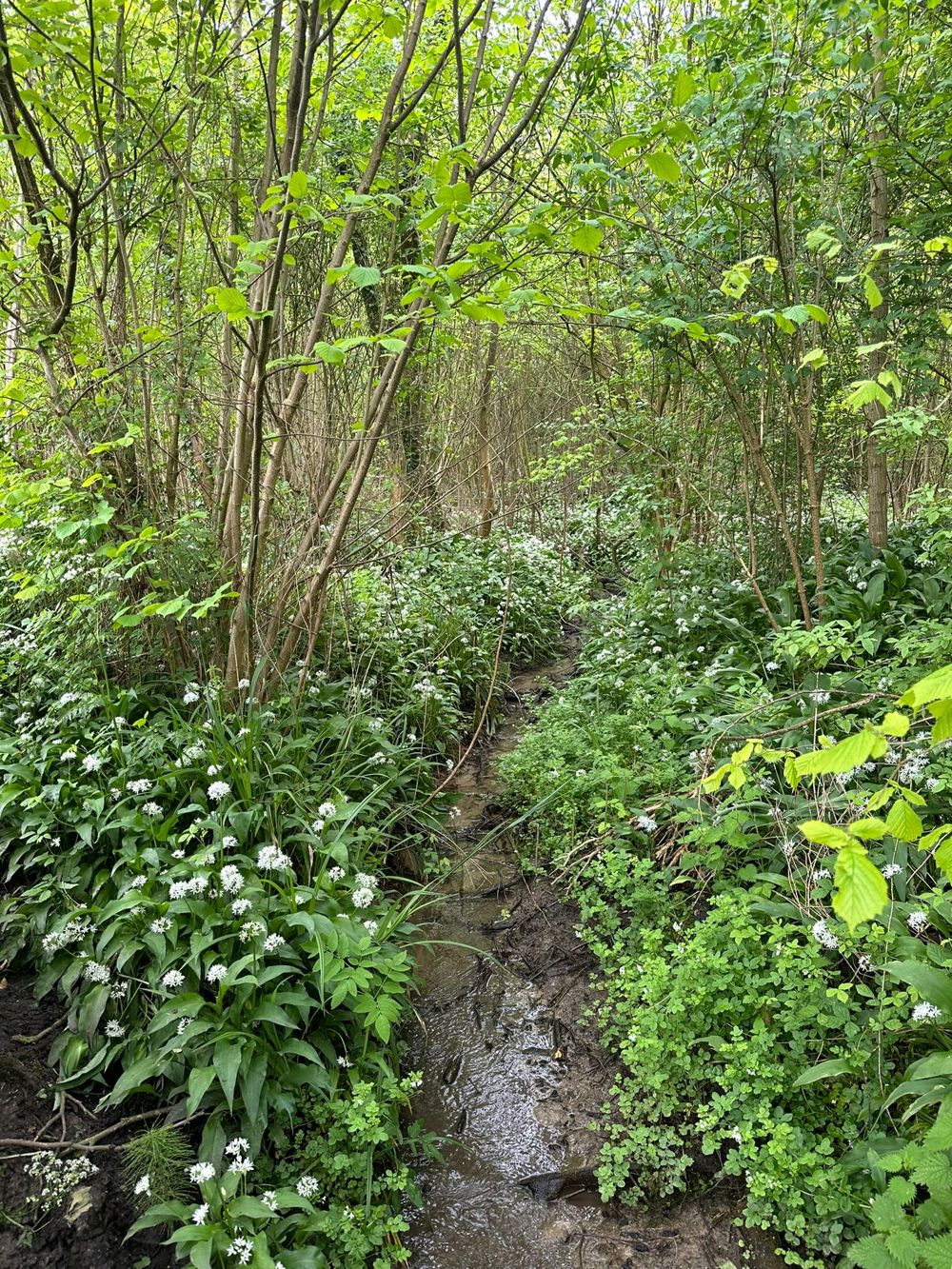
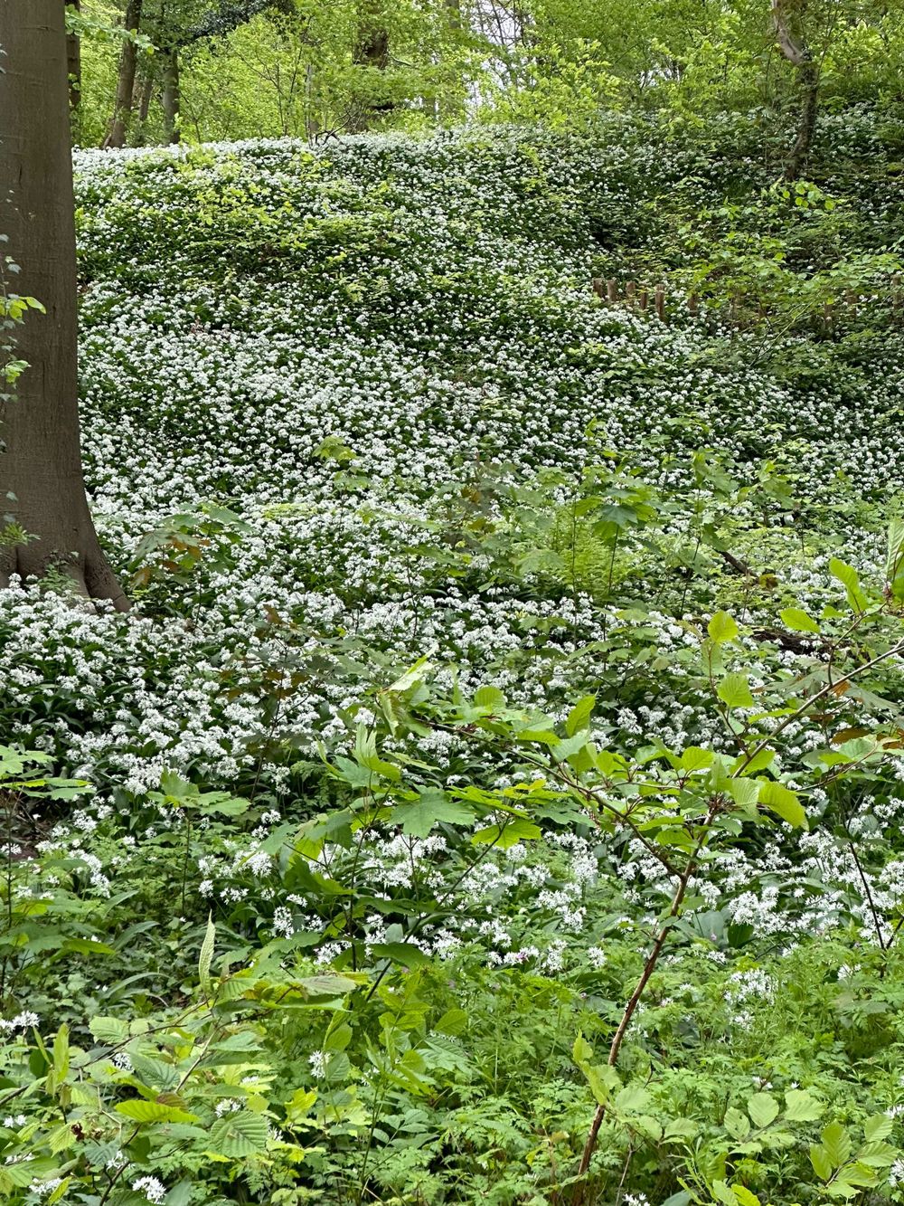
Certain times of the year, the smell of wild garlic is overwhelming. Blissful.

Just as beautiful as the popular bluebell.

Quiet, silent walk on many unpaved paths. It is advisable to wear good shoes, as it was quite a muddy affair.

automatic translation

Icon nodes to follow nodes to follow

Image node 14
0 km
Image node 15
0.9 km
Image node 16
1.4 km
Image node 811
1.9 km
Image node 818
2.4 km
Image node 817
3.2 km
Image node 809
3.7 km
Image node 808
3.9 km
Image node 807
4.2 km
Image node 807
4.2 km
Image node 804
4.8 km
Image node 805
5.1 km
Image node 810
5.5 km
Image node 810
5.6 km
Image node 812
5.7 km
Image node 813
6.2 km
Image node 811
6.5 km
Image node 16
7 km
Image node TP
8.2 km
Image node 14
9.6 km
Image node 13
9.8 km
This route has 2 review(s).
Rate route!

Sunday, April 6, 2025 by V.T.very nice hike, with some uphill sections included
automatic translation

Thursday, April 3, 2025 by J.H.Very nice walk. You discover both the Neigem and the Berchem forest. Beautiful views.
automatic translation

Which POI do you want to show on the map?

Experimental hiking network
Unsigned icon

The route you have chosen runs (partly) along an experimental virtual hiking node network (the blue-coloured nodes and sections on the map).

You must be logged in to plan routes here.

Experimental hiking network
Unsigned icon

The route you have chosen runs (partly) along an experimental virtual hiking node network (the blue-coloured nodes and sections on the map).

These routes are not controlled in the field. Before you start hiking here, take a minute to read what an experimental hiking node network is and what rules you should follow when hiking here.

By clicking 'Accept all cookies,' you agree to the use of cookies for an enhanced user experience, website traffic analysis, and personalized advertisements. Cookie policy