 Hiking
 Login
Login More
More EN
EN Premium
Pleasure Tour Raeren- "Meadow trails"
7.8 km • Raeren
 official route
7521 0 0/5
 Addresse starting point (approximate)
Burgstraße 101, 4730 Raeren
 signage
The route is fully signposted with nodes.
 Description
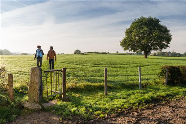
We start off at the castle, which is well worth seeing and whose walls also house an unusual pottery collection. On this beautiful spring day, a hike through the country around Raeren sounds tempting. The village, its houses and farms lie scattered in the landscape, surrounded by meadows and connected up by charming trails and paths.
We follow the Iterbach, which pours forth into the open landscape, patterned by hedgerows. On both sides of the trail there are broad meadows and fields. On the horizon you can make out copses, hedges and orchards. At the edge of the wood, the former Vennbahn runs past. You could tell where it was from a long way off in the old days by the dense black plume of smoke from its steam locomotives.
Water tanks, cables and locomotives provide clues to the strategic importance of this border station. Near the embankment, a trail runs across the country to Rott. We climb over the low parts of the fence and go from one meadow to the next, surrounded by a sea of flowers.
Signposting: 60 - 9 - 82 - 54 - 79 - 31 - 71 - 36 - 51 - 39 - 99 - 24 - 92 - 80 - 47 - 24 - 60
Parking: Raeren Castle
Equipment: hiking shoes & water bottle
 nodes to follow
0 km
0.2 km
0.4 km
0.7 km
1.5 km
1.9 km
2.9 km
3.4 km
3.5 km
4.9 km
5.2 km
5.2 km
5.8 km
6.2 km
7.1 km
7.2 km
7.5 km
7.9 km


 Upgrade to Premium Plus
