 Hiking
 Login
Login More
More EN
EN Premium
Pleasure Tour Xhoffraix - The ridges above the Warche valley
16.9 km • Malmedy
 official route
9051 0 0/5
 Addresse starting point (approximate)
Xhoffraix, 4960 Malmedy
 signage
The route is fully signposted with thematic signs (no nodes).
 Description
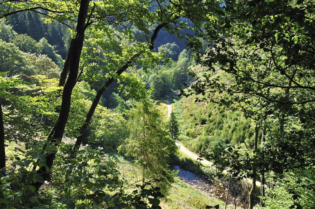
Tall hedges surround the houses here for protection against the tough climate. After the biting wind up on the plateau, things are certainly more bearable on the banks of the Warche and the Bayehon. As we climb out of the valley floor, the crystal-clear river water contrasts the green even more clearly.
After the bridge, in the remoteness of the forest, we come upon Burg Reinhardstein. On the other side, the ascent to the ridge calls for the very highest concentration, as the path is steep and slippery. Once you reach the top, the view out on to the gentle loops of the Warche in the valley compensates you for the effort. Between craggy rocks and fast-flowing streams we reach the valley basin. Now meadows and pastures frame the route and announce that the river is nearby.
You almost seem to be on a mountain hike here. There's a steep descent before we pass the mill campsite, which is also the gateway to the Warche valley. The final slope follows the Coreu stream and really puts the icing on this hike up hill and down dale.
Signposting: green rectangle and logo "duck"
Parking: at the church
Equipment: hiking shoes with ankle support, water bottle and a snack


 Upgrade to Premium Plus
