 Hiking
 Login
Login More
More EN
EN Premium
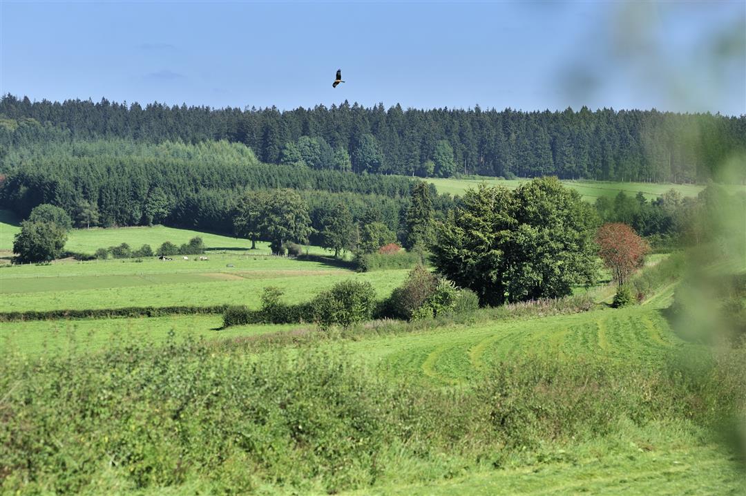
Pleasure Tour Weywertz - "The realm of birds of prey"
12.1 km • Bütgenbach
 official route
1.1701 2 4/5
 Addresse starting point (approximate)
Wallbrückstraße, 4750 Bütgenbach
 signage
The route is fully signposted with nodes.
 Description
The morning dew covers flowers and berries – up here at almost 550 metres, you can get a better feel for the chill of morning. The descent to the Warche opens your view out on to a beautiful, flat pasture landscape.
A little beach at the edge of the river invites you to stop and take a short break. In this silence it seems that the echoes of the ceasefire can still be heard: the point at which you cross the Warche here is also the entrance to the Elsenborn military base, the scene of such dire combat during the Ardennes Offensive in 1944.
The US Army succeeded in stopping the German attack. Green hedges beautify the trail, which winds its way along the ridge. At the end of our hike we reach the Warche one last time, as it ripples along between tall grasses and hay meadows.
Signposting: 25 - 21 - 30 - 24 - 35 - 32 - 29 - 26 - 36 - 33 - 25
Parking: at the church
Equipment: hiking shoes, water bottle and a snack
 nodes to follow
0 km
0.6 km
0.8 km
2.5 km
5.4 km
6.2 km
6.9 km
7.2 km
7.7 km
8.5 km
9.3 km
9.3 km
9.7 km
10.4 km
12 km
12.1 km
Tuesday, March 11, 2025 by B.B.This hike, mapped out by the tourist office of the East Cantons, takes you through fields and pine forests where you will get under your feet almost every kind of path ; the name of the hike is particularly well chosen, because besides several birds of prey, we could even spot 4 deer ; a must for nature lovers, even in foggy weather !
automatic translation
Saturday, November 2, 2024 by H.L.Top notch route! Very varied. Sturdy walking shoes
automatic translation


 Upgrade to Premium Plus
