Loading...

Between 2 Harbors

automatic translation

113.5 km • Assenede

250 0 0/5

113.5 km 0.0 km 0.0 km
10 km
© OpenStreetMap contributors, Tracestrack

route offered by

Sylvie Vandezande

Icon starting point Addresse starting point (approximate)

Dorp 60, 9968 Assenede, BE

Icon type signage of route signage

The route is fully signposted with nodes.

210.5 m 216.2 m 19.5 m -0.3 m These values indicate respectively the number of meters to rise, the highest and the lowest point in meters.
Atmosphere image 1 of route Between 2 Harbors Atmosphere image 2 of route Between 2 Harbors Atmosphere image 3 of route Between 2 Harbors
© Sylvie Vandezande

Icon description route Description

After the winter rest, I looked forward to a big cycling trip. For a long time, I wanted to see Terneuzen.

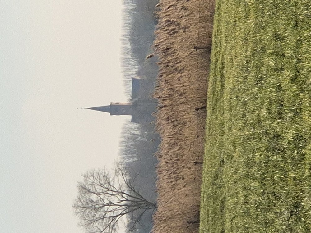
I departed from Bassevelde, cycling a lot along the dikes through the polders: Sint Joris polder, Rode polder... What was nice was that there were regularly info boards about WWII, the polders themselves, and you could also see when the polder was exactly diked, usually in the 16th century.

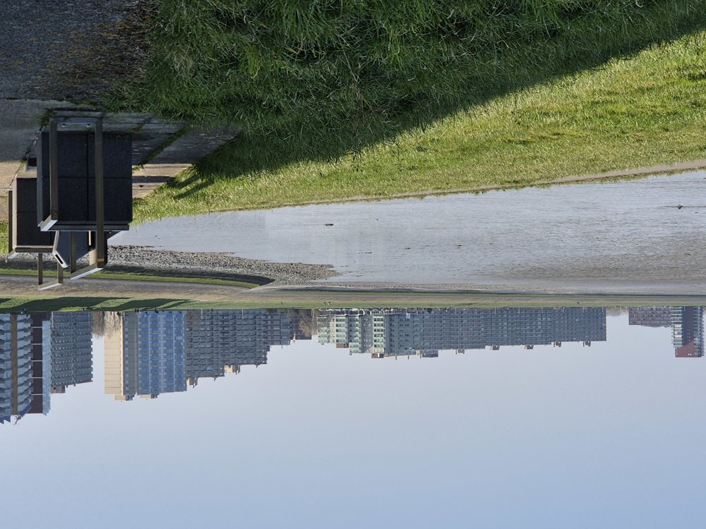
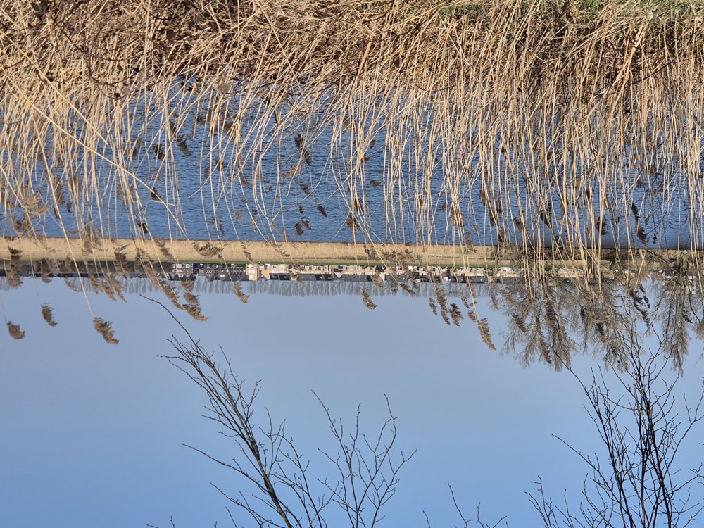
Along Ertvelde, I ended up in the port of Ghent to take a large ferry. A bit further, I passed by Wachtebeke, also a very beautiful area with many meadows and forests. I will come back here too.

In the Netherlands, there are again the very cozy villages. In Terneuzen, I cycled another stretch along the Westerschelde, with a lovely view and saw many large ships. Then I headed back inland to Philippine, known as the mussel town. I then cycled a bit more through the polders back to Bassevelde. It was a beautiful, varied cycling trip.

automatic translation

Icon nodes to follow nodes to follow

Image node 64
0 km
Image node 66
2.6 km
Image node 65
3.8 km
Image node 55
9.8 km
Image node 54
10.9 km
Image node 50
13.5 km
Image node 89
15.8 km
Image node 88
15.9 km
Image node 86
17.1 km
Image node 91
18.1 km
Image node 93
20.8 km
Image node 95
22.1 km
Image node 56
25.3 km
Image node 58
25.9 km
Image node 99
27 km
Image node 1
29.5 km
Image node 39
30.4 km
Image node 3
31.5 km
Image node 47
33.2 km
Image node 4
38.8 km
Image node 97
43.1 km
Image node 89
47.2 km
Image node 74
48.7 km
Image node 83
51.1 km
Image node 67
52.2 km
Image node 68
54.1 km
Image node 69
56.2 km
Image node 82
58 km
Image node 83
58.6 km
Image node 72
62.9 km
Image node 71
68.9 km
Image node 73
70 km
Image node 29
74.2 km
Image node 28
78.5 km
Image node 25
82.8 km
Image node 25
82.8 km
Image node 25
86.1 km
Image node 17
89.7 km
Image node 16
94.8 km
Image node 16
94.9 km
Image node 15
97.8 km
Image node 12
99.4 km
Image node 12
99.4 km
Image node 88
100.8 km
Image node 89
100.9 km
Image node 49
104.5 km
Image node 53
106.7 km
Image node 57
108.2 km
Image node 62
109.2 km
Image node 59
112.1 km
Image node 61
113.4 km
Image node 64
113.5 km
This route does not have any reviews yet. Be the first!
Rate route!

Which POI do you want to show on the map?

Experimental cycling network
Unsigned icon

The route you have chosen runs (partly) along an experimental virtual cycling node network (the blue-coloured nodes and sections on the map).

You must be logged in to plan routes here.

Experimental cycling network
Unsigned icon

The route you have chosen runs (partly) along an experimental virtual cycling node network (the blue-coloured nodes and sections on the map).

These routes are not controlled in the field. Before you start cycling here, take a minute to read what an experimental cycling node network is and what rules you should follow when cycling here.

By clicking 'Accept all cookies,' you agree to the use of cookies for an enhanced user experience, website traffic analysis, and personalized advertisements. Cookie policy