 Biking
 Login
Login More
More EN
EN Premium
Castle lords, buckriders and beguines
automatic translation
45 km • Heers
 official route
5731 0 0/5
 Addresse starting point (approximate)
Truyerstraat 24 Heers
 signage
The route is fully signposted with nodes.
 Description
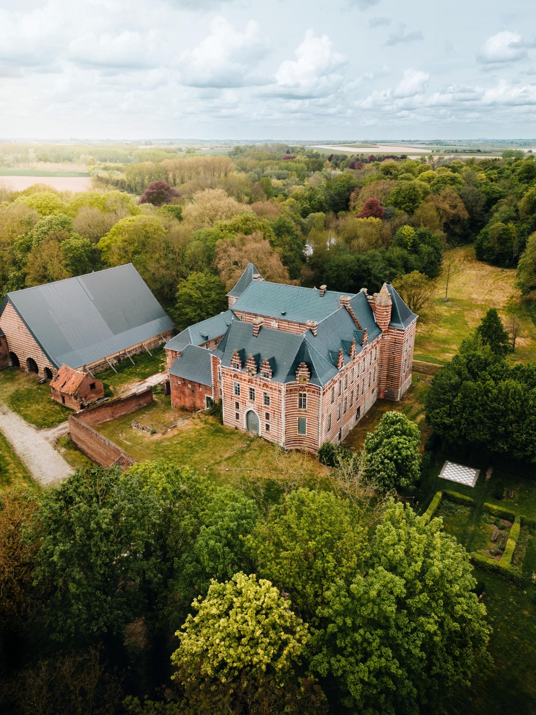
A bike tour past a castle under restoration, buckrider stories, and a millennial church listed as a World Heritage Site. This bike tour will be extra experiential during Open Monument Day on September 8, 2024! Herita, Wellen Municipality, RLHV and PCCE are providing this activity.
At Heers Castle, one of the most challenging restoration projects in Flanders will start this fall. During OMD the architects, volunteers, researchers and students involved will explain their part in this mega project. That way you get a unique look behind the scenes.
You cycle to Sint-Truiden -for centuries the residence of abbots and beguines- to visit the beguinage church. The walls of this 800-year-old Romanesque-Gothic church are decorated with 38 monumental seccos, and the organ is the oldest playable organ in the country. The beguinage is listed as a UNESCO World Heritage Site. Guides tell the stories of the church and the beguinage, and who knows, maybe that organ will also be heard.
Further down the road in Wellen, this year we are completely drawing the map of the buckriders. 250 years ago, 31 Wellen residents were executed on suspicion of being buckriders. In the Bonderkuil in Wellen, descendants tell you the true story of the Wellen buckriders. In the Oetersloven chapel, you can visit an exhibition on buckriders and witchcraft.
automatic translation
 nodes to follow
0 km
0.9 km
3.7 km
4.8 km
8.2 km
11 km
13.2 km
14.4 km
15.9 km
16 km
22.7 km
22.8 km
28 km
28.9 km
31.9 km
33.2 km
33.6 km
35.1 km
37.7 km
40.5 km
44.7 km


 Upgrade to Premium Plus
