 Biking
 Login
Login More
More EN
EN Premium
Tour to the castle of Hélécine via 4 provinces
automatic translation
58.2 km • Sint-Truiden
6471 0 0/5

 Addresse starting point (approximate)
Aalst-Dorp 15, 3800 Sint-Truiden, BE
 signage
The route is partially signposted with nodes. Use a GPS device or our app to follow the route.
 Description
This ride starts at the church of Aalst near Sint-Truiden and crosses the four provinces of Limburg, Flemish Brabant, Walloon Brabant, and Liège.
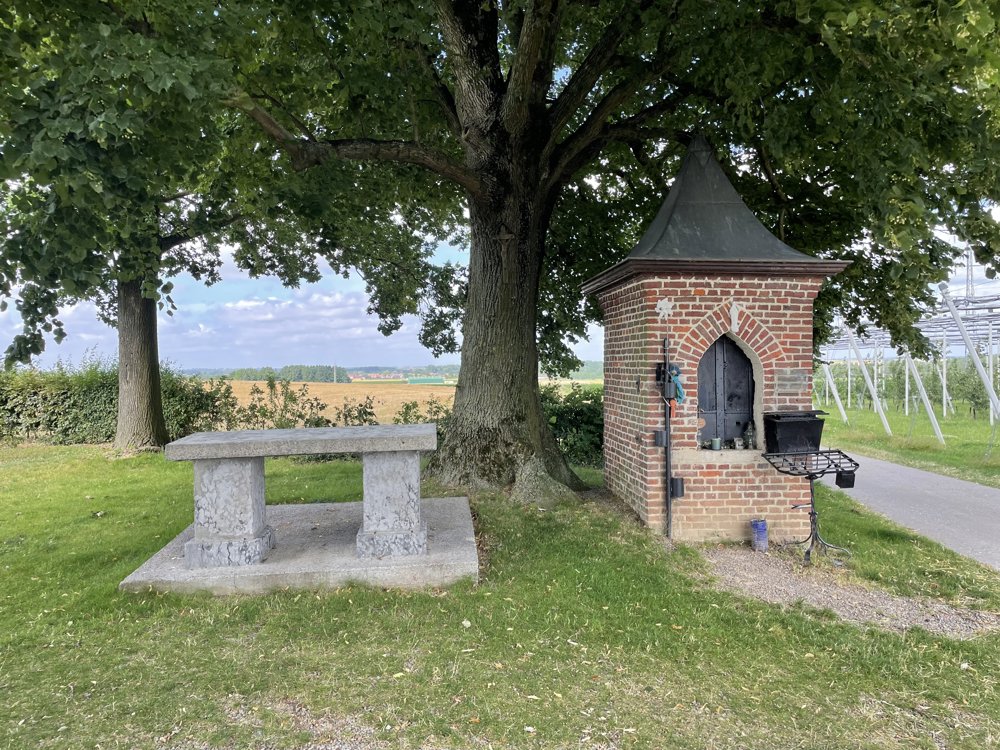
The ride goes through Kerkom to the chapel of the Brown O.L.Vrouw. After a small climb, you reach the Panoramabassin, with a beautiful view over the surroundings and the city of Sint-Truiden.
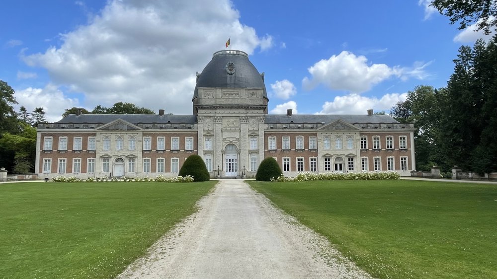
We descend to Velm and pick up the Roman road to Neerhespen (Flemish Brabant). We pass the chapel O.L.Vrouw van het Eikske. Then, we head towards the Provincial domain of Hélécine (Walloon Brabant) with its neoclassical castle and beautiful park.
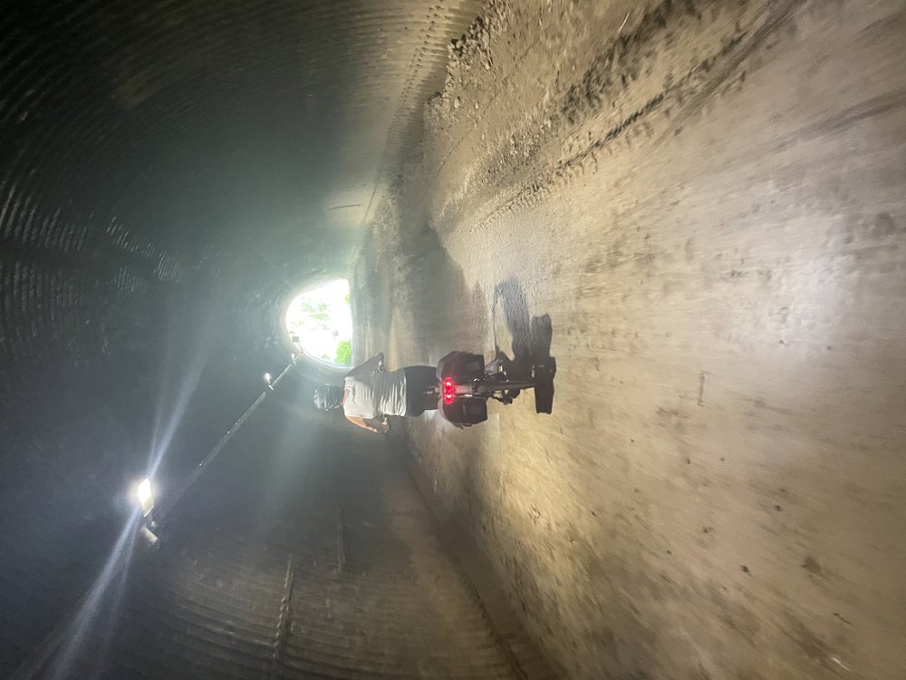
Via a wooded bike path and a tunnel under the E40, we return to pass through the fields to reach Racour (Liège).
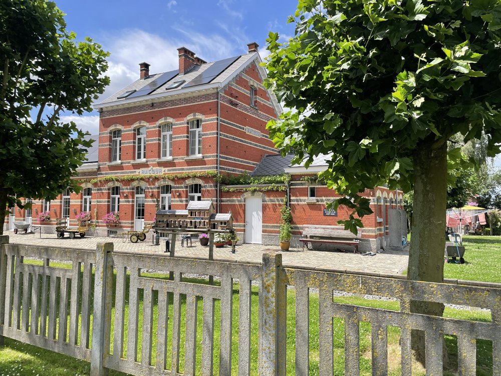
At the Racour station, currently operated as a B&B, we cycle over the Ravel L147 to Landen and further to Gingelom with its castle. From here, we return to Kerkom via a beautiful bike path and the industrial area (former military domain) and regional airport to return to our starting point.
automatic translation
 nodes to follow
0 km

0.3 km
2.9 km
3.8 km
4 km
4.6 km
7.7 km
7.8 km
8.8 km
9.7 km
11.7 km
11.8 km
14.8 km
16 km
17.3 km
19.1 km
21.2 km
22.5 km
24.3 km
24.5 km
24.7 km
25.4 km
26.7 km
28.5 km
32 km
34.7 km
36.4 km
38 km
38.8 km
39.4 km
40.3 km
42.7 km
43.9 km
45 km
45.6 km
46.8 km
48.5 km
49.3 km
53.2 km
54 km
54.7 km
55.6 km
55.9 km
56.4 km
57.3 km
57.7 km

58.2 km


 Upgrade to Premium Plus
