Loading...

Paalgraven and Slingerpad

automatic translation

39.5 km • Maashorst

1200 0 0/5

39.5 km 0.0 km 0.0 km

route offered by

Robert Mekking

Icon starting point Addresse starting point (approximate)

Noordhoek 3, 5375AR Landerd, NL

Icon type signage of route signage

The route is fully signposted with nodes.

5m 5m 5m 5m
Atmosphere image 1 of route Paalgraven and Slingerpad Atmosphere image 2 of route Paalgraven and Slingerpad Atmosphere image 3 of route Paalgraven and Slingerpad
© Robert Mekking

Icon description route Description

Round trip near Oss with a visit to the archaeological site Paalgraven.

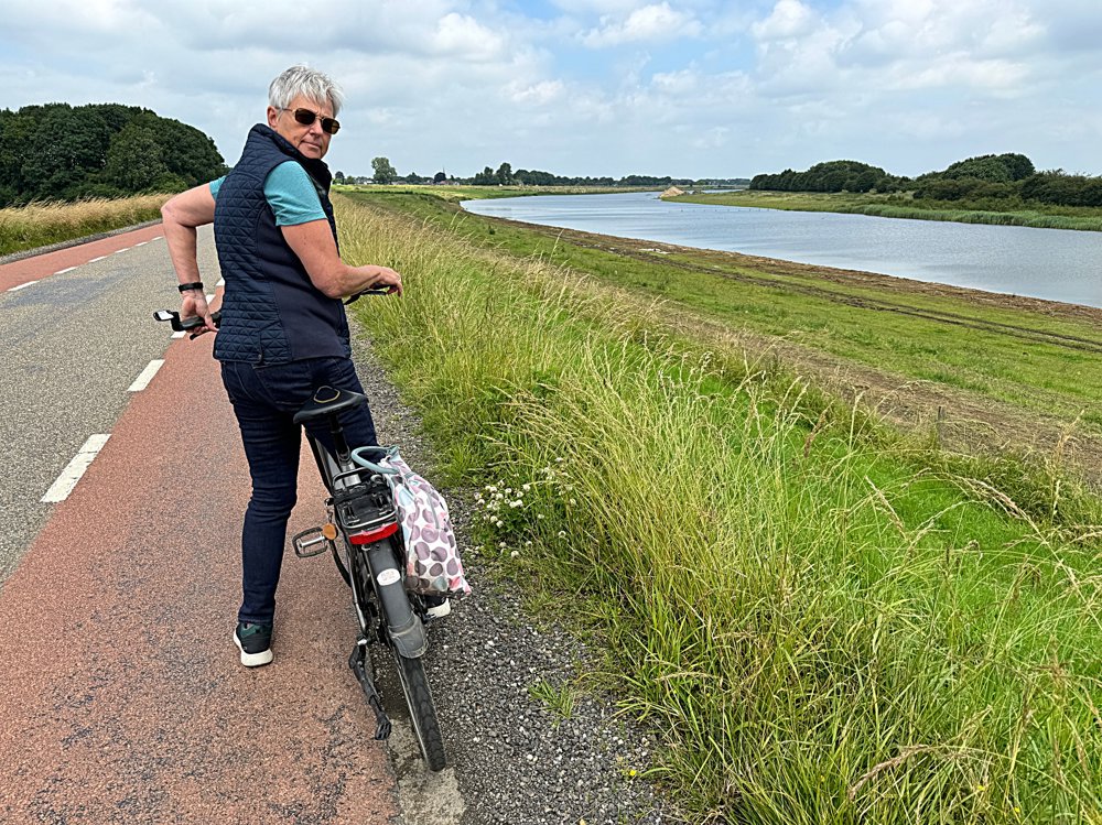
Depart from Reek over the old Maasdijk with a beautiful view of the nature reserve along this old branch of the Maas.

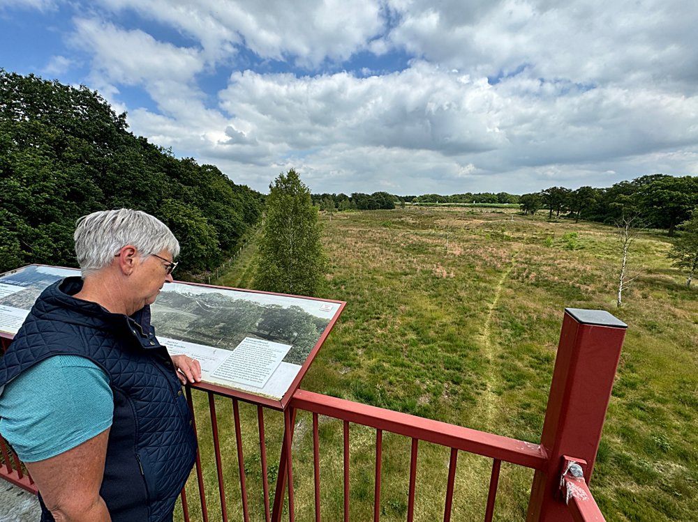
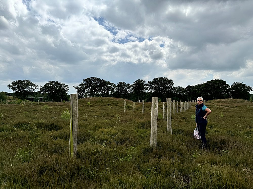
Via country roads through the Brabant villages of Herpen and Schaijk (nice terraces) towards Paalgraven (just after junction 34). Park the bike there and take a walk over this excavation of burial mounds from the Iron and Bronze Ages.

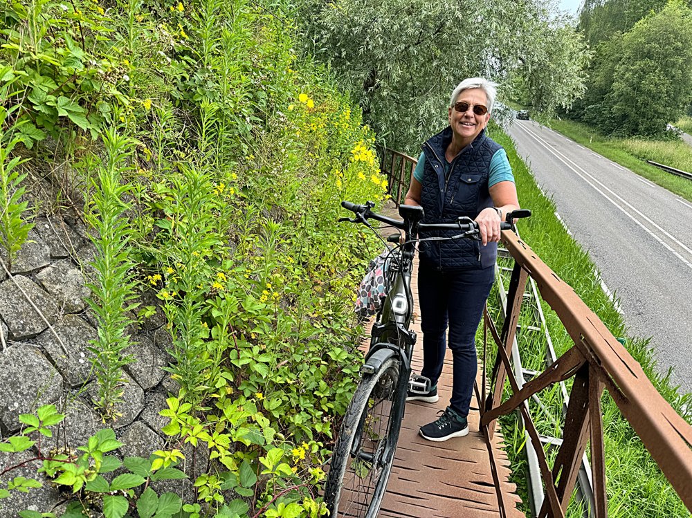
Continue the ride through woods and heath via the Slingerpad. The last stretch to the endpoint is also very beautiful (forest and heath).

automatic translation

Icon nodes to follow nodes to follow

Image node 30
0 km
Image node 31
1.6 km
Image node 32
3.1 km
Image node 61
5.3 km
Image node 61
5.3 km
Image node 59
7.6 km
Image node 62
9.5 km
Image node 60
9.8 km
Image node 60
9.9 km
Image node 25
10.6 km
Image node 25
10.6 km
Image node 25
10.7 km
Image node 25
10.7 km
Image node 25
10.7 km
Image node 24
12.5 km
Image node 1
13.6 km
Image node 34
14 km
Image node 29
15.4 km
Image node 33
16.3 km
Image node 44
17.8 km
Image node 44
18 km
Image node 68
20.6 km
Image node 54
21.9 km
Image node 55
24.5 km
Image node 56
26.1 km
Image node 56
26.1 km
Image node 92
26.9 km
Image node 91
30 km
Image node 46
30.3 km
Image node 90
31.1 km
Image node 90
31.2 km
Image node 90
31.2 km
Image node 90
31.2 km
Image node 90
31.2 km
Image node 89
32.4 km
Image node 89
32.4 km
Image node 89
32.4 km
Image node 89
32.4 km
Image node 37
34.8 km
Image node 37
34.8 km
Image node 28
38.3 km
Image node 28
38.3 km
Image node 30
39.5 km
This route does not have any reviews yet. Be the first!
Rate route!

Which POI do you want to show on the map?

Experimental cycling network
Unsigned icon

The route you have chosen runs (partly) along an experimental virtual cycling node network (the blue-coloured nodes and sections on the map).

You must be logged in to plan routes here.

Experimental cycling network
Unsigned icon

The route you have chosen runs (partly) along an experimental virtual cycling node network (the blue-coloured nodes and sections on the map).

These routes are not controlled in the field. Before you start cycling here, take a minute to read what an experimental cycling node network is and what rules you should follow when cycling here.